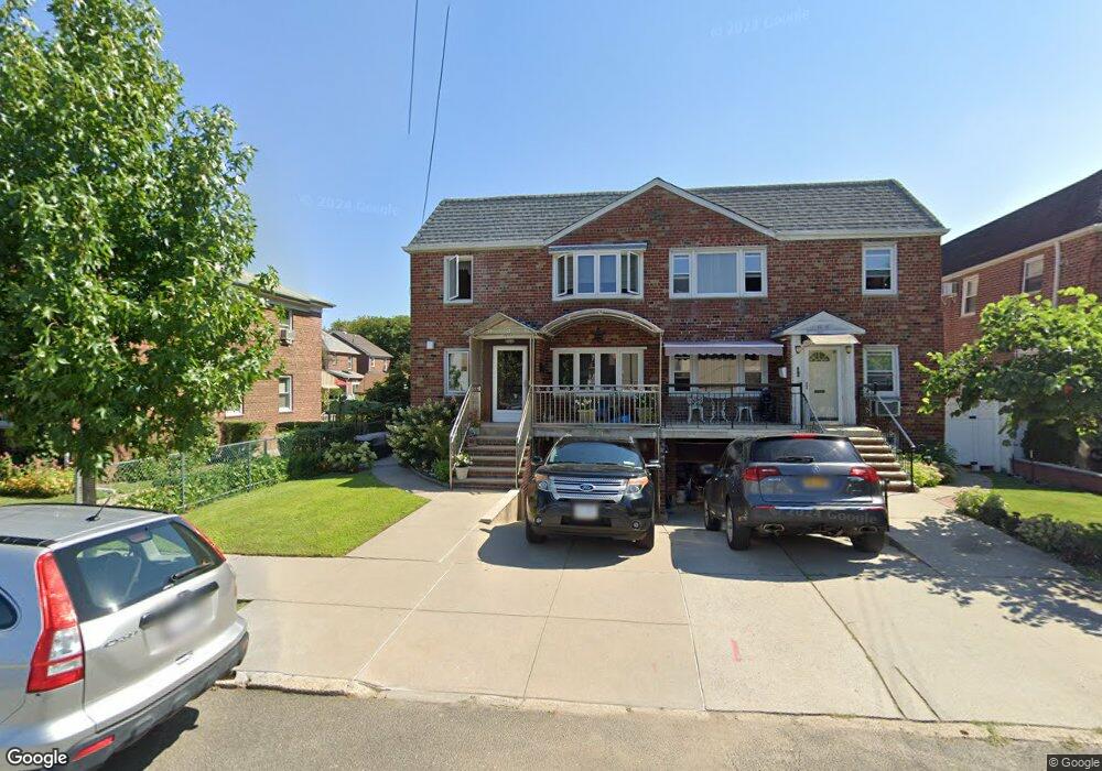
3615 200th St Bayside, NY 11361
Auburndale NeighborhoodEstimated Value: $1,357,000 - $1,583,000
--
Bed
--
Bath
2,400
Sq Ft
$623/Sq Ft
Est. Value
About This Home
This home is located at 3615 200th St, Bayside, NY 11361 and is currently estimated at $1,495,742, approximately $623 per square foot. 3615 200th St is a home located in Queens County with nearby schools including P.S. 159 Queens, I.S. 25 Adrien Block, and Bayside High School.
Ownership History
Date
Name
Owned For
Owner Type
Purchase Details
Closed on
Nov 27, 2013
Sold by
Kokoronis Billy and Kokoronis Christina Maria
Bought by
Kokoronis Christina Maria and Kokoronis Eleni
Current Estimated Value
Purchase Details
Closed on
Nov 24, 2003
Sold by
Kokoronis Ekaterini and Kokoronis Eleni
Bought by
Kokoronis Kostas and Kokoronis Pavlos
Create a Home Valuation Report for This Property
The Home Valuation Report is an in-depth analysis detailing your home's value as well as a comparison with similar homes in the area
Home Values in the Area
Average Home Value in this Area
Purchase History
| Date | Buyer | Sale Price | Title Company |
|---|---|---|---|
| Kokoronis Christina Maria | -- | -- | |
| Kokoronis Christina Maria | -- | -- | |
| Kokoronis Kostas | -- | -- | |
| Kokoronis Kostas | -- | -- |
Source: Public Records
Tax History Compared to Growth
Tax History
| Year | Tax Paid | Tax Assessment Tax Assessment Total Assessment is a certain percentage of the fair market value that is determined by local assessors to be the total taxable value of land and additions on the property. | Land | Improvement |
|---|---|---|---|---|
| 2025 | $10,864 | $58,822 | $7,688 | $51,134 |
| 2024 | $10,876 | $55,492 | $8,215 | $47,277 |
| 2023 | $10,234 | $52,352 | $7,685 | $44,667 |
| 2022 | $10,164 | $80,220 | $11,520 | $68,700 |
| 2021 | $10,639 | $69,600 | $11,520 | $58,080 |
| 2020 | $10,080 | $76,500 | $11,520 | $64,980 |
| 2019 | $9,381 | $81,840 | $11,520 | $70,320 |
| 2018 | $8,596 | $43,627 | $6,963 | $36,664 |
| 2017 | $8,594 | $43,627 | $8,054 | $35,573 |
| 2016 | $8,346 | $43,627 | $8,054 | $35,573 |
| 2015 | $4,744 | $40,848 | $12,447 | $28,401 |
| 2014 | $4,744 | $38,536 | $11,930 | $26,606 |
Source: Public Records
Map
Nearby Homes
- 36-05 200th St
- 36- 40 201st St Unit A, B, C
- 37-02 Francis Lewis Blvd
- 37-6 Francis Lewis Blvd
- 37-12 Francis Lewis Blvd
- 3454 201st St
- 35-16 203rd St
- 34-41 201st St
- 200-06 39th Ave
- 35-27 203rd St
- 194-23 Station Rd
- 3611 204th St
- 20403 36th Ave Unit 397
- 203-07 35th Ave Unit B
- 20070 39th Ave
- 19934 34th Ave
- 35-42 205th St Unit 288
- 204-8 35th Ave Unit 247
- 36-46 205th St
- 204-12 35th Ave Unit 254
- 3617 200th St Unit 2Fl
- 3617 200th St
- 3617 200th St
- 3611 200th St
- 3621 200th St
- 3609 200th St
- 20008 36th Ave
- 36-23 200th St
- 3623 200th St
- 200-08 36th Ave
- 3605 200th St
- 3614 201st St
- 3616 201st St
- 3612 201st St
- 3618 201st St
- 20012 36th Ave
- 3627 200th St
- 3620 201st St
- 3547 Francis Lewis Blvd
- 3612 201st St