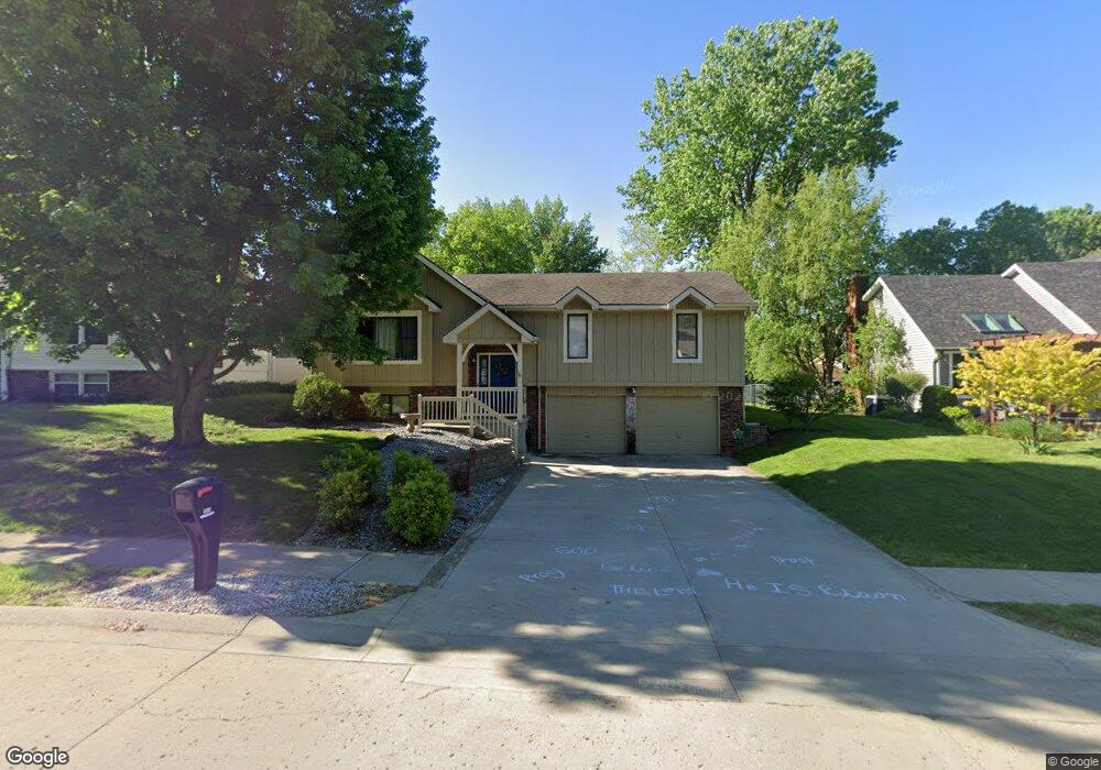
3616 Robin Ln Saint Joseph, MO 64506
Ashland NeighborhoodEstimated Value: $282,961 - $292,000
Studio
--
Bath
1,281
Sq Ft
$225/Sq Ft
Est. Value
About This Home
This home is located at 3616 Robin Ln, Saint Joseph, MO 64506 and is currently estimated at $287,990, approximately $224 per square foot. 3616 Robin Ln is a home located in Buchanan County with nearby schools including Oak Grove Elementary School, Bode Middle School, and Central High School.
Ownership History
Date
Name
Owned For
Owner Type
Purchase Details
Closed on
Nov 17, 2015
Sold by
Taylor Perry and Taylor Portia
Bought by
Ashlock Jordan T and Ashlock Alison P
Current Estimated Value
Home Financials for this Owner
Home Financials are based on the most recent Mortgage that was taken out on this home.
Original Mortgage
$175,757
Outstanding Balance
$138,237
Interest Rate
3.87%
Mortgage Type
FHA
Estimated Equity
$149,753
Create a Home Valuation Report for This Property
The Home Valuation Report is an in-depth analysis detailing your home's value as well as a comparison with similar homes in the area
Home Values in the Area
Average Home Value in this Area
Purchase History
| Date | Buyer | Sale Price | Title Company |
|---|---|---|---|
| Ashlock Jordan T | -- | -- |
Source: Public Records
Mortgage History
| Date | Status | Borrower | Loan Amount |
|---|---|---|---|
| Open | Ashlock Jordan T | $175,757 |
Source: Public Records
Tax History
| Year | Tax Paid | Tax Assessment Tax Assessment Total Assessment is a certain percentage of the fair market value that is determined by local assessors to be the total taxable value of land and additions on the property. | Land | Improvement |
|---|---|---|---|---|
| 2025 | $1,920 | $26,770 | $4,640 | $22,130 |
| 2024 | $1,809 | $25,230 | $4,640 | $20,590 |
| 2023 | $1,809 | $25,230 | $4,640 | $20,590 |
| 2022 | $1,670 | $25,230 | $4,640 | $20,590 |
| 2021 | $1,677 | $25,230 | $4,640 | $20,590 |
| 2020 | $1,667 | $25,230 | $4,640 | $20,590 |
| 2019 | $1,610 | $25,230 | $4,640 | $20,590 |
| 2018 | $1,454 | $25,230 | $4,640 | $20,590 |
| 2017 | $1,441 | $25,230 | $0 | $0 |
| 2015 | $0 | $25,230 | $0 | $0 |
| 2014 | $1,579 | $25,230 | $0 | $0 |
Source: Public Records
Map
Nearby Homes
- 3509 Robin Ln
- 3212 Morton Ln
- 3309 Mueller Ln
- 3904 Remington Ct
- 4411 Rochester Rd
- 4007 Bennington Dr
- 4301 N 169 Hwy
- 3109 Carlisle Ct
- 3107 Carlisle Ct
- 3111 Carlisle Ct
- 00 Lot 2 Highway 169
- 4001 Stacey Way Ct
- 4303 Leighton Ct
- 3103 Cook Rd
- 4200 Castlegate Ct
- 4109 Hidden Valley Dr
- 4113 Hidden Valley Dr
- 4216 Gene Field Rd
- 4215 Greystone Dr
- 3114 Gene Field Rd
- 3614 Robin Ln
- 3618 Robin Ln
- 3417 N 36th Terrace
- 3612 Robin Ln
- 3607 Robin Ln
- 3605 Robin Ln
- 3502 N 37th St
- 3504 N 37th St
- 3413 N 36th Terrace
- 3609 Robin Ln
- 3610 Robin Ln
- 3408 N 37th St
- 3501 N 36th Street Ct
- 3414 N 36th Terrace
- 3611 Robin Ln
- 3406 N 37th St
- 3503 N 36th Street Ct
- 3608 Robin Ln
- 3409 N 36th Terrace
- 3613 Robin Ln
Your Personal Tour Guide
Ask me questions while you tour the home.