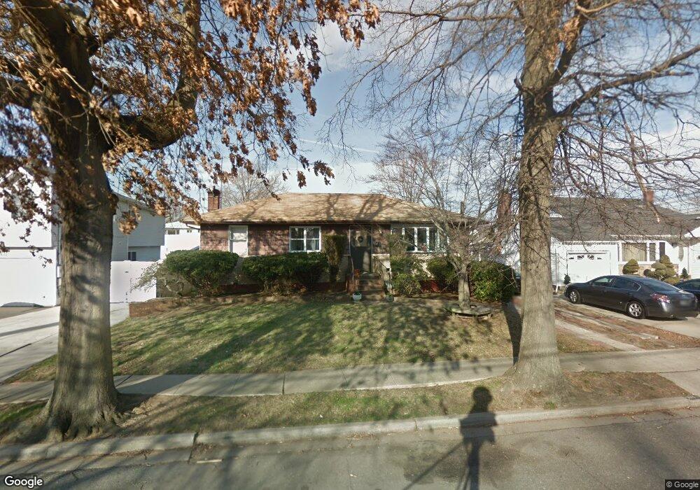
3617 Manhasset St Seaford, NY 11783
Estimated Value: $654,000 - $699,428
3
Beds
1
Bath
1,100
Sq Ft
$615/Sq Ft
Est. Value
About This Home
This home is located at 3617 Manhasset St, Seaford, NY 11783 and is currently estimated at $676,714, approximately $615 per square foot. 3617 Manhasset St is a home located in Nassau County with nearby schools including Seaford Middle School, Seaford Senior High School, and St. William the Abbot School.
Ownership History
Date
Name
Owned For
Owner Type
Purchase Details
Closed on
Oct 6, 2015
Sold by
Fannie Mae
Bought by
Cavanagh Kevin and Haan Alison
Current Estimated Value
Home Financials for this Owner
Home Financials are based on the most recent Mortgage that was taken out on this home.
Original Mortgage
$225,000
Outstanding Balance
$177,148
Interest Rate
3.9%
Mortgage Type
New Conventional
Estimated Equity
$499,566
Purchase Details
Closed on
Dec 15, 2014
Sold by
Wyllins Frank
Bought by
Federal National Mortgage Association
Create a Home Valuation Report for This Property
The Home Valuation Report is an in-depth analysis detailing your home's value as well as a comparison with similar homes in the area
Home Values in the Area
Average Home Value in this Area
Purchase History
| Date | Buyer | Sale Price | Title Company |
|---|---|---|---|
| Cavanagh Kevin | $250,000 | Attorney | |
| Federal National Mortgage Association | $273,139 | None Available |
Source: Public Records
Mortgage History
| Date | Status | Borrower | Loan Amount |
|---|---|---|---|
| Open | Cavanagh Kevin | $225,000 |
Source: Public Records
Tax History Compared to Growth
Tax History
| Year | Tax Paid | Tax Assessment Tax Assessment Total Assessment is a certain percentage of the fair market value that is determined by local assessors to be the total taxable value of land and additions on the property. | Land | Improvement |
|---|---|---|---|---|
| 2025 | $12,797 | $411 | $208 | $203 |
| 2024 | $3,606 | $411 | $208 | $203 |
| 2023 | $11,749 | $411 | $208 | $203 |
| 2022 | $11,749 | $411 | $208 | $203 |
| 2021 | $15,523 | $403 | $204 | $199 |
| 2020 | $10,923 | $532 | $531 | $1 |
| 2019 | $9,621 | $570 | $569 | $1 |
| 2018 | $9,785 | $608 | $0 | $0 |
| 2017 | $8,828 | $763 | $672 | $91 |
| 2016 | $12,361 | $763 | $672 | $91 |
| 2015 | -- | $763 | $672 | $91 |
| 2014 | -- | $763 | $672 | $91 |
| 2013 | $2,736 | $763 | $672 | $91 |
Source: Public Records
Map
Nearby Homes
- 3612 Ladonia St
- 3608 Tonopah St
- 3563 Wadena St
- 3558 Roanoke St
- 2370 Narraganset Ave
- 2208 Seaford Ave
- 3559 Verona Place
- 2296 Hampton Ave
- 0 Island Place Unit 3107575
- 3541 Kenora Place
- 2175 Wantagh Park Dr
- 2335 Maple St
- 2572 Riverside Ave
- 3719 Terrapin Place
- 3532 Waverly Ave
- 2601 Ocean Ave
- 2347 Pine St
- 3728 E End
- 2327 Mattituck Ave
- 2175 Spruce St
- 3611 Manhasset St
- 3623 Manhasset St
- 3622 Ladonia St
- 3607 Manhasset St
- 3618 Ladonia St
- 3626 Ladonia St
- 3635 Manhasset St
- 2392 Neptune Ave
- 3614 Ladonia St
- 3620 Manhasset St
- 3616 Manhasset St
- 3601 Manhasset St
- 3624 Manhasset St
- 3636 Ladonia St
- 3608 Manhasset St
- 3595 Manhasset St
- 3602 Manhasset St
- 3606 Ladonia St
- 3617 Ladonia St
- 3617 Wadena St