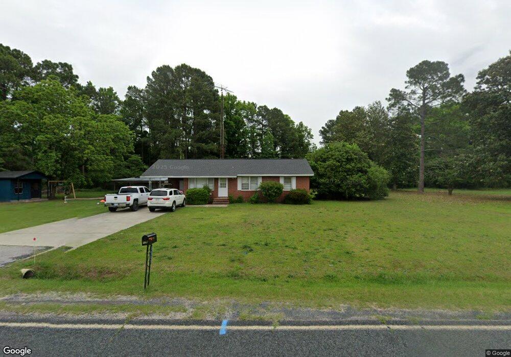
3617 Mayberry Rd Hartsville, SC 29550
Estimated Value: $100,000 - $194,000
2
Beds
2
Baths
1,456
Sq Ft
$90/Sq Ft
Est. Value
About This Home
This home is located at 3617 Mayberry Rd, Hartsville, SC 29550 and is currently estimated at $131,103, approximately $90 per square foot. 3617 Mayberry Rd is a home with nearby schools including Lamar Elementary School, Spaulding Elementary School, and Spaulding Middle School.
Ownership History
Date
Name
Owned For
Owner Type
Purchase Details
Closed on
Dec 14, 2021
Sold by
Lawson Marvin I
Bought by
Lewis Bobby Ray
Current Estimated Value
Home Financials for this Owner
Home Financials are based on the most recent Mortgage that was taken out on this home.
Original Mortgage
$42,500
Interest Rate
3.09%
Mortgage Type
Purchase Money Mortgage
Purchase Details
Closed on
Oct 25, 2019
Sold by
Lawson William Edward and Lawson James Hemphill
Bought by
Lawson Marvin I
Purchase Details
Closed on
Aug 5, 2011
Sold by
Tickell Helen M and Smulczenski Melvin
Bought by
Lawson Laurie C
Create a Home Valuation Report for This Property
The Home Valuation Report is an in-depth analysis detailing your home's value as well as a comparison with similar homes in the area
Home Values in the Area
Average Home Value in this Area
Purchase History
| Date | Buyer | Sale Price | Title Company |
|---|---|---|---|
| Lewis Bobby Ray | $85,000 | None Available | |
| Lewis Bobby Ray | $85,000 | None Listed On Document | |
| Lawson Marvin I | -- | None Available | |
| Lawson Laurie C | $45,000 | -- |
Source: Public Records
Mortgage History
| Date | Status | Borrower | Loan Amount |
|---|---|---|---|
| Closed | Lewis Bobby Ray | $42,500 |
Source: Public Records
Tax History Compared to Growth
Tax History
| Year | Tax Paid | Tax Assessment Tax Assessment Total Assessment is a certain percentage of the fair market value that is determined by local assessors to be the total taxable value of land and additions on the property. | Land | Improvement |
|---|---|---|---|---|
| 2024 | $465 | $3,400 | $0 | $0 |
| 2023 | $850 | $5,100 | $0 | $0 |
| 2022 | $850 | $5,100 | $0 | $0 |
| 2021 | $265 | $1,590 | $0 | $0 |
| 2020 | $560 | $1,590 | $0 | $0 |
| 2019 | $560 | $1,590 | $0 | $0 |
| 2018 | $534 | $1,500 | $0 | $0 |
| 2017 | $759 | $2,340 | $390 | $1,950 |
| 2016 | $703 | $2,340 | $390 | $1,950 |
| 2014 | $715 | $2,340 | $390 | $1,950 |
| 2013 | $35 | $2,030 | $390 | $1,640 |
Source: Public Records
Map
Nearby Homes
- TBD Dovetail Rd Unit Lot 4
- 3512 Oates Hwy
- 1345 Fisherman Rd
- TBD Cherokee Lady St
- 108 San Lin Ave
- 2017 Philadelphia St
- 1501 E Bobo Newsom Hwy
- 2653 Iseman Rd
- 1309 E Bobo Newsom Hwy
- 1582 Una Rd
- 101 Andy Dr
- 928 W Lydia Hwy
- 0 Spencer St Unit 20254176
- 000 Manantial Rd
- 12 Acres Manantial Rd
- 2440 Wesley Chapel Rd
- 5273 Indian Branch Rd
- 5279 Indian Branch Rd
- 2073 Gum Cir
- 3525 Lake Swamp Rd