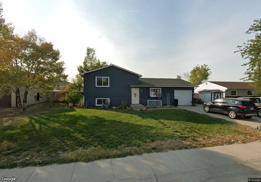
3618 Platte St Torrington, WY 82240
Estimated Value: $170,960 - $223,000
2
Beds
2
Baths
1,026
Sq Ft
$194/Sq Ft
Est. Value
About This Home
This home is located at 3618 Platte St, Torrington, WY 82240 and is currently estimated at $198,990, approximately $193 per square foot. 3618 Platte St is a home located in Goshen County with nearby schools including Lincoln Elementary School, Trail Elementary School, and Torrington Middle School.
Ownership History
Date
Name
Owned For
Owner Type
Purchase Details
Closed on
Aug 7, 2006
Sold by
Cundall Jerry and Cundall Sherma
Bought by
Mccoy Earl D and Mccoy Donita R
Current Estimated Value
Home Financials for this Owner
Home Financials are based on the most recent Mortgage that was taken out on this home.
Original Mortgage
$128,435
Outstanding Balance
$87,432
Interest Rate
6.77%
Estimated Equity
$111,558
Purchase Details
Closed on
Dec 30, 2005
Sold by
Hague Lacey May
Bought by
Cundall Jerry and Cundall Sherma
Create a Home Valuation Report for This Property
The Home Valuation Report is an in-depth analysis detailing your home's value as well as a comparison with similar homes in the area
Home Values in the Area
Average Home Value in this Area
Purchase History
| Date | Buyer | Sale Price | Title Company |
|---|---|---|---|
| Mccoy Earl D | -- | -- | |
| Cundall Jerry | -- | -- |
Source: Public Records
Mortgage History
| Date | Status | Borrower | Loan Amount |
|---|---|---|---|
| Open | Mccoy Earl D | $128,435 |
Source: Public Records
Tax History Compared to Growth
Tax History
| Year | Tax Paid | Tax Assessment Tax Assessment Total Assessment is a certain percentage of the fair market value that is determined by local assessors to be the total taxable value of land and additions on the property. | Land | Improvement |
|---|---|---|---|---|
| 2025 | $835 | $7,354 | $1,080 | $6,274 |
| 2024 | $835 | $14,095 | $2,077 | $12,018 |
| 2023 | $802 | $13,645 | $2,096 | $11,549 |
| 2022 | $747 | $12,925 | $2,143 | $10,782 |
| 2021 | $655 | $11,700 | $2,382 | $9,318 |
| 2020 | $643 | $11,537 | $2,382 | $9,155 |
| 2019 | $618 | $11,211 | $2,191 | $9,020 |
| 2018 | $570 | $10,563 | $2,191 | $8,372 |
| 2017 | $533 | $10,077 | $2,191 | $7,886 |
| 2016 | $527 | $9,992 | $2,143 | $7,849 |
| 2015 | -- | $10,835 | $2,105 | $8,730 |
| 2014 | -- | $10,650 | $2,010 | $8,640 |
Source: Public Records
Map
Nearby Homes
- 3610 Platte St
- 3626 Platte St
- 3609 Laramie St
- 3634 Platte St
- 625 Niobrara Ave Unit 625 Niobrara
- 3642 Platte St
- 3617 Platte St
- 3641 Laramie St
- 3618 Laramie St
- 3626 Laramie St
- 3634 Laramie
- TBD Laramie St
- 3603 Laramie St
- 3633 Laramie St
- 3608 Laramie St
- 3556 Laramie St
- 3600 Laramie St
- 3610 Laramie St
- 3602 Laramie St
- 3650 Platte St