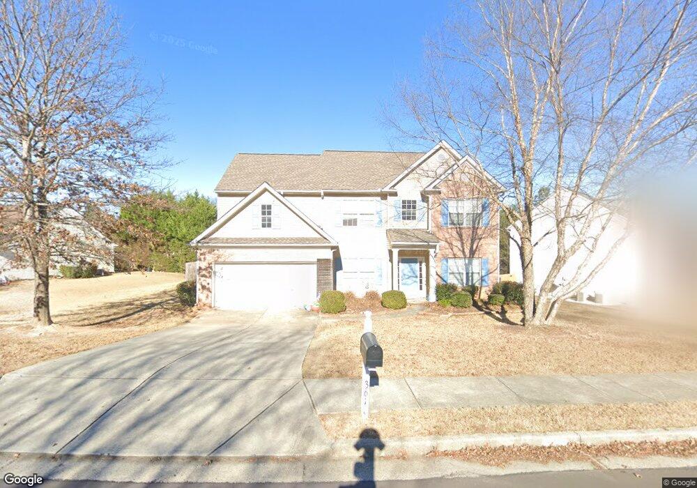
3618 Rip Rap Dr Unit 3 Buford, GA 30519
Estimated Value: $428,000 - $481,000
4
Beds
3
Baths
2,896
Sq Ft
$156/Sq Ft
Est. Value
About This Home
This home is located at 3618 Rip Rap Dr Unit 3, Buford, GA 30519 and is currently estimated at $450,348, approximately $155 per square foot. 3618 Rip Rap Dr Unit 3 is a home located in Gwinnett County with nearby schools including Ivy Creek Elementary School and Glenn C. Jones Middle School.
Ownership History
Date
Name
Owned For
Owner Type
Purchase Details
Closed on
Feb 3, 2009
Sold by
Citimortgage Inc
Bought by
Federal Natl Mtg Assn Fnma
Current Estimated Value
Purchase Details
Closed on
Feb 12, 2004
Sold by
Eric Chafin Hm Builders Inc
Bought by
Virasayachack Samreth
Home Financials for this Owner
Home Financials are based on the most recent Mortgage that was taken out on this home.
Original Mortgage
$178,100
Interest Rate
5.87%
Mortgage Type
New Conventional
Create a Home Valuation Report for This Property
The Home Valuation Report is an in-depth analysis detailing your home's value as well as a comparison with similar homes in the area
Home Values in the Area
Average Home Value in this Area
Purchase History
| Date | Buyer | Sale Price | Title Company |
|---|---|---|---|
| Federal Natl Mtg Assn Fnma | -- | -- | |
| Citimortgage Inc | -- | -- | |
| Virasayachack Samreth | $178,100 | -- |
Source: Public Records
Mortgage History
| Date | Status | Borrower | Loan Amount |
|---|---|---|---|
| Previous Owner | Virasayachack Samreth | $178,100 |
Source: Public Records
Tax History
| Year | Tax Paid | Tax Assessment Tax Assessment Total Assessment is a certain percentage of the fair market value that is determined by local assessors to be the total taxable value of land and additions on the property. | Land | Improvement |
|---|---|---|---|---|
| 2025 | $5,238 | $194,840 | $32,800 | $162,040 |
| 2024 | $4,917 | $170,720 | $30,800 | $139,920 |
| 2023 | $4,917 | $181,120 | $30,800 | $150,320 |
| 2022 | $4,639 | $158,840 | $25,600 | $133,240 |
| 2021 | $3,952 | $122,680 | $21,880 | $100,800 |
| 2020 | $3,905 | $119,240 | $19,520 | $99,720 |
| 2019 | $3,606 | $110,440 | $19,520 | $90,920 |
| 2018 | $3,388 | $100,200 | $17,600 | $82,600 |
| 2016 | $3,122 | $87,000 | $14,800 | $72,200 |
| 2015 | $2,873 | $77,320 | $12,000 | $65,320 |
| 2014 | -- | $77,320 | $12,000 | $65,320 |
Source: Public Records
Map
Nearby Homes
- 3137 Train St
- 3774 Commodore Ct
- 3508 Cast Palm Dr
- 3765 Ridgehurst Ln
- 3615 Ridgehurst Ln
- 3329 Tree Ridge Ct Unit 791
- 3604 Nathan Farm Ln
- 3727 Woodoats Cir
- 2988 Hamilton Mill Rd
- 2434 Sardis Chase Ct
- 2898 Hamilton Mill Rd
- 2675 Sardis Chase Ct
- 2410 Sardis Chase Ct
- 3342 Sardis Bend Dr
- 3080 Abelia Dr
- 3422 Adler Trail
- 3432 Adler Trail
- 3550 & 3570 Sardis Church Way
- 2716 Hamilton Mill
- 3330 Pucketts Mill Rd
- 3628 Rip Rap Dr
- 3608 Rip Rap Dr
- 4131 Plantation Mill Dr
- 3638 Rip Rap Dr Unit 3
- 4151 Plantation Mill Dr
- 3617 Rip Rap Dr
- 3617 Rip Rap Dr Unit 20
- 3627 Rip Rap Dr
- 3627 Rip Rap Dr Unit 3627
- 3627 Rip Rap Dr
- 4101 Plantation Mill Dr
- 4161 Plantation Mill Dr
- 3637 Rip Rap Dr
- 3637 Rip Rap Dr
- 3637 Rip Rap Dr Unit 3637
- 3648 Rip Rap Dr
- 4441 Plantation Mill Trail
- 4120 Plantation Mill Dr
- 4451 Plantation Mill Trail
- 4110 Plantation Mill Dr
Your Personal Tour Guide
Ask me questions while you tour the home.