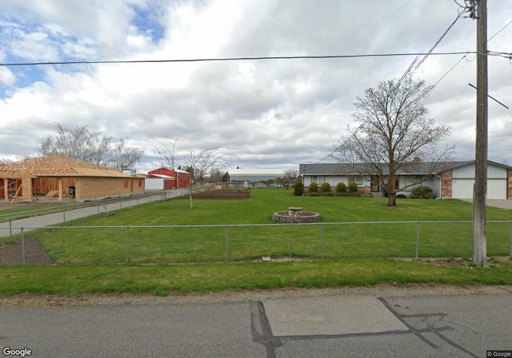
3619 N Stevenson Rd Otis Orchards, WA 99027
Otis Orchards-East Farms NeighborhoodEstimated Value: $627,000 - $707,000
3
Beds
2
Baths
1,607
Sq Ft
$404/Sq Ft
Est. Value
About This Home
This home is located at 3619 N Stevenson Rd, Otis Orchards, WA 99027 and is currently estimated at $649,497, approximately $404 per square foot. 3619 N Stevenson Rd is a home located in Spokane County with nearby schools including Otis Orchards School, East Valley Middle School, and East Valley High School & Extension.
Ownership History
Date
Name
Owned For
Owner Type
Purchase Details
Closed on
Sep 2, 1997
Sold by
Scott Susan Eileen
Bought by
Scott Douglas N
Current Estimated Value
Home Financials for this Owner
Home Financials are based on the most recent Mortgage that was taken out on this home.
Original Mortgage
$39,042
Interest Rate
6.97%
Create a Home Valuation Report for This Property
The Home Valuation Report is an in-depth analysis detailing your home's value as well as a comparison with similar homes in the area
Home Values in the Area
Average Home Value in this Area
Purchase History
| Date | Buyer | Sale Price | Title Company |
|---|---|---|---|
| Scott Douglas N | -- | First American Title Ins |
Source: Public Records
Mortgage History
| Date | Status | Borrower | Loan Amount |
|---|---|---|---|
| Closed | Scott Douglas N | $39,042 |
Source: Public Records
Tax History Compared to Growth
Tax History
| Year | Tax Paid | Tax Assessment Tax Assessment Total Assessment is a certain percentage of the fair market value that is determined by local assessors to be the total taxable value of land and additions on the property. | Land | Improvement |
|---|---|---|---|---|
| 2025 | $5,022 | $547,300 | $167,600 | $379,700 |
| 2024 | $5,022 | $513,900 | $162,600 | $351,300 |
| 2023 | $4,911 | $509,300 | $162,600 | $346,700 |
| 2022 | $4,543 | $504,700 | $162,600 | $342,100 |
| 2021 | $4,464 | $354,800 | $113,400 | $241,400 |
| 2020 | $4,360 | $328,660 | $105,560 | $223,100 |
| 2019 | $3,717 | $283,940 | $92,040 | $191,900 |
| 2018 | $3,639 | $258,660 | $71,360 | $187,300 |
| 2017 | $3,475 | $248,160 | $71,360 | $176,800 |
| 2016 | $3,195 | $230,630 | $62,430 | $168,200 |
| 2015 | $3,224 | $224,630 | $62,430 | $162,200 |
| 2014 | -- | $224,630 | $62,430 | $162,200 |
| 2013 | -- | $0 | $0 | $0 |
Source: Public Records
Map
Nearby Homes
- 3705 N Stevenson Rd
- 24005 E Garland Ave
- 23823 E Garland Ave
- 3210 N Molter Rd
- 4111 N Garry Rd
- xxxx N A Rd
- 24870 E Coopers Hawk Ln
- 24443 E Pinnacle Ct Unit 24443
- 24493 E Pinnacle Ct Unit D
- 24493 E Pinnacle Ct
- 23011 E Edgewater Ln
- 23009 E Edgewater Ln
- 4806 N Drury Rd
- 23006 E Edgewater Ln
- 23010 E Edgewater Ln
- 23015 E Edgewater Ln
- 23014 E Edgewater Ln
- 23013 E Edgewater Ln
- 23008 E Edgewater Ln
- 24503 E Feather Loop
- 3605 N Stevenson Rd
- 3795 N Stevenson Rd
- 3614 N Stevenson Rd
- 3521 N Stevenson Rd
- 3626 N Stevenson Rd
- 3722 N Stevenson Rd
- 3805 N Stevenson Rd
- 3515 N Stevenson Rd
- 3520 N Stevenson Rd
- 3808 N Stevenson Rd
- 3423 N Stevenson Rd
- 3624 N Molter Rd
- 3823 N Stevenson Rd
- 3516 N Stevenson Rd
- 3704 N Molter Rd
- 3904 N Stevenson Rd
- 3909 N Stevenson Rd
- 3623 N Malvern Rd
- 3407 N Stevenson Rd
- 3705 N Malvern Rd