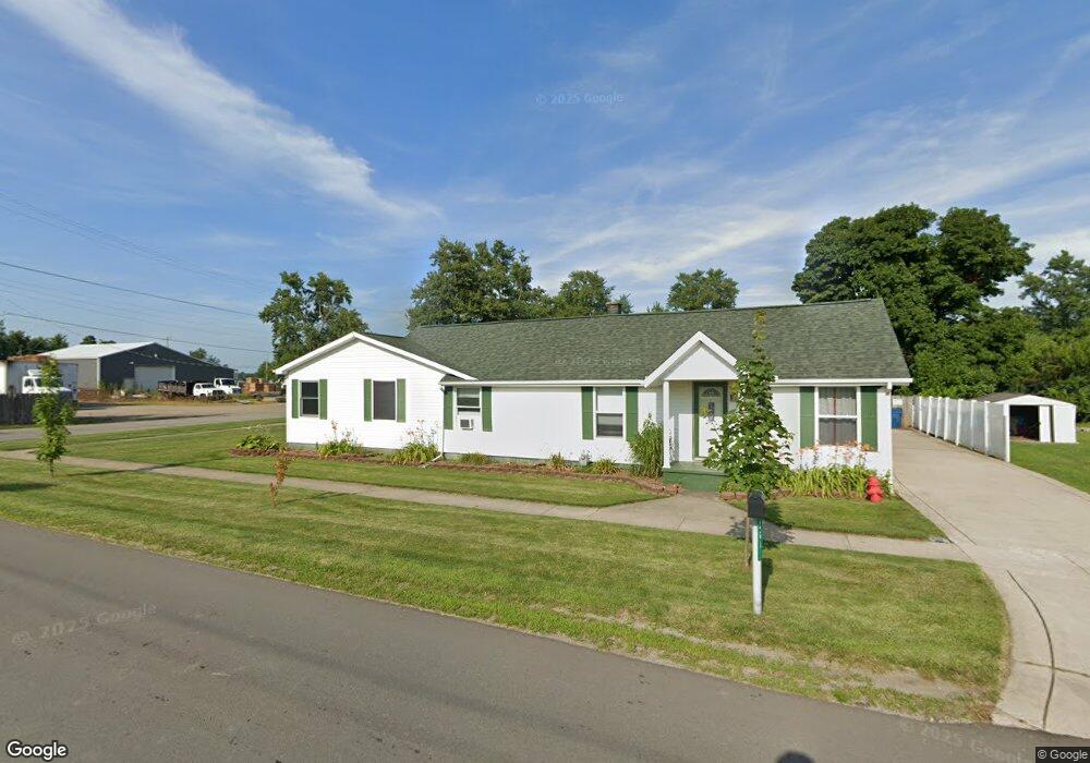
3619 State St Clayton, MI 49235
Estimated Value: $146,000 - $210,000
--
Bed
--
Bath
1,649
Sq Ft
$108/Sq Ft
Est. Value
About This Home
This home is located at 3619 State St, Clayton, MI 49235 and is currently estimated at $177,271, approximately $107 per square foot. 3619 State St is a home located in Lenawee County with nearby schools including Lincoln Elementary School, Southern Michigan Center For Science & Industry (SMCSI), and Hudson Middle School.
Ownership History
Date
Name
Owned For
Owner Type
Purchase Details
Closed on
Sep 12, 2012
Sold by
Berkshire Ron and Berkshire Janice
Bought by
Berkshire Ty G
Current Estimated Value
Purchase Details
Closed on
May 31, 2012
Sold by
Grubbs Kenneth M and Grubbs Effie S
Bought by
Wells Fargo Bank Na
Create a Home Valuation Report for This Property
The Home Valuation Report is an in-depth analysis detailing your home's value as well as a comparison with similar homes in the area
Home Values in the Area
Average Home Value in this Area
Purchase History
| Date | Buyer | Sale Price | Title Company |
|---|---|---|---|
| Berkshire Ty G | $41,200 | None Available | |
| Berkshire Ron | $41,200 | American Title Co Of Lenawee | |
| Wells Fargo Bank Na | $36,800 | None Available |
Source: Public Records
Tax History Compared to Growth
Tax History
| Year | Tax Paid | Tax Assessment Tax Assessment Total Assessment is a certain percentage of the fair market value that is determined by local assessors to be the total taxable value of land and additions on the property. | Land | Improvement |
|---|---|---|---|---|
| 2025 | $1,500 | $83,500 | $0 | $0 |
| 2024 | $1,970 | $81,300 | $0 | $0 |
| 2023 | $1,395 | $83,300 | $0 | $0 |
| 2022 | $561 | $67,700 | $0 | $0 |
| 2021 | $2,321 | $63,400 | $0 | $0 |
| 2020 | $2,250 | $63,100 | $0 | $0 |
| 2019 | $134,468 | $60,200 | $0 | $0 |
| 2018 | $2,140 | $60,224 | $0 | $0 |
| 2017 | $1,724 | $48,718 | $0 | $0 |
| 2016 | $2,057 | $50,947 | $0 | $0 |
| 2014 | -- | $52,348 | $0 | $0 |
Source: Public Records
Map
Nearby Homes
- 3601 Seneca St
- 3150 State St
- 11495 W Carleton Rd
- 10139 Cadmus Rd
- 9024 W Carleton Rd
- 4182 Whaley Hwy
- 6993 Morey Hwy
- 6712 W Cadmus Rd
- 7644 Bothwell Hwy
- V/L Forrister Rd
- 6000 Tomer Rd
- 4675 Munson Hwy
- 8160 Bothwell Hwy
- 111 & 115 N Market St
- 5576 W Beecher Rd
- 310 School St
- 17023 Mill St
- 10512 Rome Rd
- 542 Tiffin St
- 104 Valley Dr
- 3623 State St
- 10945 Dover St
- 3628 Denton St
- 3638 Denton St
- 3641 State St
- 3627 Denton St
- 3660 Denton St
- 3639 Denton St
- 3649 Denton St
- 3664 State St
- 3659 Denton St
- 10952 Railroad St
- 3615 Denton St
- 10923 Dover St
- 10931 Railroad St
- 10913 Railroad St
- 3494 East St
- 11038 Railroad St
- 11038 Railroad St Unit RAIL ROAD
- 3486 East St