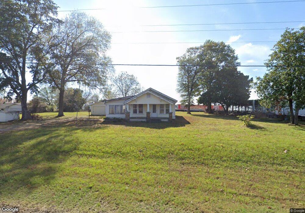
3619 U S 64 Mulberry, AR 72947
Estimated Value: $83,000 - $120,000
3
Beds
1
Bath
1,250
Sq Ft
$85/Sq Ft
Est. Value
About This Home
This home is located at 3619 U S 64, Mulberry, AR 72947 and is currently estimated at $106,245, approximately $84 per square foot. 3619 U S 64 is a home located in Crawford County with nearby schools including Marvin Primary School, Pleasant View Junior High School, and Mulberry High School.
Ownership History
Date
Name
Owned For
Owner Type
Purchase Details
Closed on
Jun 15, 2021
Sold by
Delong George and Delong Ann Beth
Bought by
Meinardus Jessica
Current Estimated Value
Purchase Details
Closed on
Nov 23, 2007
Sold by
Mcclanahan Ralph W and Mcclanahan Donna
Bought by
Delong George and Delong Carol
Home Financials for this Owner
Home Financials are based on the most recent Mortgage that was taken out on this home.
Original Mortgage
$73,548
Interest Rate
6.43%
Mortgage Type
VA
Purchase Details
Closed on
Jan 7, 2002
Bought by
Mcclanahan-Mcclanahan and Gurien
Purchase Details
Closed on
Jan 25, 2000
Bought by
Macias-Mcclanahan
Purchase Details
Closed on
Oct 3, 1996
Bought by
Pannell-Mason and Macias
Create a Home Valuation Report for This Property
The Home Valuation Report is an in-depth analysis detailing your home's value as well as a comparison with similar homes in the area
Home Values in the Area
Average Home Value in this Area
Purchase History
| Date | Buyer | Sale Price | Title Company |
|---|---|---|---|
| Meinardus Jessica | $54,100 | Western Arkansas Title Svcs | |
| Delong George | $72,000 | -- | |
| Mcclanahan-Mcclanahan | -- | -- | |
| Macias-Mcclanahan | $52,000 | -- | |
| Pannell-Mason | -- | -- | |
| Hall-Macias | $40,000 | -- |
Source: Public Records
Mortgage History
| Date | Status | Borrower | Loan Amount |
|---|---|---|---|
| Previous Owner | Delong George | $73,548 |
Source: Public Records
Tax History Compared to Growth
Tax History
| Year | Tax Paid | Tax Assessment Tax Assessment Total Assessment is a certain percentage of the fair market value that is determined by local assessors to be the total taxable value of land and additions on the property. | Land | Improvement |
|---|---|---|---|---|
| 2025 | $627 | $12,010 | $2,000 | $10,010 |
| 2024 | $627 | $12,010 | $2,000 | $10,010 |
| 2023 | $463 | $12,010 | $2,000 | $10,010 |
| 2022 | $421 | $8,060 | $1,500 | $6,560 |
| 2021 | $10 | $7,900 | $1,500 | $6,400 |
| 2020 | $10 | $7,900 | $1,500 | $6,400 |
| 2019 | $7 | $7,900 | $1,500 | $6,400 |
| 2018 | $15 | $7,900 | $1,500 | $6,400 |
| 2017 | -- | $7,140 | $1,500 | $5,640 |
| 2016 | -- | $7,140 | $1,500 | $5,640 |
| 2015 | -- | $7,140 | $1,500 | $5,640 |
| 2014 | $30 | $7,140 | $1,500 | $5,640 |
Source: Public Records
Map
Nearby Homes
- TBD Industrial Park Dr
- TBD Exsorbet Dr
- 3218 Mulberry Wire Rd
- 3042 Mulberry Highway 64 W
- 3032 King Dr
- 3819 Ridgemont Estate
- TBD (lot 29) Keystone Dr
- TBD (lot 30) Keystone Dr
- 2500 River Vista Dr
- TBD Goff Cir
- 1321 Old Graphic St
- 2034 Mulberry Wire Rd
- 10110 Booth Rd
- 5319 Chastain Rd
- 205 N Main St
- 2832 Tova Ln
- 223 S Main St
- 829 W Line St
- 317 S Main St
- 2150 Old Graphic St
- 3619 Mulberry Highway 64 W
- 3545 Mulberry Highway 64 W
- 3520 Mulberry Highway 64 W
- 917 Jim Edwards Ln
- 3741 Mulberry Highway 64 W
- 3443 Mulberry Highway 64 W
- 3443 U S 64
- 3741 U S 64
- 3825 Mulberry Highway 64 W
- 3420 Mulberry Highway 64 W
- 3500 U S 64
- 3451 Mulberry Wire Rd
- 3253 Mulberry Wire Rd
- 3334 Mulberry Highway 64 W
- 608 Industrial Park Dr
- 3815 Mulberry Highway 64 W
- 3226 Mulberry Highway 64 W
- 3220 Mulberry Highway 64 W
- 0 Exsorbet Dr
- 3210 Mulberry Highway 64 W