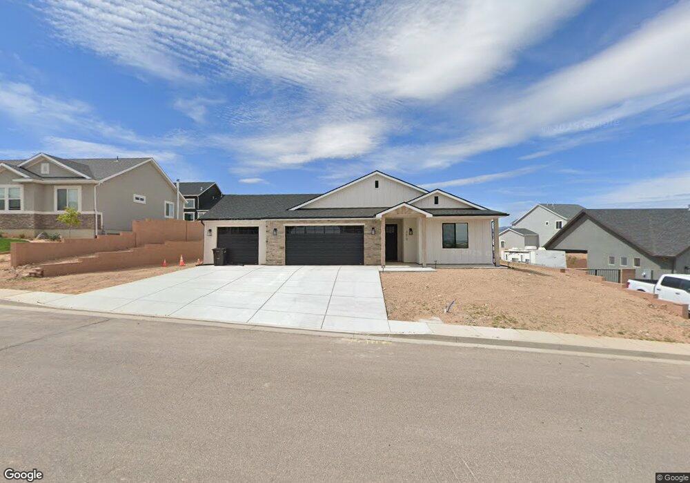
3619 W Benson Way Unit 20 Cedar City, UT 84720
Estimated Value: $449,000 - $554,000
--
Bed
--
Bath
--
Sq Ft
0.25
Acres
About This Home
This home is located at 3619 W Benson Way Unit 20, Cedar City, UT 84720 and is currently estimated at $485,814. 3619 W Benson Way Unit 20 is a home located in Iron County with nearby schools including Iron Springs School, Cedar Middle School, and Cedar City High School.
Ownership History
Date
Name
Owned For
Owner Type
Purchase Details
Closed on
Feb 26, 2025
Sold by
K & D Family Llc
Bought by
Ruiz Marni and Ruiz Rene F
Current Estimated Value
Home Financials for this Owner
Home Financials are based on the most recent Mortgage that was taken out on this home.
Original Mortgage
$275,000
Outstanding Balance
$273,638
Interest Rate
7.04%
Mortgage Type
New Conventional
Estimated Equity
$212,176
Purchase Details
Closed on
Jun 13, 2024
Sold by
Goe Whitney and Stoltz Emily
Bought by
K & D Family Llc
Purchase Details
Closed on
Sep 10, 2020
Sold by
Art And Vada Armbrust Family Prop Llc
Bought by
Goe Whitney and Stottz Emily
Create a Home Valuation Report for This Property
The Home Valuation Report is an in-depth analysis detailing your home's value as well as a comparison with similar homes in the area
Home Values in the Area
Average Home Value in this Area
Purchase History
| Date | Buyer | Sale Price | Title Company |
|---|---|---|---|
| Ruiz Marni | -- | Old Republic Title | |
| Ruiz Marni | -- | Old Republic Title | |
| K & D Family Llc | -- | Old Republic Title | |
| Goe Whitney | -- | American First Escrow & Ttl |
Source: Public Records
Mortgage History
| Date | Status | Borrower | Loan Amount |
|---|---|---|---|
| Open | Ruiz Marni | $275,000 | |
| Closed | Ruiz Marni | $275,000 |
Source: Public Records
Tax History Compared to Growth
Tax History
| Year | Tax Paid | Tax Assessment Tax Assessment Total Assessment is a certain percentage of the fair market value that is determined by local assessors to be the total taxable value of land and additions on the property. | Land | Improvement |
|---|---|---|---|---|
| 2025 | $1,457 | $187,328 | $50,706 | $136,622 |
| 2023 | $551 | $57,290 | $57,290 | $0 |
| 2022 | $492 | $53,540 | $53,540 | $0 |
| 2021 | $394 | $42,830 | $42,830 | $0 |
| 2020 | $404 | $38,935 | $38,935 | $0 |
| 2019 | $0 | $0 | $0 | $0 |
Source: Public Records
Map
Nearby Homes
- 3577 W Bladen St Unit Lot 141 Ph 5
- 3577 W Bladen St
- Sydney Plan at Old Sorrel Ranch
- Topaz Plan at Old Sorrel Ranch
- Monroe Plan at Old Sorrel Ranch
- 606 S Foundation Trail
- 535 S Foundation Trail
- 533 S Renze Adams St
- 533 S Renze Adams St Unit Lot 146 Ph 5
- 549 S Bryant St
- 549 S Bryant St Unit 129
- 503 S Renze Adams St
- 611 S Renze Adams St
- 611 S Renze Adams St Unit Lot 151 Ph 5
- 583 S Cedar Creek Dr
- 583 S Cedar Creek Dr Unit 126
- 522 S Renze Adams St
- 522 S Renze Adams St Unit Lot 142 Ph 5
- 595 S Cedar Creek Dr Unit 125
- 595 S Cedar Creek Dr
- 3619 W Benson Way Unit 1
- 3629 W Benson Way Unit 1
- 3629 W Benson Way Unit 21
- 3629 W Benson Way
- 3614 W Bladen St Unit 4
- 3614 W Bladen St Unit 82
- 3598 W Benson Way
- 3589 W Benson Way
- 3588 W Benson Way
- 3588 W Benson Way Unit 73
- 3598 W Benson Way Unit 72
- 3589 W Benson Way Unit 70
- 3599 W Benson Way Unit 71
- 3599 W Benson Way
- 3577 W Bladen St Unit Phase 5
- 3643 W Benson Way Unit 1
- 3643 W Benson Way Unit 22
- 3643 W Benson Way
- 3608 W Benson Way
- 502 Foundation Trail