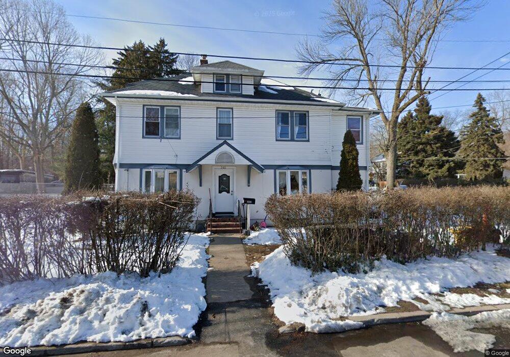
362 Balsam St Teaneck, NJ 07666
Estimated Value: $680,000 - $728,298
--
Bed
--
Bath
2,036
Sq Ft
$346/Sq Ft
Est. Value
About This Home
This home is located at 362 Balsam St, Teaneck, NJ 07666 and is currently estimated at $703,825, approximately $345 per square foot. 362 Balsam St is a home located in Bergen County with nearby schools including Teaneck Senior High School, Wilbert F Mays Seventh-Day Adventist School, and Ability School.
Ownership History
Date
Name
Owned For
Owner Type
Purchase Details
Closed on
Oct 6, 2006
Sold by
Florio Michael
Bought by
Paguay Macario
Current Estimated Value
Home Financials for this Owner
Home Financials are based on the most recent Mortgage that was taken out on this home.
Original Mortgage
$307,000
Outstanding Balance
$183,294
Interest Rate
6.47%
Estimated Equity
$520,531
Purchase Details
Closed on
Dec 14, 2005
Sold by
Paul Peter
Bought by
Florio Michael
Home Financials for this Owner
Home Financials are based on the most recent Mortgage that was taken out on this home.
Original Mortgage
$364,000
Interest Rate
6.39%
Create a Home Valuation Report for This Property
The Home Valuation Report is an in-depth analysis detailing your home's value as well as a comparison with similar homes in the area
Home Values in the Area
Average Home Value in this Area
Purchase History
| Date | Buyer | Sale Price | Title Company |
|---|---|---|---|
| Paguay Macario | $438,600 | -- | |
| Florio Michael | $455,000 | -- |
Source: Public Records
Mortgage History
| Date | Status | Borrower | Loan Amount |
|---|---|---|---|
| Open | Paguay Macario | $307,000 | |
| Previous Owner | Florio Michael | $364,000 |
Source: Public Records
Tax History Compared to Growth
Tax History
| Year | Tax Paid | Tax Assessment Tax Assessment Total Assessment is a certain percentage of the fair market value that is determined by local assessors to be the total taxable value of land and additions on the property. | Land | Improvement |
|---|---|---|---|---|
| 2025 | $12,702 | $581,600 | $191,700 | $389,900 |
| 2024 | $9,635 | $581,600 | $191,700 | $389,900 |
| 2023 | $9,446 | $291,800 | $120,800 | $171,000 |
| 2022 | $9,446 | $291,800 | $120,800 | $171,000 |
| 2021 | $9,501 | $291,800 | $120,800 | $171,000 |
| 2020 | $9,437 | $291,800 | $120,800 | $171,000 |
| 2019 | $9,329 | $291,800 | $120,800 | $171,000 |
| 2018 | $9,259 | $291,800 | $120,800 | $171,000 |
| 2017 | $9,171 | $291,800 | $120,800 | $171,000 |
| 2016 | $9,034 | $291,800 | $120,800 | $171,000 |
| 2015 | $8,891 | $291,800 | $120,800 | $171,000 |
| 2014 | $11,184 | $435,000 | $191,200 | $243,800 |
Source: Public Records
Map
Nearby Homes
- 322 W Englewood Ave
- 299 W Englewood Ave
- 105 Orange St
- 269 Hirliman Rd
- 384 W Palisade Ave
- 312 W Palisade Ave
- 208 Manhattan Ave
- 1485 Gaylord Terrace
- 1470 Gaylord Terrace
- 81 Mattlage Place
- 227-229 W Englewood Ave
- 81 Franklin Rd
- 41 Coriander Way Unit 41
- 263 Genesee Ave
- 121 Washington Place
- 201 W Englewood Ave
- 57 Brookway Ave Unit 2D
- 24 Cleveland St
- 192 W Englewood Ave
- 130 Park Ave
- 256 Englewood Ave
- 250 Englewood Ave
- 356 W Englewood Ave
- 1446 Balsam St
- 350 W Englewood Ave
- 366 W Englewood Ave
- 1436 Balsam St
- 127 Oak St
- 344 W Englewood Ave
- 531 Englewood Ave
- 96 Oak St
- 533 Englewood Ave
- 1430 Balsam St
- 131 Oak St
- 114 Wood St
- 342 W Englewood Ave
- 120 Wood St
- 537 Englewood Ave
- 542 Englewood Ave
- 92 Oak St