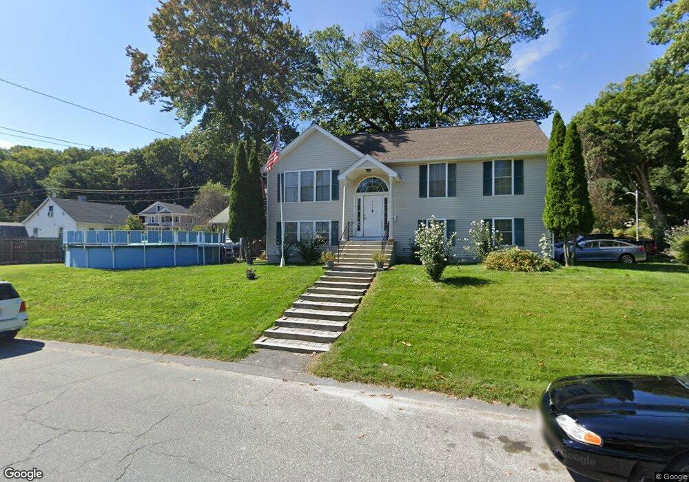
362 Bridle Path Worcester, MA 01604
Grafton Hill NeighborhoodEstimated Value: $422,000 - $532,000
5
Beds
2
Baths
1,056
Sq Ft
$451/Sq Ft
Est. Value
About This Home
This home is located at 362 Bridle Path, Worcester, MA 01604 and is currently estimated at $475,919, approximately $450 per square foot. 362 Bridle Path is a home located in Worcester County with nearby schools including Jacob Hiatt Magnet School, Chandler Magnet, and Lake View Elementary School.
Ownership History
Date
Name
Owned For
Owner Type
Purchase Details
Closed on
May 8, 1997
Sold by
Anger Jeffrey D and Anger Kimberly A
Bought by
Dillon Lee F and Dillon Monica
Current Estimated Value
Home Financials for this Owner
Home Financials are based on the most recent Mortgage that was taken out on this home.
Original Mortgage
$127,398
Interest Rate
7.88%
Mortgage Type
Purchase Money Mortgage
Purchase Details
Closed on
Oct 1, 1996
Sold by
Kelleher Daniel and Kellher Joan
Bought by
Anger Jeffrey and Anger Kimberly
Create a Home Valuation Report for This Property
The Home Valuation Report is an in-depth analysis detailing your home's value as well as a comparison with similar homes in the area
Home Values in the Area
Average Home Value in this Area
Purchase History
We collect this data history from publicly available records. To have your information removed, we recommend requesting removal directly through your county’s website.
| Date | Buyer | Sale Price | Title Company |
|---|---|---|---|
| Dillon Lee F | $124,900 | -- | |
| Anger Jeffrey | $25,000 | -- |
Source: Public Records
Mortgage History
We collect this data history from publicly available records. To have your information removed, we recommend requesting removal directly through your county’s website.
| Date | Status | Borrower | Loan Amount |
|---|---|---|---|
| Open | Anger Jeffrey | $134,450 | |
| Closed | Anger Jeffrey | $127,398 |
Source: Public Records
Tax History
| Year | Tax Paid | Tax Assessment Tax Assessment Total Assessment is a certain percentage of the fair market value that is determined by local assessors to be the total taxable value of land and additions on the property. | Land | Improvement |
|---|---|---|---|---|
| 2025 | $5,930 | $449,600 | $122,300 | $327,300 |
| 2024 | $5,776 | $420,100 | $122,300 | $297,800 |
| 2023 | $5,626 | $392,300 | $105,300 | $287,000 |
| 2022 | $4,977 | $327,200 | $84,300 | $242,900 |
| 2021 | $4,921 | $302,300 | $67,400 | $234,900 |
| 2020 | $4,672 | $274,800 | $67,200 | $207,600 |
| 2019 | $4,640 | $257,800 | $64,700 | $193,100 |
| 2018 | $4,667 | $246,800 | $64,700 | $182,100 |
| 2017 | $4,478 | $233,000 | $64,700 | $168,300 |
| 2016 | $4,520 | $219,300 | $52,300 | $167,000 |
| 2015 | $4,401 | $219,300 | $52,300 | $167,000 |
| 2014 | $4,285 | $219,300 | $52,300 | $167,000 |
Source: Public Records
Map
Nearby Homes
- 411B Lake Ave
- 36 Canna Dr
- 469 Lake Ave
- 11 Sunset Ln
- 13 Pocasset St
- 19 Cedar Rd
- 21 Middlesex Ave Unit 305
- 1 Bay View Dr
- Lot B Crawford St
- 2 Salisbury St
- 34 Marjorie St
- 2A Nonquit St Unit A
- 42 Ernest Ave
- 6 Pineland Ave
- 20 Duluth St
- 76 Valmor St
- 360 Hamilton St
- 1 Ayrshire Rd
- 330 Sunderland Rd Unit 95
- 12 Hyannis Place
Your Personal Tour Guide
Ask me questions while you tour the home.