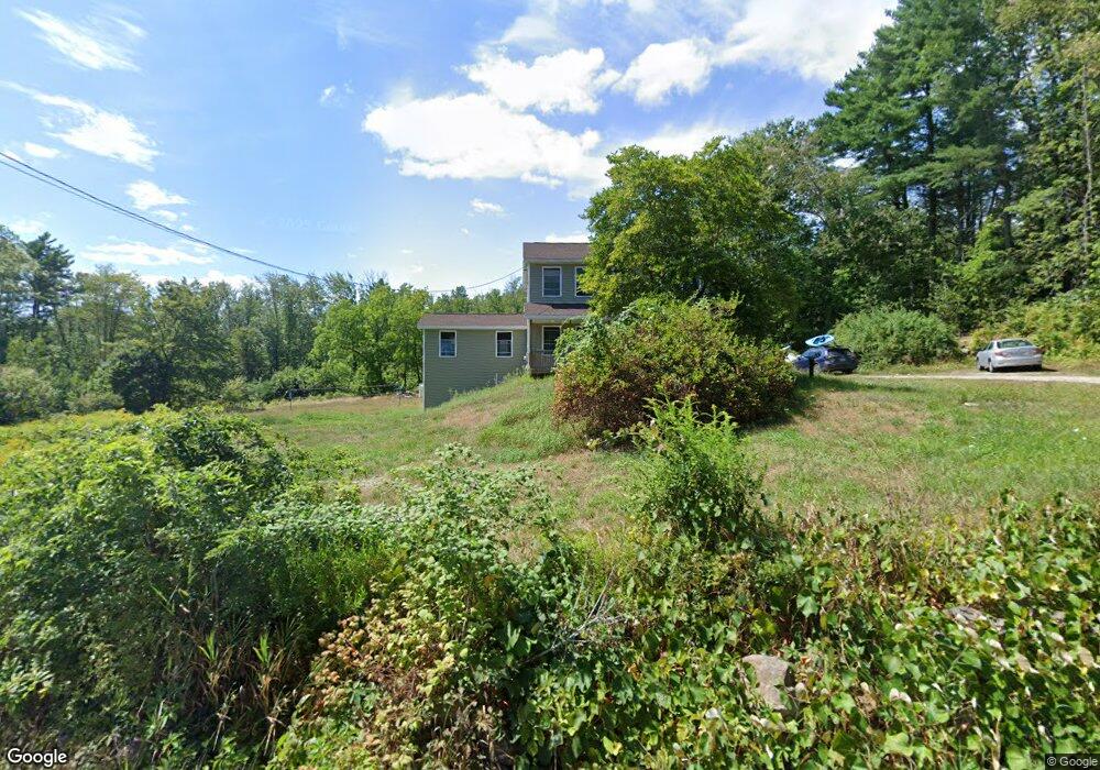
362 Clarks Bridge Rd North Waterboro, ME 04061
Waterboro NeighborhoodEstimated Value: $478,000 - $751,071
3
Beds
1
Bath
1,800
Sq Ft
$331/Sq Ft
Est. Value
About This Home
This home is located at 362 Clarks Bridge Rd, North Waterboro, ME 04061 and is currently estimated at $595,024, approximately $330 per square foot. 362 Clarks Bridge Rd is a home located in York County with nearby schools including Massabesic High School.
Ownership History
Date
Name
Owned For
Owner Type
Purchase Details
Closed on
Aug 29, 2016
Sold by
Macalpine William B and Macalpine Jonathan M
Bought by
Macalpine Jonathan M and Macalpine Andrea B
Current Estimated Value
Purchase Details
Closed on
Dec 10, 2013
Sold by
Wenger Cynthia G
Bought by
Macalpine William B and Macalpine Jonathan M
Create a Home Valuation Report for This Property
The Home Valuation Report is an in-depth analysis detailing your home's value as well as a comparison with similar homes in the area
Home Values in the Area
Average Home Value in this Area
Purchase History
| Date | Buyer | Sale Price | Title Company |
|---|---|---|---|
| Macalpine Jonathan M | -- | -- | |
| Macalpine William B | -- | -- |
Source: Public Records
Tax History Compared to Growth
Tax History
| Year | Tax Paid | Tax Assessment Tax Assessment Total Assessment is a certain percentage of the fair market value that is determined by local assessors to be the total taxable value of land and additions on the property. | Land | Improvement |
|---|---|---|---|---|
| 2024 | $7,327 | $663,100 | $111,200 | $551,900 |
| 2023 | $6,801 | $515,200 | $93,900 | $421,300 |
| 2022 | $6,425 | $458,900 | $83,700 | $375,200 |
| 2021 | $6,237 | $414,400 | $76,100 | $338,300 |
| 2020 | $6,034 | $392,100 | $69,800 | $322,300 |
| 2019 | $5,936 | $385,700 | $63,400 | $322,300 |
| 2018 | $2,063 | $133,800 | $63,400 | $70,400 |
| 2017 | $2,066 | $133,800 | $63,400 | $70,400 |
| 2016 | $2,039 | $133,800 | $63,400 | $70,400 |
| 2015 | $2,038 | $146,100 | $75,700 | $70,400 |
| 2014 | $2,044 | $146,100 | $75,700 | $70,400 |
| 2013 | $1,993 | $146,100 | $75,700 | $70,400 |
Source: Public Records
Map
Nearby Homes
- M13L30 Clarks Bridge Rd
- 5 Clarks Bridge Rd
- 157 Silver Ln
- Mp44Lt270 Silver Ln
- 4 Dragonfly Cir
- 126 Greenfield Rd
- 0 Hunter Rd Unit 1643176
- TBD New Dam Rd
- 138 Fairview Dr
- 56 Paradise Ln
- 17 High Point Cir
- 65 Beaver Dam Rd Unit Lot A
- 60 Sequoia Ln
- 107 Sequoia Ln
- 386 Lenox Cir
- 0 Island Rd Unit 1643509
- 685 Crystal Ln
- 50 Island Rd
- 52 Long Causeway
- Lot 2203 Kennedy Dr
- 0 Thyngs Mill Unit 874521
- 0 Thyngs Mill Unit 772146
- 0 Thyngs Mill Unit 820784
- 0 Thyngs Mill Unit 710788
- 0 Thyngs Mill Unit 705258
- 0 Thyngs Mill Unit 905759
- 361 Clarks Bridge Rd
- 0 Thyngs Mills Rd Unit 1082106
- 0 Thyngs Mills Rd Unit 1494987
- 0 Thyngs Mills Rd Unit 1524049
- 343 Clarks Bridge Rd
- 340 Clarks Bridge Rd
- 33 Thyngs Mill Rd
- 000 Clarks Bridge Rd
- 38 Thyngs Mill Rd
- 0 Thyngs Mill Rd Unit 655031
- 0 Thyngs Mill Rd Unit 1557634
- 0 Thyngs Mill Rd Unit 978462
- 0 Thyngs Mill Rd Unit 1038386
- 0 Thyngs Mill Rd Unit 1118372