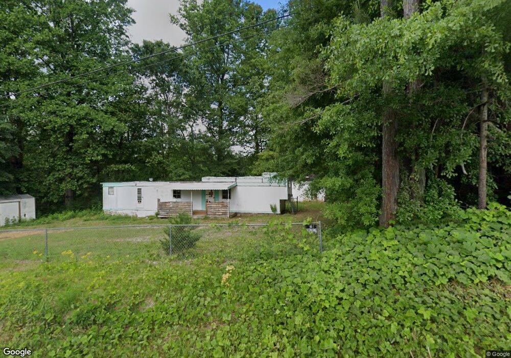
362 Coffee Rd Walhalla, SC 29691
Estimated Value: $70,622 - $134,000
Studio
--
Bath
520
Sq Ft
$187/Sq Ft
Est. Value
About This Home
This home is located at 362 Coffee Rd, Walhalla, SC 29691 and is currently estimated at $97,406, approximately $187 per square foot. 362 Coffee Rd is a home located in Oconee County with nearby schools including James M. Brown Elementary School, Walhalla Middle School, and Walhalla High School.
Ownership History
Date
Name
Owned For
Owner Type
Purchase Details
Closed on
May 16, 2022
Sold by
William James Ricky
Bought by
Cretsinger Leslie Destiny
Current Estimated Value
Purchase Details
Closed on
Apr 14, 2020
Sold by
Holland Ralph L
Bought by
James Ricky William and James Cheryl Lynn
Purchase Details
Closed on
Aug 9, 2019
Sold by
Petel Meenakshi and Patel Meenakshi
Bought by
James Ricky William and James Cheryl Lynn
Purchase Details
Closed on
Aug 3, 2013
Sold by
Duncan Virgil Dennis
Bought by
Petel Meenakshi
Purchase Details
Closed on
Dec 17, 2009
Sold by
Prater Johnny L
Bought by
Duncan Virgil Dennis and Leroy Annette D
Create a Home Valuation Report for This Property
The Home Valuation Report is an in-depth analysis detailing your home's value as well as a comparison with similar homes in the area
Home Values in the Area
Average Home Value in this Area
Purchase History
| Date | Buyer | Sale Price | Title Company |
|---|---|---|---|
| Cretsinger Leslie Destiny | $9,000 | Bagwell & Corley Law Firm Pc | |
| James Ricky William | $15,000 | None Available | |
| James Ricky William | $15,000 | None Available | |
| Petel Meenakshi | $15,000 | -- | |
| Duncan Virgil Dennis | -- | -- |
Source: Public Records
Tax History
| Year | Tax Paid | Tax Assessment Tax Assessment Total Assessment is a certain percentage of the fair market value that is determined by local assessors to be the total taxable value of land and additions on the property. | Land | Improvement |
|---|---|---|---|---|
| 2025 | $219 | $677 | $500 | $177 |
| 2024 | $219 | $677 | $500 | $177 |
| 2023 | $219 | $677 | $500 | $177 |
| 2022 | $235 | $719 | $532 | $187 |
| 2021 | $166 | $601 | $422 | $179 |
| 2020 | $166 | $601 | $422 | $179 |
| 2019 | $166 | $0 | $0 | $0 |
| 2018 | $162 | $0 | $0 | $0 |
| 2017 | $228 | $0 | $0 | $0 |
| 2016 | $228 | $0 | $0 | $0 |
| 2015 | -- | $0 | $0 | $0 |
| 2014 | -- | $708 | $586 | $123 |
| 2013 | -- | $0 | $0 | $0 |
Source: Public Records
Map
Nearby Homes
- 109 S Laurel St
- 107 S Laurel St
- 318 S Pine St
- 606 W South Broad St
- 122 Skyview Dr
- 384 E Woodland Dr
- 804 W North Broad St
- 2423 Westminster Hwy
- 320 Jaynes St
- 00 N Church St
- 430 Rock Crusher Rd
- 223 N Dogwood Dr
- 606 N Poplar St
- 00 Keowee St
- 326 Kenneth St
- 00 Abbott Ln
- 807 W Main St
- 101 Hazelwood Way
- Tract B Bobolink Dr
- 1399 Lake Jemiki Rd
- 338 Coffee Rd
- 378 Coffee Rd
- 0 S Abbott Rd
- 392 Coffee Rd
- 818 Scooters Dr
- 389 Coffee Rd
- 201 Woodland Dr Unit PALMETTO PARK
- 740 Megans Way
- 740 Megans Way
- 103 S Abbott Rd
- 120 S Abbott Rd
- 205 W Park Dr
- 399 Coffee Rd
- 128 S Abbott Rd
- 202 Woodland Dr
- 211 W Park Dr
- 403 Coffee Rd
- 307 Coffee Rd
- 133 W Park Dr
- 225 Botany Ln
Your Personal Tour Guide
Ask me questions while you tour the home.