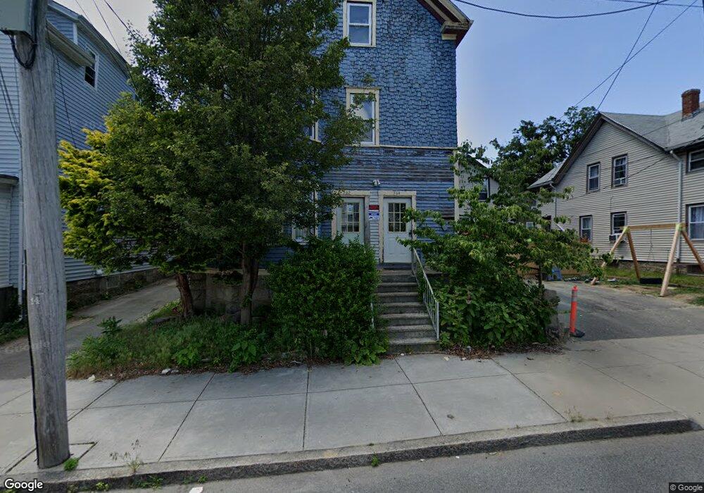
362 Linden St Fall River, MA 02720
Bank Street NeighborhoodEstimated Value: $397,361 - $669,000
9
Beds
3
Baths
3,470
Sq Ft
$170/Sq Ft
Est. Value
About This Home
This home is located at 362 Linden St, Fall River, MA 02720 and is currently estimated at $590,340, approximately $170 per square foot. 362 Linden St is a home located in Bristol County with nearby schools including Mary Fonseca Elementary School, Morton Middle School, and B M C Durfee High School.
Ownership History
Date
Name
Owned For
Owner Type
Purchase Details
Closed on
Feb 4, 2003
Sold by
Millett Chester J and Millett Regina M
Bought by
Sarlo Joseph E and Sarlo Valerie A
Current Estimated Value
Home Financials for this Owner
Home Financials are based on the most recent Mortgage that was taken out on this home.
Original Mortgage
$164,900
Interest Rate
6.09%
Mortgage Type
Purchase Money Mortgage
Create a Home Valuation Report for This Property
The Home Valuation Report is an in-depth analysis detailing your home's value as well as a comparison with similar homes in the area
Home Values in the Area
Average Home Value in this Area
Purchase History
| Date | Buyer | Sale Price | Title Company |
|---|---|---|---|
| Sarlo Joseph E | $170,000 | -- |
Source: Public Records
Mortgage History
| Date | Status | Borrower | Loan Amount |
|---|---|---|---|
| Open | Sarlo Joseph E | $240,000 | |
| Closed | Sarlo Joseph E | $164,900 | |
| Previous Owner | Sarlo Joseph E | $25,000 | |
| Previous Owner | Sarlo Joseph E | $92,000 |
Source: Public Records
Tax History Compared to Growth
Tax History
| Year | Tax Paid | Tax Assessment Tax Assessment Total Assessment is a certain percentage of the fair market value that is determined by local assessors to be the total taxable value of land and additions on the property. | Land | Improvement |
|---|---|---|---|---|
| 2025 | $5,687 | $496,700 | $115,500 | $381,200 |
| 2024 | $5,465 | $475,600 | $113,200 | $362,400 |
| 2023 | $4,919 | $400,900 | $102,000 | $298,900 |
| 2022 | $4,018 | $346,400 | $96,200 | $250,200 |
| 2021 | $4,018 | $290,500 | $91,900 | $198,600 |
| 2020 | $3,604 | $249,400 | $87,700 | $161,700 |
| 2019 | $3,203 | $219,700 | $91,700 | $128,000 |
| 2018 | $3,095 | $211,700 | $92,400 | $119,300 |
| 2017 | $2,964 | $211,700 | $92,400 | $119,300 |
| 2016 | $2,881 | $211,400 | $95,200 | $116,200 |
| 2015 | $2,765 | $211,400 | $95,200 | $116,200 |
| 2014 | $2,804 | $222,900 | $95,200 | $127,700 |
Source: Public Records
Map
Nearby Homes
- 610 Walnut St
- 499 Maple St
- 770 Locust St
- 808 Walnut St
- 104 Grove St
- 163 Linden St
- 364 High St
- 362 High St
- 360 High St
- 545 Robeson St
- 847 Locust St
- 72 Belmont St
- 862 Locust St
- 37 Shawmut St
- 501 Pine St
- 171 Ogrady St Unit 303 aka 26
- 243 Robeson St Unit 6
- 243 Robeson St Unit 3
- 450 Rock St Unit 1
- 450 Rock St Unit 2
- 370 Linden St
- 370 Linden St Unit 1
- 370-376 Linden St
- 624 Walnut St
- 624 Walnut St Unit 1
- 624 Walnut St Unit 2
- 380 Linden St
- 627 Maple St
- 279 Grove St
- 596 Walnut St Unit 598
- 627 1/2 Maple St
- 635 Maple St
- 641 Maple St
- 353-355 Linden St
- 297 Grove St
- 361 Linden St
- 613 Maple St
- 379 Linden St
- 379 Linden St Unit 2
- 353 Linden St