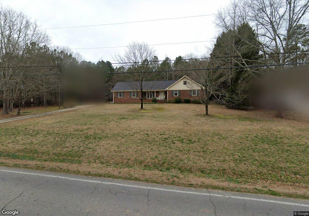
362 Miles Patrick Rd Winder, GA 30680
Estimated Value: $331,000 - $353,000
3
Beds
2
Baths
1,743
Sq Ft
$196/Sq Ft
Est. Value
About This Home
This home is located at 362 Miles Patrick Rd, Winder, GA 30680 and is currently estimated at $341,666, approximately $196 per square foot. 362 Miles Patrick Rd is a home located in Barrow County with nearby schools including County Line Elementary School, Russell Middle School, and Winder-Barrow High School.
Ownership History
Date
Name
Owned For
Owner Type
Purchase Details
Closed on
Mar 7, 2006
Sold by
Reynolds James E
Bought by
Her Bay
Current Estimated Value
Home Financials for this Owner
Home Financials are based on the most recent Mortgage that was taken out on this home.
Original Mortgage
$144,000
Outstanding Balance
$99,848
Interest Rate
10.38%
Mortgage Type
New Conventional
Estimated Equity
$241,818
Purchase Details
Closed on
Oct 26, 1994
Sold by
Harrison Lee
Bought by
Reynolds Eugene Ann
Purchase Details
Closed on
Nov 1, 1984
Bought by
Reynolds Eugene and Reynolds An
Create a Home Valuation Report for This Property
The Home Valuation Report is an in-depth analysis detailing your home's value as well as a comparison with similar homes in the area
Home Values in the Area
Average Home Value in this Area
Purchase History
| Date | Buyer | Sale Price | Title Company |
|---|---|---|---|
| Her Bay | $160,000 | -- | |
| Reynolds Eugene Ann | $25,000 | -- | |
| Reynolds Eugene | $12,000 | -- |
Source: Public Records
Mortgage History
| Date | Status | Borrower | Loan Amount |
|---|---|---|---|
| Open | Her Bay | $144,000 |
Source: Public Records
Tax History Compared to Growth
Tax History
| Year | Tax Paid | Tax Assessment Tax Assessment Total Assessment is a certain percentage of the fair market value that is determined by local assessors to be the total taxable value of land and additions on the property. | Land | Improvement |
|---|---|---|---|---|
| 2024 | $916 | $88,572 | $22,126 | $66,446 |
| 2023 | $587 | $88,572 | $22,126 | $66,446 |
| 2022 | $802 | $62,760 | $22,126 | $40,634 |
| 2021 | $733 | $62,760 | $22,126 | $40,634 |
| 2020 | $723 | $62,760 | $22,126 | $40,634 |
| 2019 | $721 | $58,511 | $21,090 | $37,421 |
| 2018 | $705 | $58,511 | $21,090 | $37,421 |
| 2017 | $1,581 | $52,990 | $21,090 | $31,900 |
| 2016 | $584 | $52,990 | $21,090 | $31,900 |
| 2015 | $1,194 | $52,990 | $21,090 | $31,900 |
| 2014 | $788 | $42,234 | $10,334 | $31,900 |
| 2013 | -- | $40,071 | $10,334 | $29,737 |
Source: Public Records
Map
Nearby Homes
- 326 Miles Patrick Rd
- 401 N 5th Ave
- 27 Creekside Dr
- 172 Settle St
- 197 Buena Vista St
- 303 Rocky Point Ct
- 0 E Northcrest Dr Unit 10648147
- 469 Plantation Dr
- 436 Northcrest Dr
- 381 W Candler St
- 254 Partridge Trail
- 352 3rd Ave
- 171 Brookview Terrace
- 256 4th Ave
- 5 Olevia St
- 281 Springdale Dr
- 217 Bellview St
- 311 2nd Ave
- 368 Miles Patrick Rd
- 367 Miles Patrick Rd Unit 1
- 375 Miles Patrick Rd Unit 1
- 374 Miles Patrick Rd
- 355 Miles Patrick Rd
- 378 Miles Patrick Rd
- 2.23 ACRES Miles Patrick Rd
- 352 Miles Patrick Rd
- 363 Miles Patrick Rd
- 377 Miles Patrick Rd Unit 1
- 351 Miles Patrick Rd
- 382 Miles Patrick Rd
- 379 Miles Patrick Rd Unit 1
- 321 Harrison Ln Unit 15
- 321 Harrison Ln
- 349 Miles Patrick Rd
- 322 Harrison Ln
- 386 Miles Patrick Rd
- 385 Miles Patrick Rd
- 340 Miles Patrick Rd