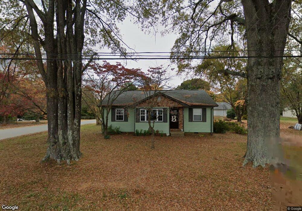
362 Union Cemetery Rd SW Concord, NC 28027
Estimated Value: $208,289 - $244,000
2
Beds
1
Bath
1,086
Sq Ft
$211/Sq Ft
Est. Value
About This Home
This home is located at 362 Union Cemetery Rd SW, Concord, NC 28027 and is currently estimated at $228,822, approximately $210 per square foot. 362 Union Cemetery Rd SW is a home located in Cabarrus County with nearby schools including Wolf Meadow Elementary School, Roberta Road Middle School, and The Daniel Academy of Concord.
Ownership History
Date
Name
Owned For
Owner Type
Purchase Details
Closed on
Dec 8, 2023
Sold by
Boles Mark A and Boles Rachel
Bought by
Lunabelle Llc
Current Estimated Value
Purchase Details
Closed on
Sep 17, 2020
Sold by
Mcclellan B Michael B and Mcclellan Janice B
Bought by
Boles Mark A
Purchase Details
Closed on
Oct 24, 2007
Sold by
Harvell Lonie A
Bought by
Mcclellan B Michael and Mcclellan Janice B
Create a Home Valuation Report for This Property
The Home Valuation Report is an in-depth analysis detailing your home's value as well as a comparison with similar homes in the area
Home Values in the Area
Average Home Value in this Area
Purchase History
| Date | Buyer | Sale Price | Title Company |
|---|---|---|---|
| Lunabelle Llc | -- | None Listed On Document | |
| Boles Mark A | $150,000 | None Available | |
| Mcclellan B Michael | $110,000 | None Available |
Source: Public Records
Tax History Compared to Growth
Tax History
| Year | Tax Paid | Tax Assessment Tax Assessment Total Assessment is a certain percentage of the fair market value that is determined by local assessors to be the total taxable value of land and additions on the property. | Land | Improvement |
|---|---|---|---|---|
| 2025 | $2,019 | $202,700 | $135,720 | $66,980 |
| 2024 | $2,019 | $202,700 | $135,720 | $66,980 |
| 2023 | $1,409 | $115,460 | $74,990 | $40,470 |
| 2022 | $1,409 | $115,460 | $74,990 | $40,470 |
| 2021 | $1,409 | $115,460 | $74,990 | $40,470 |
| 2020 | $1,409 | $115,460 | $74,990 | $40,470 |
| 2019 | $1,287 | $105,510 | $68,180 | $37,330 |
| 2018 | $1,266 | $105,510 | $68,180 | $37,330 |
| 2017 | $1,245 | $105,510 | $68,180 | $37,330 |
| 2016 | $739 | $96,400 | $47,720 | $48,680 |
| 2015 | $1,138 | $96,400 | $47,720 | $48,680 |
| 2014 | $1,138 | $96,400 | $47,720 | $48,680 |
Source: Public Records
Map
Nearby Homes
- 41 Fleetwood Dr SW
- 220 Highland Ave SW
- 1015 Rockland Cir SW
- 207 Highland Ave SW
- 933 Old Charlotte Rd
- 554 Splicewood Dr SW
- 600 Sunderland Rd
- 620 Palmer Ave SW
- 82 Highland Ave SW
- 84 Highland Ave SW
- 64 Robinson Dr SW
- 782 Chalice St SW
- 1067 Old Charlotte Rd
- 809 Fargo Dr SW
- 131 Swink St SW
- 5 Bost Ave SW
- 0000 Bost Ave SW
- 664 Jackson Terrace SW
- 668 Jackson Terrace SW
- 758 Main St SW
- 354 Union Cemetery Rd SW
- 348 Union Cemetery Rd SW
- 374 Union Cemetery Rd SW
- 1940 Coley St SW
- 342 Union Cemetery Rd SW
- 1927 Coley St SW
- 1950 Coley St SW
- 386 Union Cemetery Rd SW
- 1949 Coley St SW
- 359 Union Cemetery Rd SW
- 357 Union Cemetery Rd SW
- 353 Union Cemetery Rd SW
- 345 Union Cemetery Rd SW
- 1956 Coley St SW
- 334 Union Cemetery Rd SW
- 1960 Coley St SW
- 351 Union Cemetery Rd SW
- 381 Union Cemetery Rd SW
- 388 Union Cemetery Rd SW
- 1961 Coley St SW