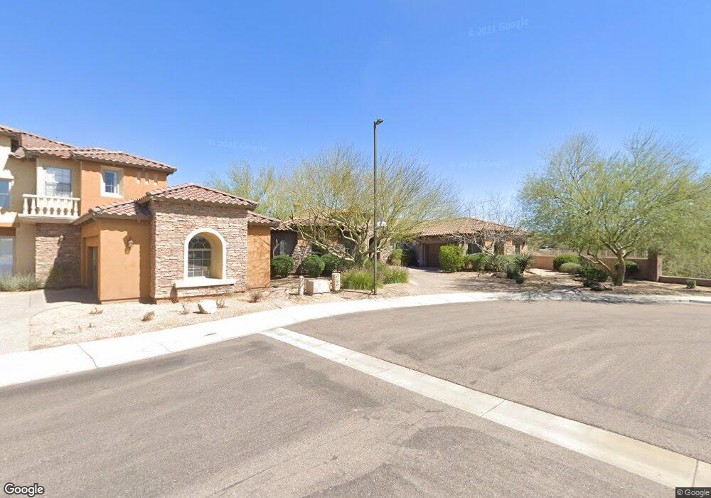
3620 E Robin Ln Phoenix, AZ 85050
Desert Ridge NeighborhoodEstimated Value: $1,526,000 - $1,645,000
3
Beds
4
Baths
4,165
Sq Ft
$383/Sq Ft
Est. Value
About This Home
This home is located at 3620 E Robin Ln, Phoenix, AZ 85050 and is currently estimated at $1,593,593, approximately $382 per square foot. 3620 E Robin Ln is a home located in Maricopa County with nearby schools including Wildfire Elementary School, Explorer Middle School, and Pinnacle High School.
Ownership History
Date
Name
Owned For
Owner Type
Purchase Details
Closed on
Feb 17, 2022
Sold by
Wistort and Michele
Bought by
Wistort Family Trust
Current Estimated Value
Purchase Details
Closed on
May 28, 2008
Sold by
Morris David P
Bought by
Wistort Peter and Wistort Michelle
Home Financials for this Owner
Home Financials are based on the most recent Mortgage that was taken out on this home.
Original Mortgage
$670,000
Interest Rate
5.75%
Mortgage Type
New Conventional
Purchase Details
Closed on
May 17, 2006
Sold by
Toll Brothers Az Lp
Bought by
Morris David P
Home Financials for this Owner
Home Financials are based on the most recent Mortgage that was taken out on this home.
Original Mortgage
$700,000
Interest Rate
6.46%
Mortgage Type
New Conventional
Create a Home Valuation Report for This Property
The Home Valuation Report is an in-depth analysis detailing your home's value as well as a comparison with similar homes in the area
Home Values in the Area
Average Home Value in this Area
Purchase History
| Date | Buyer | Sale Price | Title Company |
|---|---|---|---|
| Wistort Family Trust | -- | Reynoso Luke | |
| Wistort Family Trust | -- | Reynoso Luke | |
| Wistort Peter | $837,500 | Magnus Title Agency | |
| Morris David P | $1,018,842 | Westminster Title Agency Inc | |
| Toll Brothers Az Lp | -- | Westminster Title Agency Inc |
Source: Public Records
Mortgage History
| Date | Status | Borrower | Loan Amount |
|---|---|---|---|
| Previous Owner | Wistort Peter | $670,000 | |
| Previous Owner | Morris David P | $700,000 |
Source: Public Records
Tax History
| Year | Tax Paid | Tax Assessment Tax Assessment Total Assessment is a certain percentage of the fair market value that is determined by local assessors to be the total taxable value of land and additions on the property. | Land | Improvement |
|---|---|---|---|---|
| 2025 | $8,814 | $92,119 | -- | -- |
| 2024 | $8,378 | $87,732 | -- | -- |
| 2023 | $8,378 | $106,920 | $21,380 | $85,540 |
| 2022 | $8,287 | $84,060 | $16,810 | $67,250 |
| 2021 | $8,314 | $80,270 | $16,050 | $64,220 |
| 2020 | $8,038 | $78,210 | $15,640 | $62,570 |
| 2019 | $8,049 | $74,450 | $14,890 | $59,560 |
| 2018 | $7,765 | $71,700 | $14,340 | $57,360 |
| 2017 | $7,419 | $70,310 | $14,060 | $56,250 |
| 2016 | $7,285 | $69,610 | $13,920 | $55,690 |
| 2015 | $6,702 | $68,960 | $13,790 | $55,170 |
Source: Public Records
Map
Nearby Homes
- 22308 N 36th Way
- 22220 N 36th St
- 3729 E Robin Ln
- 3901 E Pinnacle Peak Rd Unit 270
- 3901 E Pinnacle Peak Rd Unit 376
- 3901 E Pinnacle Peak Rd Unit 134
- 3901 E Pinnacle Peak Rd Unit 203
- 3901 E Pinnacle Peak Rd Unit 283
- 3901 E Pinnacle Peak Rd Unit 344
- 3901 E Pinnacle Peak Rd Unit 208
- 3901 E Pinnacle Peak Rd Unit 374
- 3901 E Pinnacle Peak Rd Unit 105
- 3901 E Pinnacle Peak Rd Unit 196
- 3901 E Pinnacle Peak Rd Unit 275
- 3901 E Pinnacle Peak Rd Unit 83
- 3901 E Pinnacle Peak Rd Unit 108
- 3901 E Pinnacle Peak Rd Unit 320
- 3901 E Pinnacle Peak Rd Unit 87
- 3901 E Pinnacle Peak Rd Unit 358
- 3901 E Pinnacle Peak Rd Unit 236
- 3616 E Robin Ln
- 3612 E Robin Ln
- 3613 E Robin Ln
- 3608 E Robin Ln
- 3635 E Maffeo Rd
- 3636 E Maffeo Rd
- 3609 E Robin Ln
- 3614 E Donald Dr
- 3640 E Maffeo Rd
- 22414 N 36th Way
- 22410 N 36th Way
- 3605 E Robin Ln
- 3610 E Donald Dr
- 3644 E Maffeo Rd
- 22324 N 36th Way
- 3648 E Maffeo Rd
- 3606 E Donald Dr
- 22401 N 36th Way
- 3649 E Maffeo Rd
- 22320 N 36th Way
Your Personal Tour Guide
Ask me questions while you tour the home.