Estimated Value: $279,201 - $355,000
3
Beds
3
Baths
1,120
Sq Ft
$281/Sq Ft
Est. Value
About This Home
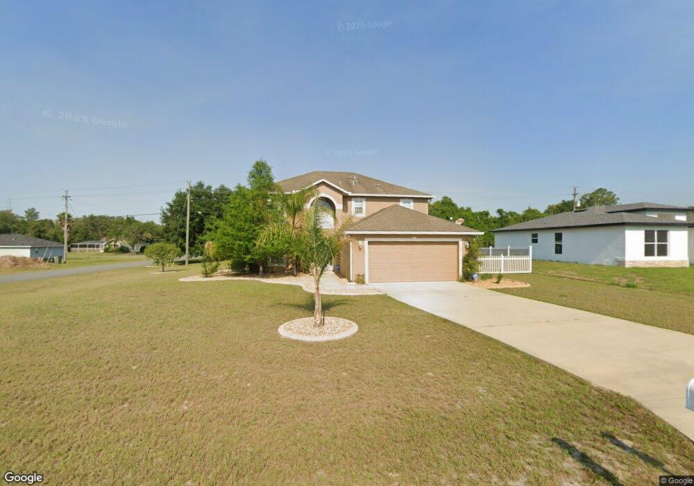
This home is located at 3620 SW 133rd Loop, Ocala, FL 34473 and is currently estimated at $314,800, approximately $281 per square foot. 3620 SW 133rd Loop is a home located in Marion County with nearby schools including Marion Oaks Elementary School, Horizon Academy At Marion Oaks, and West Port High School.
Ownership History
Date
Name
Owned For
Owner Type
Purchase Details
Closed on
Dec 21, 2007
Sold by
Maronda Homes Inc Of Florida
Bought by
Persaud Rajendra D
Current Estimated Value
Home Financials for this Owner
Home Financials are based on the most recent Mortgage that was taken out on this home.
Original Mortgage
$151,025
Outstanding Balance
$93,540
Interest Rate
6.15%
Mortgage Type
Purchase Money Mortgage
Estimated Equity
$221,260
Purchase Details
Closed on
Aug 19, 2005
Sold by
Navarro Gregory Q and Navarro Louise S
Bought by
Maronda Homes Inc Of Florida
Create a Home Valuation Report for This Property
The Home Valuation Report is an in-depth analysis detailing your home's value as well as a comparison with similar homes in the area
Home Values in the Area
Average Home Value in this Area
Purchase History
| Date | Buyer | Sale Price | Title Company |
|---|---|---|---|
| Persaud Rajendra D | $201,100 | Kampf Title & Guaranty Corp | |
| Maronda Homes Inc Of Florida | $35,200 | Kampf Title & Guaranty Corp |
Source: Public Records
Mortgage History
| Date | Status | Borrower | Loan Amount |
|---|---|---|---|
| Open | Persaud Rajendra D | $151,025 |
Source: Public Records
Tax History
| Year | Tax Paid | Tax Assessment Tax Assessment Total Assessment is a certain percentage of the fair market value that is determined by local assessors to be the total taxable value of land and additions on the property. | Land | Improvement |
|---|---|---|---|---|
| 2025 | $1,519 | $95,755 | -- | -- |
| 2024 | $1,282 | $93,056 | -- | -- |
| 2023 | $1,245 | $90,346 | $0 | $0 |
| 2022 | $1,181 | $87,715 | $0 | $0 |
| 2021 | $1,167 | $85,160 | $0 | $0 |
| 2020 | $1,154 | $83,984 | $0 | $0 |
| 2019 | $1,131 | $82,096 | $0 | $0 |
| 2018 | $1,082 | $80,565 | $0 | $0 |
| 2017 | $1,061 | $78,908 | $0 | $0 |
| 2016 | $1,027 | $77,285 | $0 | $0 |
| 2015 | $1,025 | $76,748 | $0 | $0 |
| 2014 | $975 | $76,139 | $0 | $0 |
Source: Public Records
Map
Nearby Homes
- 13350 SW 38th Ct
- 3940 SW 134th St
- 4017 SW 133rd Loop
- 4009 SW 133rd Loop
- 4052 SW 132nd Ln
- 4064 SW 132nd Ln
- 4094 SW 132nd Ln
- 0 SW 130 Place Unit MFROM713242
- TBD SW 37th Ave
- 0 SW 133rd Loop Unit MFRO6341074
- 3932 SW 133rd Loop
- 3926 SW 133rd Loop
- 13621 SW 40th Cir
- 3995 SW 134th St
- 3782 SW 131st St
- 13236 SW 42nd Cir
- 13690 SW 43rd Cir
- 0 SW 41 Ct
- 3825 SW 131st St
- 13215 SW 41st Ct
- 3636 SW 133rd Loop
- 3644 SW 133rd Loop
- 3637 SW 133rd Loop
- 3645 SW 133rd Loop
- 0000 SW 134th St
- 00 SW 134th St
- 13397 SW 39th Avenue Rd
- 3621 SW 133rd Loop
- 3652 SW 133rd Loop
- 13331 SW 39th Avenue Rd
- 3653 SW 133rd Loop
- 13377 SW 39th Avenue Rd
- 13374 SW 38th Ct
- 13311 SW 39th Avenue Rd
- 3906 SW 134th St
- 13768 SW 38th Ct
- 3662 SW 133rd Loop
- 3661 SW 133rd Loop
- 4 SW 133 Ln
- 13326 SW 38th Ct
Your Personal Tour Guide
Ask me questions while you tour the home.