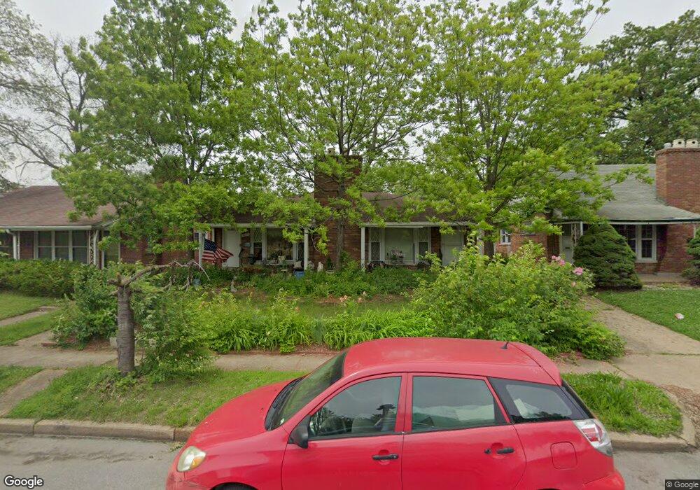
3621 Jamieson Ave Saint Louis, MO 63109
Lindenwood Park NeighborhoodEstimated Value: $202,005 - $400,000
--
Bed
2
Baths
3,520
Sq Ft
$90/Sq Ft
Est. Value
About This Home
This home is located at 3621 Jamieson Ave, Saint Louis, MO 63109 and is currently estimated at $317,001, approximately $90 per square foot. 3621 Jamieson Ave is a home located in St. Louis City with nearby schools including Mason Elementary School, Long International Middle School, and Roosevelt High School.
Ownership History
Date
Name
Owned For
Owner Type
Purchase Details
Closed on
May 4, 2005
Sold by
Hughes Eugene M and Hughes Carol A
Bought by
Hughes Eugene Merton and Hughes Carol Ann
Current Estimated Value
Purchase Details
Closed on
Jun 30, 2003
Sold by
Hughes Eugene Merton and Hughes Carol Ann
Bought by
Hughes Eugene Merton and Hughes Carol Ann
Create a Home Valuation Report for This Property
The Home Valuation Report is an in-depth analysis detailing your home's value as well as a comparison with similar homes in the area
Home Values in the Area
Average Home Value in this Area
Purchase History
| Date | Buyer | Sale Price | Title Company |
|---|---|---|---|
| Hughes Eugene Merton | -- | -- | |
| Hughes Eugene Merton | -- | -- |
Source: Public Records
Tax History Compared to Growth
Tax History
| Year | Tax Paid | Tax Assessment Tax Assessment Total Assessment is a certain percentage of the fair market value that is determined by local assessors to be the total taxable value of land and additions on the property. | Land | Improvement |
|---|---|---|---|---|
| 2025 | $2,589 | $36,190 | $2,600 | $33,590 |
| 2024 | $2,463 | $30,590 | $2,600 | $27,990 |
| 2023 | $2,463 | $30,590 | $2,600 | $27,990 |
| 2022 | $2,346 | $28,040 | $2,600 | $25,440 |
| 2021 | $2,342 | $28,040 | $2,600 | $25,440 |
| 2020 | $2,171 | $26,160 | $2,600 | $23,560 |
| 2019 | $2,163 | $26,160 | $2,600 | $23,560 |
| 2018 | $2,060 | $24,140 | $2,380 | $21,760 |
| 2017 | $2,025 | $24,130 | $2,380 | $21,760 |
| 2016 | $1,974 | $23,220 | $2,380 | $20,840 |
| 2015 | $1,790 | $23,220 | $2,380 | $20,840 |
| 2014 | $1,788 | $23,220 | $2,380 | $20,840 |
| 2013 | -- | $23,200 | $2,380 | $20,820 |
Source: Public Records
Map
Nearby Homes
- 6659 Tholozan Ave
- 7038 Pernod Ave
- 6656 Oleatha Ave
- 6811 Marquette Ave
- 7047 Tholozan Ave
- 3815 Mccausland Ave Unit 4
- 6631 Pernod Ave
- 6621 Tholozan Ave
- 6611 Pernod Ave
- 6973 Winona Ave
- 3558 Wabash Ave
- 6953 Arthur Ave
- 6653 Hancock Ave
- 3308 Jamieson Ave
- 7081 Winona Ave
- 6565 Winnebago St
- 6625 Hancock Ave
- 6541 Lindenwood Place
- 7081 Bancroft Ave
- 6962 Sutherland Ave
- 3625 Jamieson Ave
- 3617 Jamieson Ave
- 36253627 Jamieson Ave
- 3625 Jamieson 3627 Ave
- 3615 Jamieson Ave
- 3620 Berger Ave
- 3616 Berger Ave
- 3624 Berger Ave
- 3612 Berger Ave
- 3607 Jamieson Ave
- 3608 Berger Ave
- 3601 Jamieson Ave
- 3604 Berger Ave
- 3600 Berger Ave
- 6935 Tholozan Ave
- 3710 Berger Ave
- 3715 Jamieson Ave
- 6936 Pernod Ave
- 6937 Tholozan Ave
- 3714 Berger Ave