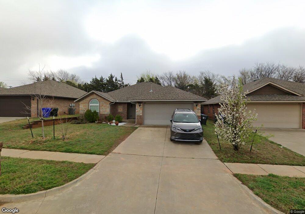
3621 Truman Dr Norman, OK 73072
Southeast Norman NeighborhoodEstimated Value: $255,000 - $269,000
3
Beds
2
Baths
1,607
Sq Ft
$164/Sq Ft
Est. Value
About This Home
This home is located at 3621 Truman Dr, Norman, OK 73072 and is currently estimated at $262,960, approximately $163 per square foot. 3621 Truman Dr is a home with nearby schools including Madison Elementary School, Irving Middle School, and Norman High School.
Ownership History
Date
Name
Owned For
Owner Type
Purchase Details
Closed on
Jul 2, 2015
Sold by
Independence Valley Properties Llc
Bought by
Yamsakul Saravut and Yamsakul Rakchanog
Current Estimated Value
Home Financials for this Owner
Home Financials are based on the most recent Mortgage that was taken out on this home.
Original Mortgage
$165,339
Outstanding Balance
$129,905
Interest Rate
4.08%
Mortgage Type
FHA
Estimated Equity
$133,055
Create a Home Valuation Report for This Property
The Home Valuation Report is an in-depth analysis detailing your home's value as well as a comparison with similar homes in the area
Home Values in the Area
Average Home Value in this Area
Purchase History
| Date | Buyer | Sale Price | Title Company |
|---|---|---|---|
| Yamsakul Saravut | $173,500 | Fatco |
Source: Public Records
Mortgage History
| Date | Status | Borrower | Loan Amount |
|---|---|---|---|
| Open | Yamsakul Saravut | $165,339 |
Source: Public Records
Tax History Compared to Growth
Tax History
| Year | Tax Paid | Tax Assessment Tax Assessment Total Assessment is a certain percentage of the fair market value that is determined by local assessors to be the total taxable value of land and additions on the property. | Land | Improvement |
|---|---|---|---|---|
| 2024 | $2,947 | $24,600 | $3,337 | $21,263 |
| 2023 | $2,814 | $23,429 | $3,602 | $19,827 |
| 2022 | $2,570 | $22,313 | $3,358 | $18,955 |
| 2021 | $2,579 | $21,251 | $4,227 | $17,024 |
| 2020 | $2,404 | $20,239 | $3,360 | $16,879 |
| 2019 | $2,446 | $20,239 | $3,360 | $16,879 |
| 2018 | $2,372 | $20,239 | $3,360 | $16,879 |
| 2017 | $2,397 | $20,239 | $0 | $0 |
| 2016 | $2,438 | $20,239 | $3,360 | $16,879 |
| 2015 | -- | $8,773 | $419 | $8,354 |
| 2014 | -- | $419 | $419 | $0 |
Source: Public Records
Map
Nearby Homes
- 1125 Osprey Dr
- 616 Black Hawk Dr
- 613 Coopers Hawk Dr
- 3604 Glendale Dr
- 608 Coopers Hawk Dr
- 617 Golden Eagle Dr
- 809 Coopers Hawk Dr
- 517 Goshawk Dr
- 705 Night Hawk Dr
- 4404 Condor Dr
- 4217 Caracara Ct
- 1133 Barbary Dr
- 504 Laleh Ct
- Bradford Plan at Eagle Cliff South
- 1201 Monterey Dr
- 848 Cardinal Creek Blvd Unit C
- 827 Red Bird Ln Unit C
- 803 Cardinal Creek Blvd Unit B
- 818 Cardinal Creek Blvd Unit D
- 1307 Presidio Dr
- 3625 Truman Dr
- 3617 Truman Dr
- 3701 Truman Dr
- 3613 Truman Dr
- 3612 Peregrine Dr
- 3608 Peregrine Dr
- 3616 Peregrine Dr
- 3705 Truman Dr
- 3609 Truman Dr
- 3618 Truman Dr
- 3604 Peregrine Dr
- 3614 Truman Dr
- 516 Dalton Ln
- 3620 Peregrine Dr
- 3709 Truman Dr
- 3600 Peregrine Dr
- 3605 Truman Dr
- 3610 Truman Dr
- 3624 Peregrine Dr
- 512 Dalton Ln