Estimated Value: $526,000 - $563,625
3
Beds
2
Baths
3,098
Sq Ft
$178/Sq Ft
Est. Value
About This Home
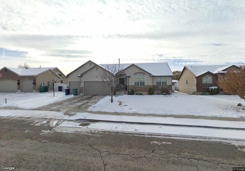
This home is located at 3621 W 5275 S, Roy, UT 84067 and is currently estimated at $551,406, approximately $177 per square foot. 3621 W 5275 S is a home located in Weber County with nearby schools including Municipal School, Roy Junior High School, and Roy High School.
Ownership History
Date
Name
Owned For
Owner Type
Purchase Details
Closed on
Jun 18, 2015
Sold by
Henry Brian
Bought by
Barton Hillary and Barton Levi
Current Estimated Value
Home Financials for this Owner
Home Financials are based on the most recent Mortgage that was taken out on this home.
Original Mortgage
$214,800
Outstanding Balance
$166,487
Interest Rate
3.77%
Mortgage Type
New Conventional
Estimated Equity
$384,919
Purchase Details
Closed on
Feb 4, 2011
Sold by
Northern Regal Homes Inc
Bought by
Henry Brian
Home Financials for this Owner
Home Financials are based on the most recent Mortgage that was taken out on this home.
Original Mortgage
$216,558
Interest Rate
4.79%
Mortgage Type
VA
Create a Home Valuation Report for This Property
The Home Valuation Report is an in-depth analysis detailing your home's value as well as a comparison with similar homes in the area
Home Values in the Area
Average Home Value in this Area
Purchase History
| Date | Buyer | Sale Price | Title Company |
|---|---|---|---|
| Barton Hillary | -- | None Available | |
| Henry Brian | -- | Executive Title Ogden |
Source: Public Records
Mortgage History
| Date | Status | Borrower | Loan Amount |
|---|---|---|---|
| Open | Barton Hillary | $214,800 | |
| Previous Owner | Henry Brian | $216,558 |
Source: Public Records
Tax History Compared to Growth
Tax History
| Year | Tax Paid | Tax Assessment Tax Assessment Total Assessment is a certain percentage of the fair market value that is determined by local assessors to be the total taxable value of land and additions on the property. | Land | Improvement |
|---|---|---|---|---|
| 2025 | $3,442 | $559,311 | $177,555 | $381,756 |
| 2024 | $3,361 | $302,499 | $97,655 | $204,844 |
| 2023 | $3,448 | $312,400 | $94,449 | $217,951 |
| 2022 | $3,330 | $308,550 | $72,332 | $236,218 |
| 2021 | $3,003 | $461,000 | $86,105 | $374,895 |
| 2020 | $2,825 | $398,000 | $86,105 | $311,895 |
| 2019 | $2,476 | $326,000 | $69,948 | $256,052 |
| 2018 | $2,333 | $289,000 | $59,958 | $229,042 |
| 2017 | $2,220 | $258,000 | $57,005 | $200,995 |
| 2016 | $2,211 | $138,679 | $30,259 | $108,420 |
| 2015 | $1,832 | $116,372 | $24,304 | $92,068 |
| 2014 | $1,837 | $115,552 | $24,304 | $91,248 |
Source: Public Records
Map
Nearby Homes
- 3607 W 5400 S
- 3766 W 5300 S
- 3443 W 5200 S Unit 2&3
- 5578 S 3450 W
- 3832 W 5625 S
- 3809 W 5625 S
- 5235 Midland Dr
- 3820 Foxglen Dr
- 4964 S 3375 W
- Poplar Plan at Highgate Cove
- Pando Plan at Highgate Cove
- 3509 W 4835 S Unit 26
- 3523 W 4835 S Unit 28
- 3524 W 4835 S Unit 22
- 5465 S 4050 W
- 3826 W 5750 S
- 5321 S 3100 W
- 5432 S 3150 W
- 3923 W 5700 S
- 5538 S 3150 W
- 3611 W 5275 S
- 3611 W 5275 S Unit 70
- 3633 W 5275 S
- 3633 W 5275 S Unit 72
- 3643 W 5275 S
- 3643 W 5275 S Unit 73
- 3599 W 5275 S
- 3622 W 5275 S
- 3610 W 5275 S
- 3610 W 5275 S Unit 61
- 3634 W 5275 S
- 3626 W 5350 S
- 3655 W 5275 S
- 5261 S 3575 W
- 3589 W 5275 S
- 3646 W 5275 S
- 3610 W 5350 S
- 3642 W 5350 S
- 3596 W 5350 S
- 3658 W 5275 S