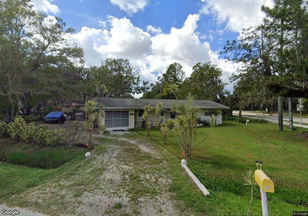
3622 Desoto Rd Sarasota, FL 34235
Estimated Value: $319,000 - $372,000
3
Beds
2
Baths
1,513
Sq Ft
$229/Sq Ft
Est. Value
About This Home
This home is located at 3622 Desoto Rd, Sarasota, FL 34235 and is currently estimated at $346,919, approximately $229 per square foot. 3622 Desoto Rd is a home located in Sarasota County with nearby schools including Emma E. Booker Elementary School, Booker Middle School, and Booker High School.
Ownership History
Date
Name
Owned For
Owner Type
Purchase Details
Closed on
Jul 27, 2006
Sold by
Moreland David L and Moreland Chris R
Bought by
Labsan Hermie A
Current Estimated Value
Home Financials for this Owner
Home Financials are based on the most recent Mortgage that was taken out on this home.
Original Mortgage
$132,500
Outstanding Balance
$78,857
Interest Rate
6.6%
Mortgage Type
Stand Alone First
Estimated Equity
$268,062
Purchase Details
Closed on
Sep 23, 2005
Sold by
Howe Ronny A and Howe Audrey J
Bought by
Moreland David L and Moreland Chris R
Home Financials for this Owner
Home Financials are based on the most recent Mortgage that was taken out on this home.
Original Mortgage
$112,000
Interest Rate
6%
Mortgage Type
Fannie Mae Freddie Mac
Create a Home Valuation Report for This Property
The Home Valuation Report is an in-depth analysis detailing your home's value as well as a comparison with similar homes in the area
Home Values in the Area
Average Home Value in this Area
Purchase History
| Date | Buyer | Sale Price | Title Company |
|---|---|---|---|
| Labsan Hermie A | $250,000 | None Available | |
| Moreland David L | $140,000 | Kuhlman Title Sarasota Lllp |
Source: Public Records
Mortgage History
| Date | Status | Borrower | Loan Amount |
|---|---|---|---|
| Open | Labsan Hermie A | $132,500 | |
| Previous Owner | Moreland David L | $112,000 |
Source: Public Records
Tax History Compared to Growth
Tax History
| Year | Tax Paid | Tax Assessment Tax Assessment Total Assessment is a certain percentage of the fair market value that is determined by local assessors to be the total taxable value of land and additions on the property. | Land | Improvement |
|---|---|---|---|---|
| 2024 | $1,190 | $81,755 | -- | -- |
| 2023 | $1,190 | $79,374 | $0 | $0 |
| 2022 | $1,116 | $77,062 | $0 | $0 |
| 2021 | $1,127 | $74,817 | $0 | $0 |
| 2020 | $1,108 | $73,784 | $0 | $0 |
| 2019 | $1,063 | $72,125 | $0 | $0 |
| 2018 | $1,030 | $70,780 | $0 | $0 |
| 2017 | $1,024 | $69,324 | $0 | $0 |
| 2016 | $1,024 | $112,100 | $39,500 | $72,600 |
| 2015 | $1,034 | $93,600 | $32,100 | $61,500 |
| 2014 | $1,033 | $65,902 | $0 | $0 |
Source: Public Records
Map
Nearby Homes
- 5327 Angeles Ave
- 5405 San Juan Dr
- 3736 Maple Hollow Ct
- 5742 Forester Oak Ct
- Lot 53 Prado Dr
- 3404 Shady Brook Ln
- 3401 51st St
- 5920 Bonaventure Place
- 5330 Barbarossa Ave
- 6052 Bonaventure Place
- 3671 Parkridge Cir Unit 8201
- 3662 Bonaventure Ct
- 3642 Bonaventure Ct
- 3564 Parkridge Cir Unit 30203
- 0 51st St Unit MFRA4656610
- 3557 Parkridge Cir Unit 14106
- 6145 Bonaventure Ct
- 5417 Evora Ave
- 3486 Parkridge Cir Unit 32101
- 3787 Parkridge Cir Unit 3102
- 5473 Capitan Ave
- 3632 Desoto Rd Unit A
- 3632 Desoto Rd
- 5461 Capitan Ave
- 5454 Capitan Ave
- 3604 San Juan Dr
- 3604 Desoto Rd
- 5449 Capitan Ave
- 5450 Capitan Ave
- 5413 Angeles Ave Unit 1
- 5401 Angeles Ave
- 5315 Angeles Ave
- 5437 Capitan Ave
- 5307 Angeles Ave
- 3538 Desoto Rd
- 5312 San Juan Dr
- 5517 Shady Brook Trail
- 5301 Angeles Ave
- 5523 Shady Brook Trail
- 5414 Angeles Ave Unit 1