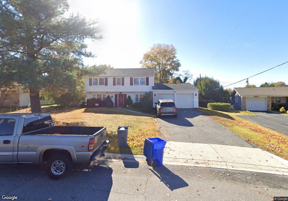
3622 Maroon Ln Bowie, MD 20715
Meadowbrook NeighborhoodEstimated Value: $465,553 - $537,000
--
Bed
3
Baths
1,872
Sq Ft
$272/Sq Ft
Est. Value
About This Home
This home is located at 3622 Maroon Ln, Bowie, MD 20715 and is currently estimated at $508,388, approximately $271 per square foot. 3622 Maroon Ln is a home located in Prince George's County with nearby schools including Whitehall Elementary School, Samuel Ogle Middle School, and Bowie High School.
Ownership History
Date
Name
Owned For
Owner Type
Purchase Details
Closed on
Jan 18, 2019
Sold by
Shandy Steven G and Shandy Suzanne L
Bought by
Turpin Joseph M and Turpin Julie C
Current Estimated Value
Home Financials for this Owner
Home Financials are based on the most recent Mortgage that was taken out on this home.
Original Mortgage
$318,986
Outstanding Balance
$279,128
Interest Rate
4.37%
Mortgage Type
FHA
Estimated Equity
$229,260
Purchase Details
Closed on
Jun 13, 1994
Sold by
Sablan Anthony F
Bought by
Shandy Steven G
Home Financials for this Owner
Home Financials are based on the most recent Mortgage that was taken out on this home.
Original Mortgage
$135,000
Interest Rate
8.29%
Purchase Details
Closed on
May 12, 1987
Sold by
Barone Michael A
Bought by
Sablan Anthony F and Sablan Pamela D
Create a Home Valuation Report for This Property
The Home Valuation Report is an in-depth analysis detailing your home's value as well as a comparison with similar homes in the area
Home Values in the Area
Average Home Value in this Area
Purchase History
| Date | Buyer | Sale Price | Title Company |
|---|---|---|---|
| Turpin Joseph M | $330,000 | Monarch Title Inc | |
| Shandy Steven G | $150,000 | -- | |
| Sablan Anthony F | $114,900 | -- |
Source: Public Records
Mortgage History
| Date | Status | Borrower | Loan Amount |
|---|---|---|---|
| Open | Turpin Joseph M | $318,986 | |
| Previous Owner | Shandy Steven G | $135,000 |
Source: Public Records
Tax History Compared to Growth
Tax History
| Year | Tax Paid | Tax Assessment Tax Assessment Total Assessment is a certain percentage of the fair market value that is determined by local assessors to be the total taxable value of land and additions on the property. | Land | Improvement |
|---|---|---|---|---|
| 2025 | $6,104 | $381,300 | $101,600 | $279,700 |
| 2024 | $6,104 | $366,733 | $0 | $0 |
| 2023 | $5,874 | $352,167 | $0 | $0 |
| 2022 | $5,582 | $337,600 | $101,600 | $236,000 |
| 2021 | $5,320 | $323,900 | $0 | $0 |
| 2020 | $5,168 | $310,200 | $0 | $0 |
| 2019 | $4,981 | $296,500 | $100,800 | $195,700 |
| 2018 | $0 | $286,033 | $0 | $0 |
| 2017 | $3,970 | $275,567 | $0 | $0 |
| 2016 | -- | $265,100 | $0 | $0 |
| 2015 | $3,369 | $259,300 | $0 | $0 |
| 2014 | $3,369 | $253,500 | $0 | $0 |
Source: Public Records
Map
Nearby Homes
- 12304 Manvel Ln
- 12303 Manvel Ln
- 12510 Chelton Ln
- 3608 Maureen Ln
- 12409 Melody Turn
- 12513 Chalford Ln
- 12209 Wynmore Ln
- 12210 Madeley Ln
- 3900 Chapel Forge Dr
- 12515 Canfield Ln
- 3414 Morlock Ln
- 3521 Malec Ln
- 3520 Malec Ln
- 12213 Westmont Ln
- 3404 Morlock Ln
- 3902 Wakefield Ln
- 12620 Millstream Dr
- 3508 Mullin Ln
- 4004 Welsley Ln
- 12105 Myra Place
- 3624 Maroon Ln
- 3620 Maroon Ln
- 12306 Manvel Ln
- 12308 Manvel Ln
- 12310 Manvel Ln
- 12307 Millstream Dr
- 3621 Maroon Ln
- 12302 Manvel Ln
- 3625 Maroon Ln
- 12305 Millstream Dr
- 3616 Maroon Ln
- 12303 Millstream Dr
- 3619 Maroon Ln
- 12313 Millstream Dr
- 12314 Manvel Ln
- 12300 Manvel Ln
- 3614 Maroon Ln
- 12309 Manvel Ln
- 3617 Maroon Ln
- 12307 Manvel Ln