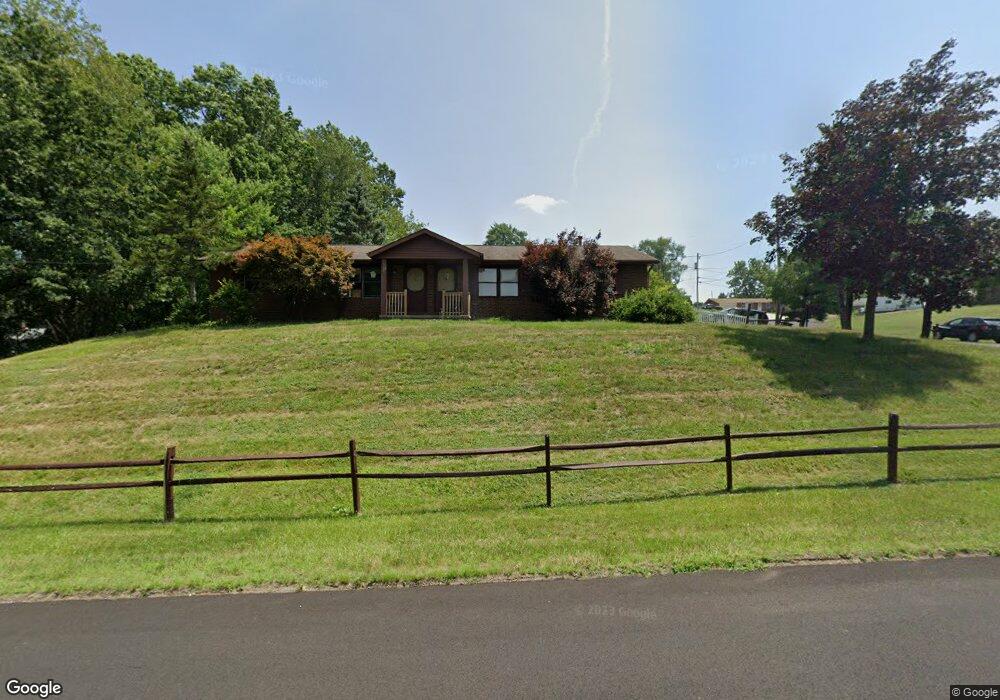
3624 Forestdale Ave SW Canton, OH 44706
Estimated Value: $173,000 - $235,100
4
Beds
2
Baths
1,792
Sq Ft
$114/Sq Ft
Est. Value
About This Home
This home is located at 3624 Forestdale Ave SW, Canton, OH 44706 and is currently estimated at $205,025, approximately $114 per square foot. 3624 Forestdale Ave SW is a home located in Stark County with nearby schools including Faircrest Memorial Elementary School, Canton South High School, and Beacon Academy.
Ownership History
Date
Name
Owned For
Owner Type
Purchase Details
Closed on
Oct 5, 2016
Sold by
Taylor Curtis L and Taylor Sheila M
Bought by
Taylor Curtis L and Taylor Sheila M
Current Estimated Value
Purchase Details
Closed on
Nov 16, 1994
Sold by
Clugston Mark W
Bought by
Taylor Laura C and Taylor Sheila
Home Financials for this Owner
Home Financials are based on the most recent Mortgage that was taken out on this home.
Original Mortgage
$85,500
Interest Rate
7.12%
Mortgage Type
New Conventional
Create a Home Valuation Report for This Property
The Home Valuation Report is an in-depth analysis detailing your home's value as well as a comparison with similar homes in the area
Home Values in the Area
Average Home Value in this Area
Purchase History
| Date | Buyer | Sale Price | Title Company |
|---|---|---|---|
| Taylor Curtis L | -- | None Available | |
| Taylor Laura C | $90,000 | -- |
Source: Public Records
Mortgage History
| Date | Status | Borrower | Loan Amount |
|---|---|---|---|
| Closed | Taylor Laura C | $85,500 |
Source: Public Records
Tax History Compared to Growth
Tax History
| Year | Tax Paid | Tax Assessment Tax Assessment Total Assessment is a certain percentage of the fair market value that is determined by local assessors to be the total taxable value of land and additions on the property. | Land | Improvement |
|---|---|---|---|---|
| 2025 | -- | $74,310 | $19,150 | $55,160 |
| 2024 | -- | $74,310 | $19,150 | $55,160 |
| 2023 | $2,617 | $56,950 | $14,250 | $42,700 |
| 2022 | $2,433 | $56,950 | $14,250 | $42,700 |
| 2021 | $2,443 | $56,950 | $14,250 | $42,700 |
| 2020 | $2,200 | $44,980 | $11,310 | $33,670 |
| 2019 | $2,232 | $44,980 | $11,310 | $33,670 |
| 2018 | $2,217 | $44,980 | $11,310 | $33,670 |
| 2017 | $2,268 | $43,440 | $10,430 | $33,010 |
| 2016 | $2,170 | $41,510 | $10,430 | $31,080 |
| 2015 | $2,173 | $41,510 | $10,430 | $31,080 |
| 2014 | $191 | $39,310 | $9,870 | $29,440 |
| 2013 | $1,102 | $39,310 | $9,870 | $29,440 |
Source: Public Records
Map
Nearby Homes
- 3641 Diane Ave SW
- 3673 Highview Ave SW
- 3415 Cleveland Ave SW
- 3245 Sierra Ave SW
- 236 32nd St SW
- 223 Faircrest St SW
- 1521 Bravado Rd SW
- 3939 Cleveland Ave SW
- 1550 Rebel St SW
- 3223 Dueber Ave SW
- 4314 Millport Ave SW
- 4624 Ridge Ave SE
- 5226 Ashmont Ave SW
- 900 53rd St SW
- 1926 Village St SE
- 0 20th St SW
- 340 53rd St SW
- 1700 Clark Ave SW
- 4805 Harvest Cir SE
- 1628 Clark Ave SW
- 544 Malhaven St SW
- 530 Carnwise St SW
- 3644 Forestdale Ave SW
- 520 Carnwise St SW
- 538 Malhaven St SW
- 3625 Forestdale Ave SW
- 600 Carnwise St SW
- 510 Carnwise St SW
- 537 Malhaven St SW
- 3650 Forestdale Ave SW
- 604 Malhaven St SW
- 530 Malhaven St SW
- 614 Carnwise St SW
- 500 Carnwise St S W
- 500 Carnwise St SW
- 3653 Forestdale Ave SW
- 701 Malhaven St SW
- 3660 Forestdale Ave SW
- 522 Malhaven St SW
- 700 Carnwise St SW