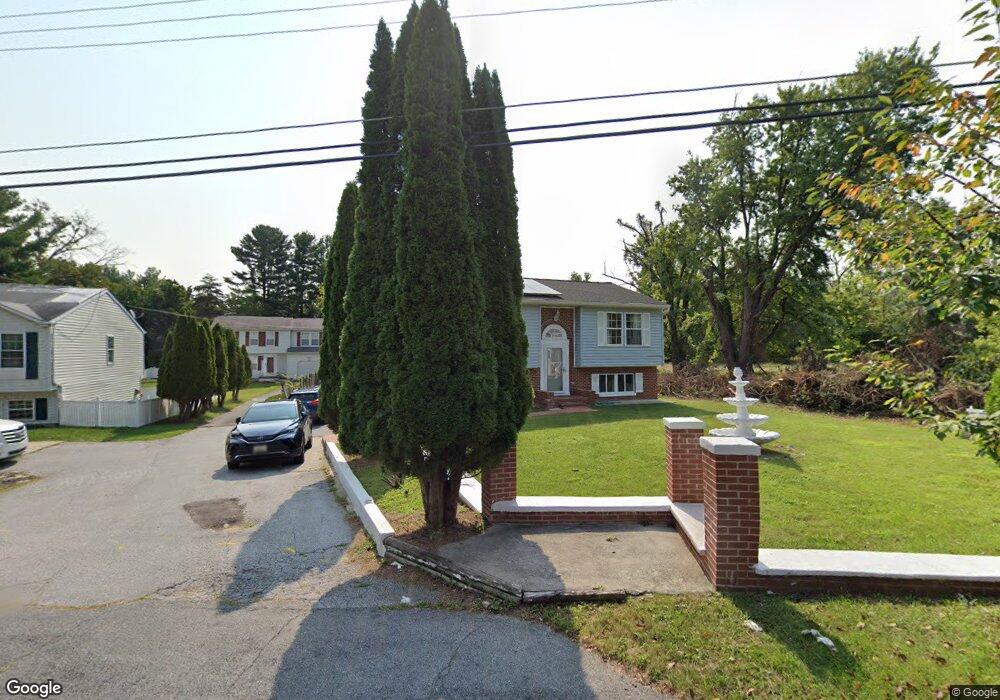
3625 Burmont Ave Randallstown, MD 21133
Estimated Value: $358,000 - $442,000
--
Bed
2
Baths
1,377
Sq Ft
$288/Sq Ft
Est. Value
About This Home
This home is located at 3625 Burmont Ave, Randallstown, MD 21133 and is currently estimated at $396,280, approximately $287 per square foot. 3625 Burmont Ave is a home located in Baltimore County with nearby schools including Randallstown Elementary School, Deer Park Middle Magnet School, and Randallstown High School.
Ownership History
Date
Name
Owned For
Owner Type
Purchase Details
Closed on
Aug 11, 2005
Sold by
Lois Jones and Lois Smith
Bought by
Chibayere Esther B
Current Estimated Value
Purchase Details
Closed on
Jan 29, 2004
Sold by
Griffin David A
Purchase Details
Closed on
Jul 20, 1994
Sold by
Faulstich Margaret C
Bought by
Griffin David A
Home Financials for this Owner
Home Financials are based on the most recent Mortgage that was taken out on this home.
Original Mortgage
$113,395
Interest Rate
8.19%
Create a Home Valuation Report for This Property
The Home Valuation Report is an in-depth analysis detailing your home's value as well as a comparison with similar homes in the area
Home Values in the Area
Average Home Value in this Area
Purchase History
| Date | Buyer | Sale Price | Title Company |
|---|---|---|---|
| Chibayere Esther B | $310,000 | -- | |
| -- | $201,900 | -- | |
| Griffin David A | $113,500 | -- |
Source: Public Records
Mortgage History
| Date | Status | Borrower | Loan Amount |
|---|---|---|---|
| Previous Owner | Griffin David A | $113,395 |
Source: Public Records
Tax History Compared to Growth
Tax History
| Year | Tax Paid | Tax Assessment Tax Assessment Total Assessment is a certain percentage of the fair market value that is determined by local assessors to be the total taxable value of land and additions on the property. | Land | Improvement |
|---|---|---|---|---|
| 2025 | $4,212 | $303,567 | -- | -- |
| 2024 | $4,212 | $268,300 | $63,100 | $205,200 |
| 2023 | $2,103 | $261,700 | $0 | $0 |
| 2022 | $4,120 | $255,100 | $0 | $0 |
| 2021 | $3,952 | $248,500 | $63,100 | $185,400 |
| 2020 | $3,952 | $241,833 | $0 | $0 |
| 2019 | $3,576 | $235,167 | $0 | $0 |
| 2018 | $3,460 | $228,500 | $63,100 | $165,400 |
| 2017 | $3,860 | $226,167 | $0 | $0 |
| 2016 | $2,818 | $223,833 | $0 | $0 |
| 2015 | $2,818 | $221,500 | $0 | $0 |
| 2014 | $2,818 | $221,500 | $0 | $0 |
Source: Public Records
Map
Nearby Homes
- 9208A Liberty Rd
- 9210 Liberty Rd
- 9406 Painted Tree Dr
- 9202 Samoset Rd
- 9401 Summer Squal Dr
- 9302 Silver Charm Dr
- 3816 Cassandra Rd
- 3402 Offutt Rd
- 3332 Offutt Rd
- 3506 Bayer Ave
- 3805 Terka Cir
- 3320 Offutt Rd
- 3418 Carroll Ave
- 3705 Allenswood Ct
- 9044 Allenswood Rd
- 9112 Meadow Heights Rd
- 9012 Allenswood Rd
- 3903 Red Deer Cir
- 9311 Colorado Ave
- 4108 Brown Bark Cir
- 3629 Burmont Ave
- 3621 Burmont Ave
- 3627 Burmont Ave
- 3700 Burmont Ave
- 9319 Samoset Rd
- 9317 Samoset Rd
- 3702 Burmont Ave
- 9315 Samoset Rd
- 9313 Samoset Rd
- 3704 Burmont Ave
- 9311 Samoset Rd
- 9314 Lykens Ct
- 9312 Lykens Ct
- 9310 Lykens Ct
- 9308 Lykens Ct
- 9309 Samoset Rd
- 9319 Lykens Ct
- 3701 Tall Grass Ct
- 3706 Burmont Ave
- 3703 Tall Grass Ct