Estimated Value: $210,821 - $228,000
3
Beds
2
Baths
1,151
Sq Ft
$190/Sq Ft
Est. Value
About This Home
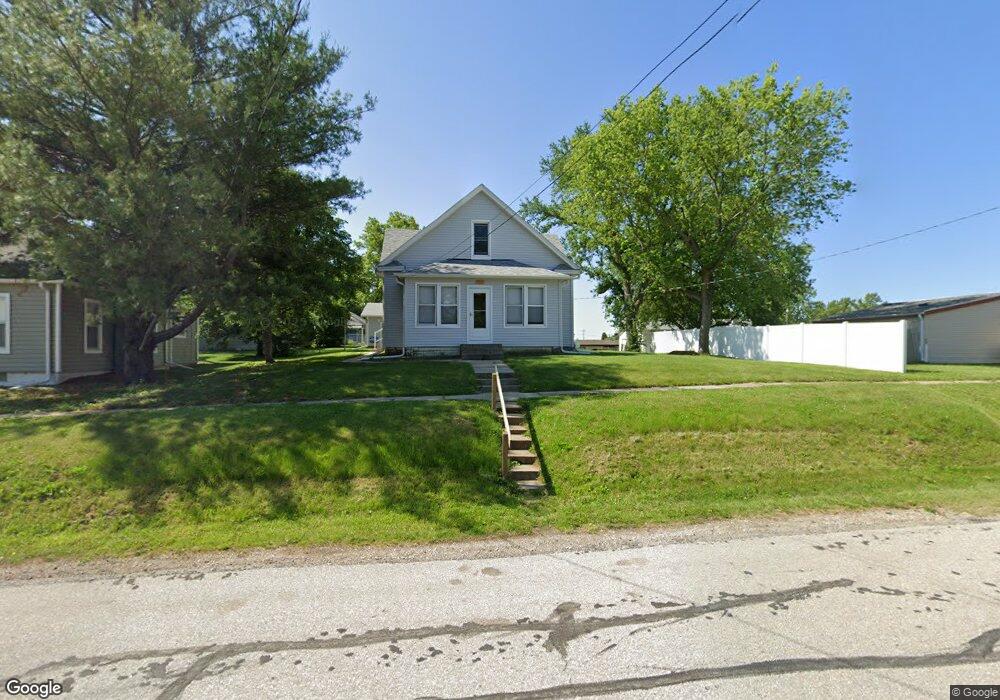
This home is located at 3625 Cedar St, Davey, NE 68336 and is currently estimated at $219,205, approximately $190 per square foot. 3625 Cedar St is a home with nearby schools including Raymond Central High School.
Ownership History
Date
Name
Owned For
Owner Type
Purchase Details
Closed on
Apr 23, 2025
Sold by
Hornung Larry D and Hornung Shirley A
Bought by
Ronspies Makenzie K and Ronspies Broderick M
Current Estimated Value
Home Financials for this Owner
Home Financials are based on the most recent Mortgage that was taken out on this home.
Original Mortgage
$203,700
Outstanding Balance
$202,794
Interest Rate
6.64%
Mortgage Type
New Conventional
Estimated Equity
$16,411
Create a Home Valuation Report for This Property
The Home Valuation Report is an in-depth analysis detailing your home's value as well as a comparison with similar homes in the area
Purchase History
| Date | Buyer | Sale Price | Title Company |
|---|---|---|---|
| Ronspies Makenzie K | $210,000 | Nebraska Title |
Source: Public Records
Mortgage History
| Date | Status | Borrower | Loan Amount |
|---|---|---|---|
| Open | Ronspies Makenzie K | $203,700 |
Source: Public Records
Tax History
| Year | Tax Paid | Tax Assessment Tax Assessment Total Assessment is a certain percentage of the fair market value that is determined by local assessors to be the total taxable value of land and additions on the property. | Land | Improvement |
|---|---|---|---|---|
| 2025 | $642 | $183,900 | $28,000 | $155,900 |
| 2024 | $642 | $166,300 | $25,600 | $140,700 |
| 2023 | $2,386 | $157,000 | $25,600 | $131,400 |
| 2022 | $2,098 | $114,100 | $21,600 | $92,500 |
| 2021 | $1,976 | $114,100 | $27,000 | $87,100 |
| 2020 | $2,068 | $116,000 | $25,000 | $91,000 |
| 2019 | $2,061 | $116,000 | $25,000 | $91,000 |
| 2018 | $1,284 | $70,400 | $20,000 | $50,400 |
| 2017 | $1,277 | $70,400 | $20,000 | $50,400 |
| 2016 | $1,635 | $89,200 | $20,000 | $69,200 |
| 2015 | $1,657 | $89,200 | $20,000 | $69,200 |
| 2014 | $1,463 | $78,600 | $20,000 | $58,600 |
| 2013 | -- | $78,600 | $20,000 | $58,600 |
Source: Public Records
Map
Nearby Homes
- 5830 Rock Creek Rd
- 135 Hunter St
- 120 Hunter St
- 6030 Little Salt Rd
- 6531 Mill Rd
- 8645 Agnew Rd
- 8601 Agnew Lot 4 Rd
- 8601 Agnew Lot 3 Rd
- 8601 Agnew Lot 1 Rd
- 5001 Donnette Dr
- 5021 Donnette Dr
- 5027 Donnette Dr
- 7631 Gulls Way
- 5039 Donnette Dr
- 5045 Donnette Dr
- 5051 Donnette Dr
- 7620 Gulls Way
- 4910 Dr
- 4931 Donnette Dr
- 7700 Gulls Way
Your Personal Tour Guide
Ask me questions while you tour the home.