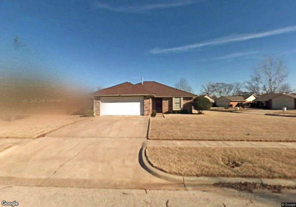
3625 Peregrine Dr Norman, OK 73072
Southeast Norman NeighborhoodEstimated Value: $198,613 - $233,000
3
Beds
2
Baths
1,212
Sq Ft
$173/Sq Ft
Est. Value
About This Home
This home is located at 3625 Peregrine Dr, Norman, OK 73072 and is currently estimated at $209,653, approximately $172 per square foot. 3625 Peregrine Dr is a home located in Cleveland County with nearby schools including Madison Elementary School, Irving Middle School, and Norman High School.
Ownership History
Date
Name
Owned For
Owner Type
Purchase Details
Closed on
Aug 8, 2023
Sold by
Melodye Jan Pipes Revocable Living Trust
Bought by
Heath Frances Elizabeth and Heath Rickey A
Current Estimated Value
Home Financials for this Owner
Home Financials are based on the most recent Mortgage that was taken out on this home.
Original Mortgage
$180,455
Outstanding Balance
$175,871
Interest Rate
6.67%
Mortgage Type
FHA
Estimated Equity
$33,782
Purchase Details
Closed on
Aug 10, 2020
Sold by
Jan Pipes Melodye
Bought by
Melodye Jan Pipes Revocable Li
Purchase Details
Closed on
Sep 27, 2002
Sold by
Lyon Lisa
Bought by
Pipes Melodye J
Create a Home Valuation Report for This Property
The Home Valuation Report is an in-depth analysis detailing your home's value as well as a comparison with similar homes in the area
Home Values in the Area
Average Home Value in this Area
Purchase History
| Date | Buyer | Sale Price | Title Company |
|---|---|---|---|
| Heath Frances Elizabeth | $187,000 | Old Republic Title | |
| Melodye Jan Pipes Revocable Li | -- | None Listed On Document | |
| Pipes Melodye J | $89,500 | -- |
Source: Public Records
Mortgage History
| Date | Status | Borrower | Loan Amount |
|---|---|---|---|
| Open | Heath Frances Elizabeth | $180,455 |
Source: Public Records
Tax History Compared to Growth
Tax History
| Year | Tax Paid | Tax Assessment Tax Assessment Total Assessment is a certain percentage of the fair market value that is determined by local assessors to be the total taxable value of land and additions on the property. | Land | Improvement |
|---|---|---|---|---|
| 2024 | $2,483 | $21,738 | $3,682 | $18,056 |
| 2023 | $1,717 | $14,296 | $2,178 | $12,118 |
| 2022 | $0 | $13,615 | $2,548 | $11,067 |
| 2021 | $1,483 | $13,219 | $3,026 | $10,193 |
| 2020 | $1,405 | $12,834 | $2,640 | $10,194 |
| 2019 | $1,430 | $12,834 | $2,640 | $10,194 |
| 2018 | $1,387 | $12,834 | $2,640 | $10,194 |
| 2017 | $1,379 | $12,834 | $0 | $0 |
| 2016 | $1,357 | $12,270 | $2,524 | $9,746 |
| 2015 | $1,275 | $11,912 | $2,400 | $9,512 |
| 2014 | $1,255 | $11,644 | $1,157 | $10,487 |
Source: Public Records
Map
Nearby Homes
- 1125 Osprey Dr
- 616 Black Hawk Dr
- 613 Coopers Hawk Dr
- 608 Coopers Hawk Dr
- 617 Golden Eagle Dr
- 809 Coopers Hawk Dr
- 3604 Glendale Dr
- 517 Goshawk Dr
- 705 Night Hawk Dr
- 1133 Barbary Dr
- 4217 Caracara Ct
- 4404 Condor Dr
- 504 Laleh Ct
- Bradford Plan at Eagle Cliff South
- 1201 Monterey Dr
- 1307 Presidio Dr
- 848 Cardinal Creek Blvd Unit C
- 827 Red Bird Ln Unit C
- 803 Cardinal Creek Blvd Unit B
- 818 Cardinal Creek Blvd Unit D
- 501 Black Hawk Dr
- 3621 Peregrine Dr
- 1104 Osprey Dr
- 1120 Osprey Dr
- 1108 Osprey Dr
- 1140 Osprey Dr
- 1132 Osprey Dr
- 1116 Osprey Dr
- 1124 Osprey Dr
- 1141 Osprey Dr
- 1128 Osprey Dr
- 1136 Osprey Dr
- 1100 Osprey Dr
- 1133 Osprey Dr
- 1137 Osprey Dr
- 1129 Osprey Dr
- 1101 Osprey Dr
- 1121 Osprey Dr
- 1144 Osprey Dr
- 1117 Osprey Dr