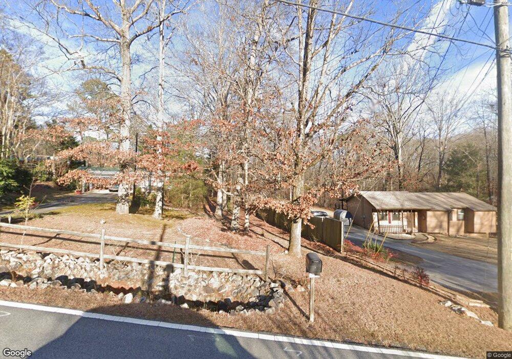
3626 King Dr Unit 4 Douglasville, GA 30135
Lithia Springs NeighborhoodEstimated Value: $191,000 - $225,000
3
Beds
1
Bath
1,104
Sq Ft
$187/Sq Ft
Est. Value
About This Home
This home is located at 3626 King Dr Unit 4, Douglasville, GA 30135 and is currently estimated at $206,526, approximately $187 per square foot. 3626 King Dr Unit 4 is a home located in Douglas County with nearby schools including New Manchester Elementary School, Factory Shoals Middle School, and New Manchester High School.
Ownership History
Date
Name
Owned For
Owner Type
Purchase Details
Closed on
Jan 21, 2015
Sold by
Bedingfield Royce Paul
Bought by
Watkins Ginger L and Watkins Eric J
Current Estimated Value
Home Financials for this Owner
Home Financials are based on the most recent Mortgage that was taken out on this home.
Original Mortgage
$68,732
Outstanding Balance
$53,184
Interest Rate
4.12%
Mortgage Type
FHA
Estimated Equity
$153,342
Purchase Details
Closed on
Oct 7, 2010
Sold by
Bedingfield Robert P
Bought by
Bedingfield Royce P
Purchase Details
Closed on
Apr 22, 1994
Sold by
Smallwood Jeanette
Bought by
Bedingfield Robert
Home Financials for this Owner
Home Financials are based on the most recent Mortgage that was taken out on this home.
Original Mortgage
$60,429
Interest Rate
8.48%
Mortgage Type
FHA
Create a Home Valuation Report for This Property
The Home Valuation Report is an in-depth analysis detailing your home's value as well as a comparison with similar homes in the area
Home Values in the Area
Average Home Value in this Area
Purchase History
| Date | Buyer | Sale Price | Title Company |
|---|---|---|---|
| Watkins Ginger L | $70,000 | -- | |
| Bedingfield Royce P | -- | -- | |
| Bedingfield Robert | $61,700 | -- |
Source: Public Records
Mortgage History
| Date | Status | Borrower | Loan Amount |
|---|---|---|---|
| Open | Watkins Ginger L | $68,732 | |
| Previous Owner | Bedingfield Robert | $60,429 |
Source: Public Records
Tax History Compared to Growth
Tax History
| Year | Tax Paid | Tax Assessment Tax Assessment Total Assessment is a certain percentage of the fair market value that is determined by local assessors to be the total taxable value of land and additions on the property. | Land | Improvement |
|---|---|---|---|---|
| 2024 | $1,086 | $47,320 | $8,960 | $38,360 |
| 2023 | $1,086 | $47,320 | $8,960 | $38,360 |
| 2022 | $1,076 | $45,040 | $14,000 | $31,040 |
| 2021 | $815 | $31,920 | $8,800 | $23,120 |
| 2020 | $832 | $31,920 | $8,800 | $23,120 |
| 2019 | $790 | $31,560 | $8,960 | $22,600 |
| 2018 | $737 | $28,840 | $8,360 | $20,480 |
| 2017 | $696 | $26,360 | $8,360 | $18,000 |
| 2016 | $645 | $23,440 | $8,960 | $14,480 |
| 2015 | $759 | $23,040 | $8,960 | $14,080 |
| 2014 | $868 | $25,840 | $10,640 | $15,200 |
| 2013 | -- | $25,760 | $10,640 | $15,120 |
Source: Public Records
Map
Nearby Homes
- 3609 King Dr
- Reynold Plan at Palmer Falls
- Somerset III Plan at Palmer Falls
- 3544 Palmer Falls Dr
- 3687 Thornhill Ct
- 3677 Thornhill Ct
- 3664 Thornhill Ct
- 2070 Woodmont Dr
- 3540 Lindsy Brooke Ct
- 9931 Mancunian Way
- 3760 Lindsy Brooke Ct
- 9912 Mancunian Way E
- 9990 Blackfriars Rd
- 3137 Primrose St
- 9942 Ashton Old Rd
- 3990 Ridgeland Dr
- 9941 Stretford Rd
- 3206 Brantingham Rd
