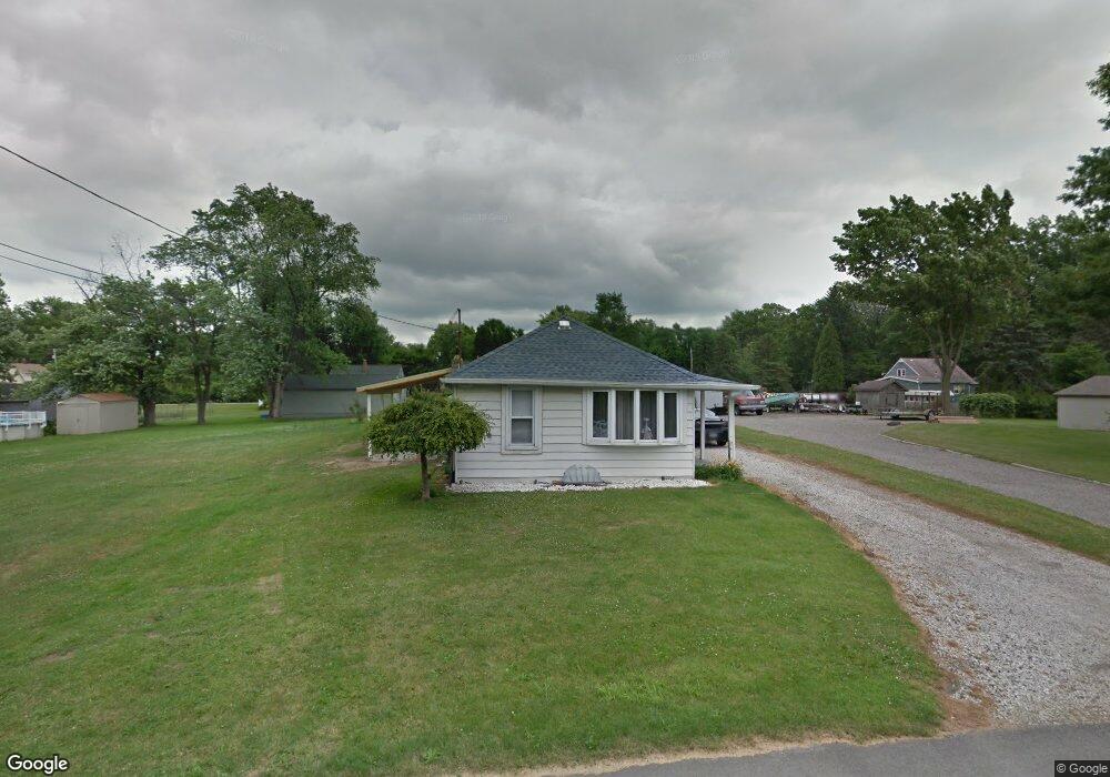
3627 Liberty Ave Hubbard, OH 44425
Estimated Value: $102,841 - $141,000
2
Beds
1
Bath
880
Sq Ft
$137/Sq Ft
Est. Value
About This Home
This home is located at 3627 Liberty Ave, Hubbard, OH 44425 and is currently estimated at $120,210, approximately $136 per square foot. 3627 Liberty Ave is a home located in Trumbull County with nearby schools including Hubbard Elementary School, Hubbard Middle School, and Hubbard High School.
Ownership History
Date
Name
Owned For
Owner Type
Purchase Details
Closed on
Oct 9, 2019
Sold by
Mcmonagle Leslie A
Bought by
Mcmonagle Leslie A and Mcmonagle William J
Current Estimated Value
Purchase Details
Closed on
Jul 23, 2019
Sold by
Mcmonagle Leslie Ann and The Mary Jane Toda Trust
Bought by
Mcmonagle Leslie A
Purchase Details
Closed on
Jan 1, 1990
Sold by
Est Edith M Yarnell-Lf
Bought by
Samuel Toda J and Samuel S
Create a Home Valuation Report for This Property
The Home Valuation Report is an in-depth analysis detailing your home's value as well as a comparison with similar homes in the area
Home Values in the Area
Average Home Value in this Area
Purchase History
| Date | Buyer | Sale Price | Title Company |
|---|---|---|---|
| Mcmonagle Leslie A | -- | None Available | |
| Mcmonagle Leslie A | -- | None Available | |
| Samuel Toda J | -- | -- |
Source: Public Records
Tax History Compared to Growth
Tax History
| Year | Tax Paid | Tax Assessment Tax Assessment Total Assessment is a certain percentage of the fair market value that is determined by local assessors to be the total taxable value of land and additions on the property. | Land | Improvement |
|---|---|---|---|---|
| 2024 | $292 | $24,290 | $3,150 | $21,140 |
| 2023 | $292 | $24,290 | $3,150 | $21,140 |
| 2022 | $150 | $19,460 | $3,150 | $16,310 |
| 2021 | $151 | $19,460 | $3,150 | $16,310 |
| 2020 | $151 | $19,460 | $3,150 | $16,310 |
| 2019 | $651 | $17,990 | $3,150 | $14,840 |
| 2018 | $632 | $17,990 | $3,150 | $14,840 |
| 2017 | $630 | $17,990 | $3,150 | $14,840 |
| 2016 | $548 | $17,120 | $2,700 | $14,420 |
| 2015 | $550 | $17,120 | $2,700 | $14,420 |
| 2014 | $539 | $17,120 | $2,700 | $14,420 |
| 2013 | $586 | $17,890 | $2,700 | $15,190 |
Source: Public Records
Map
Nearby Homes
- 5843 Fairlawn Ave
- 6068 Evans Dr
- 3234 Bell Wick Rd
- 3317 Beechwood Dr
- 3943 Logangate Rd
- 3275 Beechwood Dr
- 2160 Lansdowne Blvd
- 0 Homestead Rd
- 366 Westview Ave
- 3502 Somerset Dr Unit B
- 257 Westview Ave
- 2010 Powder Mill Run
- 0 Powder Mill Run Unit 5127327
- 0 Powder Mill Run Unit 5127333
- V/L Jacobs Rd
- 2012 Crestwood Blvd
- 2021 Crestwood Blvd
- 124 Rebecca Ave
- 3712 Logan Way
- 1720 Jacobs Rd
- 3613 Liberty Ave
- 3626 Franklin Ave
- 3641 Liberty Ave
- 3620 Franklin Ave
- 3620 Franklin Ave
- 3626 Liberty Ave
- 3638 Liberty Ave
- 3614 Liberty Ave
- 3655 Liberty Ave
- 3597 Liberty Ave
- 3648 Franklin Ave
- 5930 Fairlawn Ave
- 3596 Liberty Ave
- 3627 Overlook Ave
- 3621 Franklin Ave
- 3633 Overlook Ave
- 3629 Franklin Ave
- 3641 Overlook Ave
- 3652 Liberty Ave
- 3653 Franklin Ave