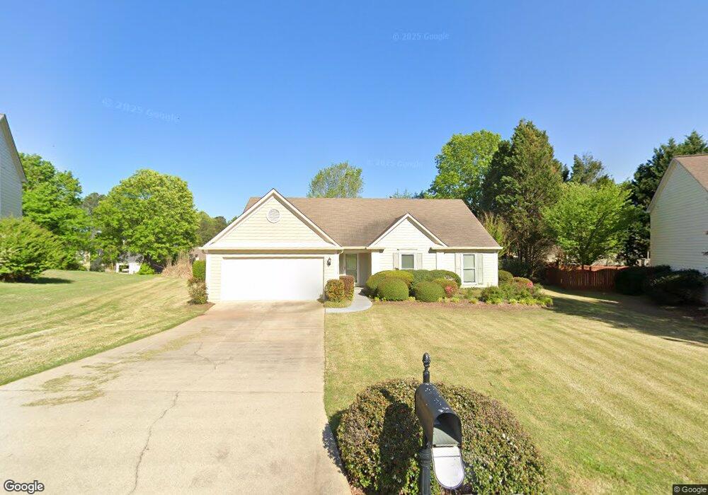
3627 Thornbrooke Place Duluth, GA 30097
Estimated Value: $435,101 - $487,000
3
Beds
2
Baths
1,865
Sq Ft
$243/Sq Ft
Est. Value
About This Home
This home is located at 3627 Thornbrooke Place, Duluth, GA 30097 and is currently estimated at $452,525, approximately $242 per square foot. 3627 Thornbrooke Place is a home located in Gwinnett County with nearby schools including Chattahoochee Elementary School, Coleman Middle School, and Duluth High School.
Ownership History
Date
Name
Owned For
Owner Type
Purchase Details
Closed on
May 31, 2002
Sold by
Commare Joseph N and Commare Patricia A
Bought by
Liew Seah Y
Current Estimated Value
Home Financials for this Owner
Home Financials are based on the most recent Mortgage that was taken out on this home.
Original Mortgage
$128,500
Outstanding Balance
$53,041
Interest Rate
6.75%
Mortgage Type
New Conventional
Estimated Equity
$399,484
Purchase Details
Closed on
Jun 26, 1995
Sold by
Pulte Home Corp
Bought by
Commare Joseph N
Create a Home Valuation Report for This Property
The Home Valuation Report is an in-depth analysis detailing your home's value as well as a comparison with similar homes in the area
Home Values in the Area
Average Home Value in this Area
Purchase History
| Date | Buyer | Sale Price | Title Company |
|---|---|---|---|
| Liew Seah Y | $178,500 | -- | |
| Commare Joseph N | $127,000 | -- |
Source: Public Records
Mortgage History
| Date | Status | Borrower | Loan Amount |
|---|---|---|---|
| Open | Liew Seah Y | $128,500 | |
| Closed | Commare Joseph N | $0 |
Source: Public Records
Tax History Compared to Growth
Tax History
| Year | Tax Paid | Tax Assessment Tax Assessment Total Assessment is a certain percentage of the fair market value that is determined by local assessors to be the total taxable value of land and additions on the property. | Land | Improvement |
|---|---|---|---|---|
| 2025 | $1,136 | $159,720 | $34,000 | $125,720 |
| 2024 | $4,695 | $146,720 | $38,000 | $108,720 |
| 2023 | $4,695 | $146,720 | $38,000 | $108,720 |
| 2022 | $4,439 | $138,280 | $32,000 | $106,280 |
| 2021 | $3,402 | $103,720 | $24,000 | $79,720 |
| 2020 | $3,166 | $95,800 | $21,600 | $74,200 |
| 2019 | $2,978 | $95,800 | $21,600 | $74,200 |
| 2018 | $2,978 | $89,960 | $21,600 | $68,360 |
| 2016 | $2,443 | $73,880 | $19,600 | $54,280 |
| 2015 | $2,353 | $70,200 | $19,600 | $50,600 |
| 2014 | -- | $67,080 | $16,000 | $51,080 |
Source: Public Records
Map
Nearby Homes
- 3515 River Summit Trail
- 3625 River Summit Trail
- 3629 Rogers Bridge Rd
- 2643 Timberbrooke Place
- 3634 Clearbrooke Way
- 2571 Royston Dr
- 3590 North St
- 3653 North St
- 4180 Cavalier Way
- 3955 Longlake Dr
- 3475 Leaf Land Ct
- 4105 Cavalier Way
- 2301 Castlemaine Dr
- 4220 Cavalier Way
- The Smithwood Plan at Riversong
- The Pinewood Plan at Riversong
- 4160 Cavalier Way
- 4734 Dewitt Dr
- 3825 Carriage Gate Dr
- 3617 Thornbrooke Place
- 3637 Thornbrooke Place
- 3425 River Summit Trail
- 3415 River Summit Trail
- 3445 River Summit Trail
- 3455 River Summit Trail
- 3395 River Summit Trail
- 3632 Thornbrooke Place
- 3607 Thornbrooke Place
- 3647 Thornbrooke Place
- 3465 River Summit Trail
- 3602 Thornbrooke Place
- 3385 River Summit Trail
- 3485 River Summit Trail
- 3597 Thornbrooke Place
- 3657 Thornbrooke Place
- 3652 Thornbrooke Place
- 3375 River Summit Trail
- 3592 Thornbrooke Place
- 3495 River Summit Trail