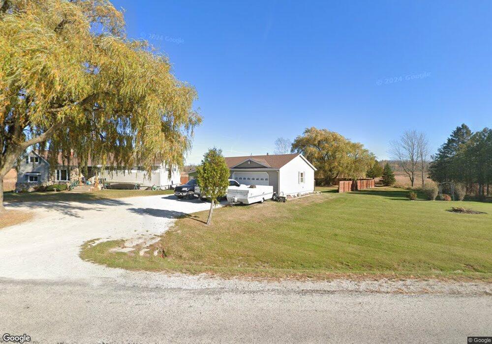
3627 Woodland Dr Manitowoc, WI 54220
Estimated Value: $277,157 - $294,000
--
Bed
--
Bath
--
Sq Ft
1
Acres
About This Home
This home is located at 3627 Woodland Dr, Manitowoc, WI 54220 and is currently estimated at $285,579. 3627 Woodland Dr is a home located in Manitowoc County with nearby schools including Riverview Elementary School, Wilson Middle School, and Lincoln High School.
Ownership History
Date
Name
Owned For
Owner Type
Purchase Details
Closed on
Sep 16, 2016
Sold by
Greetan Stephanie M
Bought by
Riesterer Ryan
Current Estimated Value
Home Financials for this Owner
Home Financials are based on the most recent Mortgage that was taken out on this home.
Original Mortgage
$102,000
Outstanding Balance
$81,526
Interest Rate
3.45%
Mortgage Type
New Conventional
Estimated Equity
$204,053
Purchase Details
Closed on
Aug 27, 2009
Sold by
Lesperance Dorthy E
Bought by
Greetan Stephanie M
Home Financials for this Owner
Home Financials are based on the most recent Mortgage that was taken out on this home.
Original Mortgage
$123,000
Interest Rate
5.27%
Mortgage Type
New Conventional
Create a Home Valuation Report for This Property
The Home Valuation Report is an in-depth analysis detailing your home's value as well as a comparison with similar homes in the area
Home Values in the Area
Average Home Value in this Area
Purchase History
| Date | Buyer | Sale Price | Title Company |
|---|---|---|---|
| Riesterer Ryan | -- | First American Title | |
| Greetan Stephanie M | $133,000 | None Available |
Source: Public Records
Mortgage History
| Date | Status | Borrower | Loan Amount |
|---|---|---|---|
| Open | Riesterer Ryan | $102,000 | |
| Previous Owner | Greetan Stephanie M | $123,000 |
Source: Public Records
Tax History Compared to Growth
Tax History
| Year | Tax Paid | Tax Assessment Tax Assessment Total Assessment is a certain percentage of the fair market value that is determined by local assessors to be the total taxable value of land and additions on the property. | Land | Improvement |
|---|---|---|---|---|
| 2024 | $2,392 | $205,100 | $30,000 | $175,100 |
| 2023 | $2,057 | $205,100 | $30,000 | $175,100 |
| 2022 | $1,713 | $133,700 | $20,000 | $113,700 |
| 2021 | $2,056 | $133,700 | $20,000 | $113,700 |
| 2020 | $2,082 | $133,700 | $20,000 | $113,700 |
| 2019 | $1,980 | $133,700 | $20,000 | $113,700 |
| 2018 | $1,944 | $133,700 | $20,000 | $113,700 |
| 2017 | $1,893 | $133,700 | $20,000 | $113,700 |
| 2016 | $1,901 | $133,700 | $20,000 | $113,700 |
| 2015 | $1,866 | $133,700 | $20,000 | $113,700 |
| 2014 | -- | $133,700 | $20,000 | $113,700 |
| 2013 | $1,974 | $133,700 | $20,000 | $113,700 |
Source: Public Records
Map
Nearby Homes
- 4220 Memorial Dr
- Lt1 Hawthorne Ave
- 2940 Memorial Dr
- Lt1 Columbus St
- LT0 Mosie Ct
- 807 E Linden Ave
- 1616 Fern Dr
- 2317 10th St
- 2903 County Highway B -
- 1415 Glenwood St
- 2152 Roosevelt Ave
- 2101 Hunters Ridge Ct
- 1005 Webster St
- 1925 Creekwood Ct
- 315 E Magnolia Ave
- 2114 10th St
- 2510 Stoney Brook Ct
- 1209 Hawthorne St
- 743 Memorial Dr Unit E
- 2734 33rd St
- 3803 Woodland Dr
- 3814 Woodland Dr
- Lt100 Woodland Dr
- 3405 Woodland Dr
- 2309 E Goodwin Rd
- 3104 Woodland Dr
- 2425 E Goodwin Rd
- 3615 Mirro Dr
- 4211 Woodland Dr
- 4191 Woodland Dr
- 2928 Woodland Dr
- 4307 Woodland Dr
- 4.613 acre Mirro Dr
- LOT 1 Mirro Dr
- Lt1 Mirro Dr
- 2510 Mirro Dr
- 2510 Mirro Dr Unit 2510
- 16 Ac Mirro Dr
- 3812 Mirro Dr
- Lt0 Johnson Dr