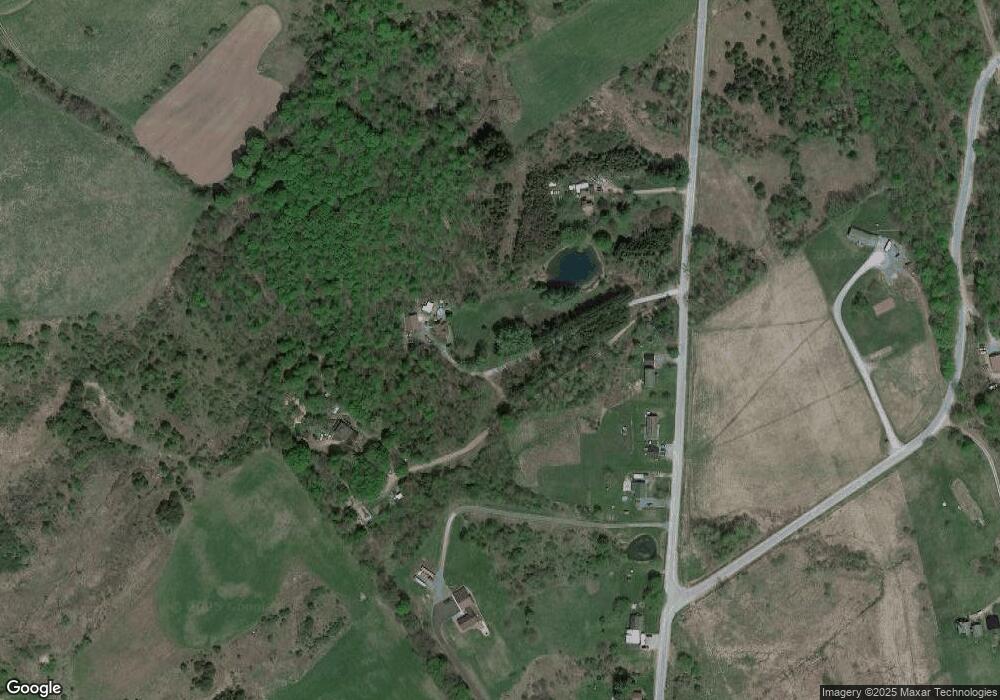
3628 McDonald Rd Port Leyden, NY 13433
Estimated Value: $144,000 - $329,012
3
Beds
1
Bath
1,288
Sq Ft
$160/Sq Ft
Est. Value
About This Home
This home is located at 3628 McDonald Rd, Port Leyden, NY 13433 and is currently estimated at $206,253, approximately $160 per square foot. 3628 McDonald Rd is a home with nearby schools including South Lewis High School.
Ownership History
Date
Name
Owned For
Owner Type
Purchase Details
Closed on
Sep 8, 2021
Sold by
Brown Heather S and Brown Ryan H
Bought by
Brown Heather S and Brown Ryan H
Current Estimated Value
Home Financials for this Owner
Home Financials are based on the most recent Mortgage that was taken out on this home.
Original Mortgage
$143,500
Interest Rate
3.85%
Mortgage Type
New Conventional
Create a Home Valuation Report for This Property
The Home Valuation Report is an in-depth analysis detailing your home's value as well as a comparison with similar homes in the area
Home Values in the Area
Average Home Value in this Area
Purchase History
| Date | Buyer | Sale Price | Title Company |
|---|---|---|---|
| Brown Heather S | -- | None Available | |
| Brown Heather S | -- | None Available |
Source: Public Records
Mortgage History
| Date | Status | Borrower | Loan Amount |
|---|---|---|---|
| Previous Owner | Brown Heather S | $143,500 |
Source: Public Records
Tax History Compared to Growth
Tax History
| Year | Tax Paid | Tax Assessment Tax Assessment Total Assessment is a certain percentage of the fair market value that is determined by local assessors to be the total taxable value of land and additions on the property. | Land | Improvement |
|---|---|---|---|---|
| 2024 | $4,274 | $176,700 | $24,400 | $152,300 |
| 2023 | $4,621 | $176,700 | $24,400 | $152,300 |
| 2022 | $4,399 | $166,700 | $24,400 | $142,300 |
| 2021 | $4,405 | $166,700 | $24,400 | $142,300 |
| 2020 | $3,893 | $166,700 | $24,400 | $142,300 |
| 2019 | $3,803 | $166,700 | $24,400 | $142,300 |
| 2018 | $3,803 | $166,700 | $24,400 | $142,300 |
| 2017 | $3,699 | $160,900 | $19,400 | $141,500 |
| 2016 | $3,684 | $160,900 | $19,400 | $141,500 |
| 2015 | -- | $160,900 | $19,400 | $141,500 |
| 2014 | -- | $134,700 | $19,200 | $115,500 |
Source: Public Records
Map
Nearby Homes
- 7109 Walker Rd
- 3641 Kelpytown Rd
- 3655 Kelpytown Rd
- 6749 Rugg Rd
- 00 South St
- 7032 North St
- 6821 Mcalpine St
- 3002 S Elm St
- 7168 E Main St
- 4068 Cherry St
- 4004 Edgewood Dr
- 6823 Charlotte St
- Lot 1 Lyons Falls Rd
- Lot 2 Lyons Falls Rd
- Lot 3 Lyons Falls Rd
- Lot 4 Lyons Falls Rd
- 7315 E Main St
- 3313 Pearl St
- 0 Moose River Rd Unit Lot 1 11487744
- 6632 Turin Rd
- 3622 McDonald Rd
- 3632 McDonald Rd
- 3616 McDonald Rd
- 6759 Hells Kitchen Rd
- 3612 McDonald Rd
- 6826 Hells Kitchen Rd
- 3608 McDonald Rd
- 3626 McDonald Rd
- 3646 McDonald Rd
- 6753 Hells Kitchen Rd
- 3654 McDonald Rd
- 6819 Hells Kitchen Rd
- 3654 McDonald Rd
- 3655 McDonald Rd
- 3660 McDonald Rd
- 6747 Hells Kitchen Rd
- 3621 State Route 12
- 3606 State Route 12
- 3639 Kelpytown Rd
- 3663 McDonald Rd
