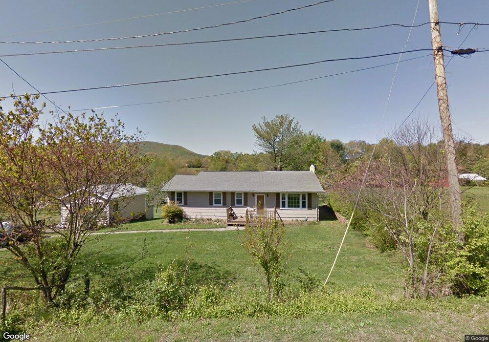
3629 Bushdale Rd Roanoke, VA 24014
Estimated Value: $132,000 - $226,000
3
Beds
1
Bath
1,176
Sq Ft
$167/Sq Ft
Est. Value
About This Home
This home is located at 3629 Bushdale Rd, Roanoke, VA 24014 and is currently estimated at $196,036, approximately $166 per square foot. 3629 Bushdale Rd is a home located in Roanoke County with nearby schools including Mt. Pleasant Elementary School, William Byrd Middle School, and William Byrd High School.
Ownership History
Date
Name
Owned For
Owner Type
Purchase Details
Closed on
Dec 19, 2022
Sold by
Stinson-Bagby Kelly
Bought by
Bagby Bathurst
Current Estimated Value
Purchase Details
Closed on
May 20, 2005
Sold by
Wells Fargo Bank Na
Bought by
Bagby Bathurst B and Stinson Bagby Kelly L
Home Financials for this Owner
Home Financials are based on the most recent Mortgage that was taken out on this home.
Original Mortgage
$44,000
Interest Rate
5.62%
Mortgage Type
New Conventional
Create a Home Valuation Report for This Property
The Home Valuation Report is an in-depth analysis detailing your home's value as well as a comparison with similar homes in the area
Home Values in the Area
Average Home Value in this Area
Purchase History
| Date | Buyer | Sale Price | Title Company |
|---|---|---|---|
| Bagby Bathurst | -- | -- | |
| Bagby Bathurst B | $55,000 | None Available |
Source: Public Records
Mortgage History
| Date | Status | Borrower | Loan Amount |
|---|---|---|---|
| Previous Owner | Bagby Bathurst B | $44,000 |
Source: Public Records
Tax History Compared to Growth
Tax History
| Year | Tax Paid | Tax Assessment Tax Assessment Total Assessment is a certain percentage of the fair market value that is determined by local assessors to be the total taxable value of land and additions on the property. | Land | Improvement |
|---|---|---|---|---|
| 2025 | $1,680 | $163,100 | $38,000 | $125,100 |
| 2024 | $1,554 | $149,400 | $34,200 | $115,200 |
| 2023 | $1,495 | $141,000 | $34,200 | $106,800 |
| 2022 | $1,380 | $126,600 | $32,300 | $94,300 |
| 2021 | $1,248 | $114,500 | $30,400 | $84,100 |
| 2020 | $1,203 | $110,400 | $30,400 | $80,000 |
| 2019 | $1,151 | $105,600 | $28,500 | $77,100 |
| 2018 | $1,127 | $104,100 | $28,500 | $75,600 |
| 2017 | $1,127 | $103,400 | $28,500 | $74,900 |
| 2016 | $1,092 | $100,200 | $28,500 | $71,700 |
| 2015 | $1,067 | $97,900 | $26,100 | $71,800 |
| 2014 | $1,068 | $98,000 | $26,100 | $71,900 |
Source: Public Records
Map
Nearby Homes
- 1701 Mayfield Dr
- 3523 Bandy Rd
- 3091 Pitzer Rd
- 1313 Ashebrook Dr
- 1631 Eanes Rd
- 3036 Woodway Rd
- 0 Ventnor Rd SE Unit 922423
- 3520 Ballyhack Trail
- 3540 Ballyhack Trail
- 3716 Ventnor Rd SE
- 1523 Rosewalk Ln
- 2602 Mount Pleasant Blvd SE
- 3517 Ballyhack Trail
- 0 Garden City Blvd SE
- 3527 Ballyhack Trail
- 3559 Ballyhack Trail
- 3537 Ballyhack Trail
- 3112 Garden City Blvd SE
- 3592 Ballyhack Trail
- 0 Tall Pine Ln
- 3611 Bushdale Rd
- 3635 Bushdale Rd
- 3519 Bushdale Rd
- 3643 Bushdale Rd
- 3550 Alcoa Rd
- 3640 Bushdale Rd
- 3605 Bushdale Rd
- 3534 Alcoa Rd
- 3514 Alcoa Rd
- 3515 Bushdale Rd
- 3527 Hemingway Rd
- 3504 Alcoa Rd
- 3412 Bushdale Rd
- 3511 Hemingway Rd
- 3535 Alcoa Rd
- 3580 Alcoa Rd
- 3407 Hemingway Rd
- 3557 Hemingway Rd
- 3513 Bushdale Rd
- 3331 Hemingway Rd