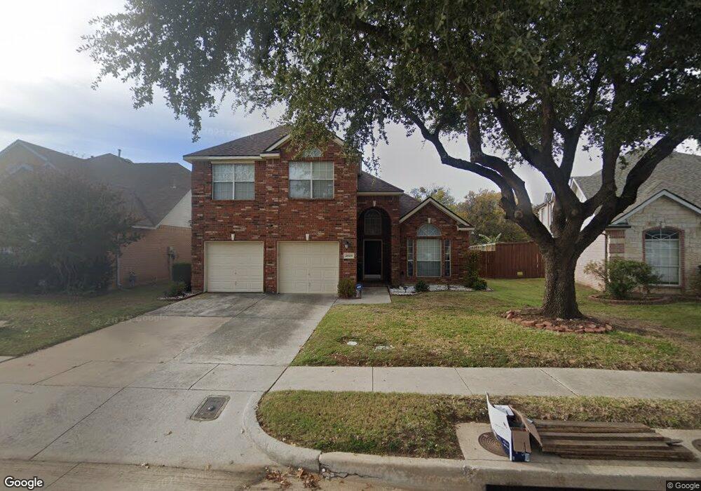
3629 Smoke Tree Trail Euless, TX 76040
Stonewood-Stone Creek NeighborhoodEstimated Value: $472,000 - $495,000
5
Beds
3
Baths
2,660
Sq Ft
$182/Sq Ft
Est. Value
About This Home
This home is located at 3629 Smoke Tree Trail, Euless, TX 76040 and is currently estimated at $483,121, approximately $181 per square foot. 3629 Smoke Tree Trail is a home located in Tarrant County with nearby schools including Viridian Elementary School, Central J High School, and Trinity High School.
Ownership History
Date
Name
Owned For
Owner Type
Purchase Details
Closed on
Jan 30, 2001
Sold by
Denman Robert E and Denman Belinda
Bought by
Gul Mahmood
Current Estimated Value
Home Financials for this Owner
Home Financials are based on the most recent Mortgage that was taken out on this home.
Original Mortgage
$179,100
Outstanding Balance
$3,826
Interest Rate
7.19%
Mortgage Type
Construction
Estimated Equity
$479,295
Purchase Details
Closed on
Feb 29, 2000
Sold by
First Texas Homes Inc
Bought by
Denman Robert E and Denman Belinda
Home Financials for this Owner
Home Financials are based on the most recent Mortgage that was taken out on this home.
Original Mortgage
$169,700
Interest Rate
8.31%
Create a Home Valuation Report for This Property
The Home Valuation Report is an in-depth analysis detailing your home's value as well as a comparison with similar homes in the area
Home Values in the Area
Average Home Value in this Area
Purchase History
| Date | Buyer | Sale Price | Title Company |
|---|---|---|---|
| Gul Mahmood | -- | First American Title Co | |
| Denman Robert E | -- | Ticor Land Title |
Source: Public Records
Mortgage History
| Date | Status | Borrower | Loan Amount |
|---|---|---|---|
| Open | Gul Mahmood | $179,100 | |
| Previous Owner | Denman Robert E | $169,700 |
Source: Public Records
Tax History
| Year | Tax Paid | Tax Assessment Tax Assessment Total Assessment is a certain percentage of the fair market value that is determined by local assessors to be the total taxable value of land and additions on the property. | Land | Improvement |
|---|---|---|---|---|
| 2025 | $5,303 | $429,000 | $85,000 | $344,000 |
| 2024 | $5,303 | $467,872 | $85,000 | $382,872 |
| 2023 | $8,109 | $458,013 | $60,000 | $398,013 |
| 2022 | $8,436 | $347,495 | $60,000 | $287,495 |
| 2021 | $8,198 | $347,495 | $60,000 | $287,495 |
| 2020 | $7,516 | $299,000 | $60,000 | $239,000 |
| 2019 | $7,063 | $299,000 | $60,000 | $239,000 |
| 2018 | $5,662 | $240,325 | $40,000 | $200,325 |
| 2017 | $6,111 | $218,477 | $40,000 | $178,477 |
| 2016 | $6,707 | $256,955 | $40,000 | $216,955 |
| 2015 | $5,321 | $218,000 | $22,000 | $196,000 |
| 2014 | $5,321 | $218,000 | $22,000 | $196,000 |
Source: Public Records
Map
Nearby Homes
- 3674 Crowberry Way
- 3805 Trinity Hills Ln
- 12626 Bay Ave
- 3987 Fernando Dr
- 12607 Bay Ave
- 4703 Boyds Branch Dr
- 4825 Beaver Creek Dr
- 3395 Euless South Main St
- 1415 Huntsman Ridge Ln
- 1939 Spotted Fawn Dr
- 4826 Forest Crest Pkwy
- 4801 Park View Place
- 4408 Meadow Hawk Dr
- 4820 Blackhawk Green Ct
- 2085 Emerald Grove Dr
- 2085 Pine Grove Ln
- 1409 Mount Evans Trail
- 4796 Blackhawk Green Ct
- 1201 White Squall Trail
- 4798 Blackhawk Green Ct
- 3625 Smoke Tree Trail
- 3633 Smoke Tree Trail
- 3621 Smoke Tree Trail
- 3637 Smoke Tree Trail
- 3624 Smoke Tree Trail
- 3617 Smoke Tree Trail
- 3620 Smoke Tree Trail
- 3641 Smoke Tree Trail
- 3616 Smoke Tree Trail
- 3645 Smoke Tree Trail
- 3613 Smoke Tree Trail
- 3644 Smoke Tree Trail
- 3612 Smoke Tree Trail
- 3601 Blue Spruce Dr
- 3600 White Birch Way
- 3649 Smoke Tree Trail
- 3609 Smoke Tree Trail
- 3648 Smoke Tree Trail
- 3600 Smoke Tree Trail
- 3639 Crowberry Way
Your Personal Tour Guide
Ask me questions while you tour the home.