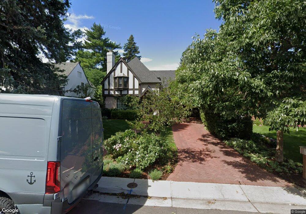
363 Dexter St Denver, CO 80220
Hilltop NeighborhoodEstimated Value: $2,631,877 - $3,630,000
5
Beds
5
Baths
5,062
Sq Ft
$588/Sq Ft
Est. Value
About This Home
This home is located at 363 Dexter St, Denver, CO 80220 and is currently estimated at $2,975,219, approximately $587 per square foot. 363 Dexter St is a home located in Denver County with nearby schools including Steck Elementary School, Hill Campus of Arts & Sciences, and George Washington High School.
Ownership History
Date
Name
Owned For
Owner Type
Purchase Details
Closed on
Jul 2, 2014
Sold by
Winfield Ann and Winfield Gary L
Bought by
Strasburg Donald Peter and Baker Strasburg Jennifer
Current Estimated Value
Home Financials for this Owner
Home Financials are based on the most recent Mortgage that was taken out on this home.
Original Mortgage
$1,040,000
Outstanding Balance
$793,059
Interest Rate
4.19%
Mortgage Type
New Conventional
Estimated Equity
$2,182,160
Purchase Details
Closed on
Oct 28, 2013
Sold by
Darre Nicole J and Darre Bernard C
Bought by
Winfield Ann and Winfield Gary L
Home Financials for this Owner
Home Financials are based on the most recent Mortgage that was taken out on this home.
Original Mortgage
$1,158,500
Interest Rate
5.5%
Mortgage Type
Adjustable Rate Mortgage/ARM
Purchase Details
Closed on
Dec 18, 2001
Sold by
Darre Bernard C and Darre Nicole J
Bought by
Darre Bernard C and Darre Nicole J
Purchase Details
Closed on
Mar 26, 1999
Sold by
Collins Lynda B
Bought by
Darre Bernard C and Darre Nicole J
Home Financials for this Owner
Home Financials are based on the most recent Mortgage that was taken out on this home.
Original Mortgage
$403,750
Interest Rate
6.69%
Purchase Details
Closed on
Mar 23, 1999
Sold by
Collins Robert James
Bought by
Collins Lynda B
Home Financials for this Owner
Home Financials are based on the most recent Mortgage that was taken out on this home.
Original Mortgage
$403,750
Interest Rate
6.69%
Purchase Details
Closed on
Feb 7, 1995
Sold by
Collins Lynda B and Collins Robert J
Bought by
Collins Lynda B
Create a Home Valuation Report for This Property
The Home Valuation Report is an in-depth analysis detailing your home's value as well as a comparison with similar homes in the area
Home Values in the Area
Average Home Value in this Area
Purchase History
| Date | Buyer | Sale Price | Title Company |
|---|---|---|---|
| Strasburg Donald Peter | $1,790,000 | Stewart Title | |
| Winfield Ann | $1,680,000 | Land Title Guarantee Company | |
| Darre Bernard C | -- | -- | |
| Darre Bernard C | $475,000 | Land Title | |
| Collins Lynda B | -- | Land Title | |
| Collins Lynda B | -- | -- |
Source: Public Records
Mortgage History
| Date | Status | Borrower | Loan Amount |
|---|---|---|---|
| Open | Strasburg Donald Peter | $1,040,000 | |
| Previous Owner | Winfield Ann | $1,158,500 | |
| Previous Owner | Darre Bernard C | $403,750 |
Source: Public Records
Tax History Compared to Growth
Tax History
| Year | Tax Paid | Tax Assessment Tax Assessment Total Assessment is a certain percentage of the fair market value that is determined by local assessors to be the total taxable value of land and additions on the property. | Land | Improvement |
|---|---|---|---|---|
| 2024 | $14,708 | $185,700 | $61,310 | $124,390 |
| 2023 | $14,389 | $185,700 | $61,310 | $124,390 |
| 2022 | $11,923 | $149,930 | $45,750 | $104,180 |
| 2021 | $11,510 | $154,250 | $47,070 | $107,180 |
| 2020 | $10,351 | $139,510 | $44,590 | $94,920 |
| 2019 | $10,061 | $139,510 | $44,590 | $94,920 |
| 2018 | $10,139 | $131,060 | $37,420 | $93,640 |
| 2017 | $10,109 | $131,060 | $37,420 | $93,640 |
| 2016 | $10,551 | $129,380 | $33,098 | $96,282 |
| 2015 | $10,108 | $129,380 | $33,098 | $96,282 |
| 2014 | $6,782 | $81,660 | $32,262 | $49,398 |
Source: Public Records
Map
Nearby Homes
- 444 Cherry St
- 456 Cherry St
- 371 Birch St
- 235 Eudora St
- 258 Eudora St
- 4824 E 6th Avenue Pkwy
- 1182 N Clermont Street Pkwy Unit 101
- 838 N Cherry St Unit 2
- 832 N Cherry St Unit 1
- 628 Cherry St
- 385 Forest St
- 445 Forest St
- 665 Cherry St
- 350 Albion St
- 1421 N Fairfax St
- 162 Ash St
- 636 Fairfax St
- 420 Colorado Blvd
- 10 Cherry St
- 729 Elm St