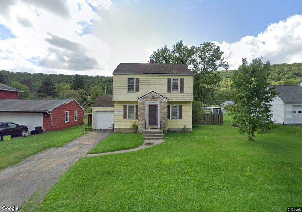
363 Interstate Pkwy Bradford, PA 16701
Estimated Value: $124,000 - $225,000
--
Bed
--
Bath
2,102
Sq Ft
$86/Sq Ft
Est. Value
About This Home
This home is located at 363 Interstate Pkwy, Bradford, PA 16701 and is currently estimated at $181,789, approximately $86 per square foot. 363 Interstate Pkwy is a home located in McKean County with nearby schools including George Blaisdell Elementary School, School Street Elementary School, and Floyd C. Fretz Middle School.
Ownership History
Date
Name
Owned For
Owner Type
Purchase Details
Closed on
Nov 17, 2011
Sold by
Buck Fred L
Bought by
Buck Fred L and Buck Cassandra P
Current Estimated Value
Home Financials for this Owner
Home Financials are based on the most recent Mortgage that was taken out on this home.
Original Mortgage
$42,000
Outstanding Balance
$4,269
Interest Rate
4.1%
Mortgage Type
Credit Line Revolving
Estimated Equity
$177,520
Create a Home Valuation Report for This Property
The Home Valuation Report is an in-depth analysis detailing your home's value as well as a comparison with similar homes in the area
Home Values in the Area
Average Home Value in this Area
Purchase History
| Date | Buyer | Sale Price | Title Company |
|---|---|---|---|
| Buck Fred L | -- | None Available |
Source: Public Records
Mortgage History
| Date | Status | Borrower | Loan Amount |
|---|---|---|---|
| Open | Buck Fred L | $42,000 |
Source: Public Records
Tax History Compared to Growth
Tax History
| Year | Tax Paid | Tax Assessment Tax Assessment Total Assessment is a certain percentage of the fair market value that is determined by local assessors to be the total taxable value of land and additions on the property. | Land | Improvement |
|---|---|---|---|---|
| 2025 | $3,055 | $75,200 | $9,810 | $65,390 |
| 2024 | $2,961 | $75,200 | $9,810 | $65,390 |
| 2023 | $2,961 | $75,200 | $9,810 | $65,390 |
| 2022 | $2,961 | $75,200 | $9,810 | $65,390 |
| 2021 | $2,961 | $75,200 | $9,810 | $65,390 |
| 2020 | $2,885 | $75,200 | $9,810 | $65,390 |
| 2019 | $2,810 | $75,200 | $9,810 | $65,390 |
| 2018 | $28 | $75,200 | $9,810 | $65,390 |
| 2017 | -- | $75,200 | $9,810 | $65,390 |
| 2016 | $2,716 | $75,200 | $9,810 | $65,390 |
| 2015 | $96 | $75,200 | $9,810 | $65,390 |
| 2014 | $96 | $75,200 | $9,810 | $65,390 |
Source: Public Records
Map
Nearby Homes
- 7 Royal Ave
- 63 Southgate Rd
- 19 Parkway Ln
- 37 Stone Ave
- 56 Calvin Ct
- 53 Orchard Place
- 54 Calvin Ct
- 2 Abbott Rd
- 174 N Bennett St
- 51 Interstate Pkwy
- 173 Pleasant St
- 165 Pleasant St
- 160 Pleasant St
- 0 W Washington St Unit R1643118
- 50 Onofrio St
- 7 Louette Dr
- 112 Pleasant St
- 126 Barbour St
- 25 School St
- 52 Summer St
- 367 Interstate Pkwy
- 359 Interstate Pkwy
- 31 Sullivan Rd
- 355 Interstate Pkwy
- 33 Sullivan Rd
- 25 Sullivan Rd
- 364 Interstate Pkwy
- 35 Sullivan Rd
- 19 Sullivan Rd
- 21 Sullivan Rd
- 362 Interstate Pkwy
- 39 Sullivan Rd
- 9 Royal Ave
- 42 Southgate Rd
- 44 Southgate Rd
- 360 Interstate Pkwy
- 17 Sullivan Rd
- 41 Sullivan Rd
- 358 Interstate Pkwy
- 8 Royal Ave