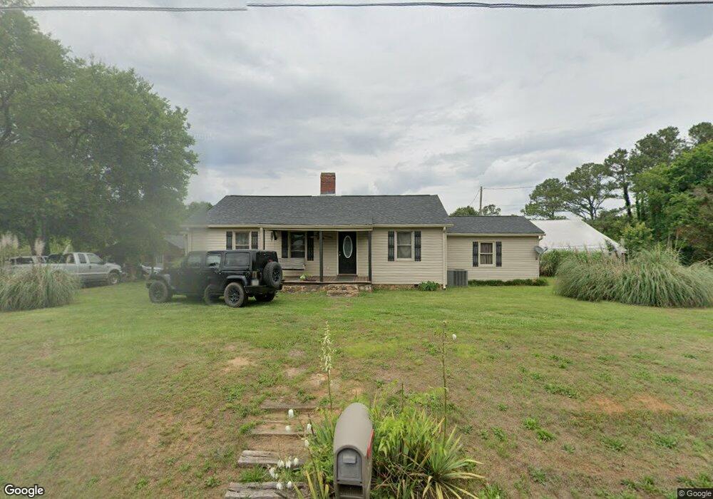
363 Liberty Rd SW Calhoun, GA 30701
Estimated Value: $240,013 - $320,000
2
Beds
1
Bath
1,544
Sq Ft
$178/Sq Ft
Est. Value
About This Home
This home is located at 363 Liberty Rd SW, Calhoun, GA 30701 and is currently estimated at $275,253, approximately $178 per square foot. 363 Liberty Rd SW is a home located in Gordon County with nearby schools including Swain Elementary School, Ashworth Middle School, and Gordon Central High School.
Ownership History
Date
Name
Owned For
Owner Type
Purchase Details
Closed on
Oct 1, 2004
Sold by
Naymick Kathryn E
Bought by
Rush Russell N and Rush Katarina E
Current Estimated Value
Purchase Details
Closed on
Jul 26, 1996
Bought by
Naymick Kathryn E
Purchase Details
Closed on
Aug 31, 1995
Bought by
Cole Barbara N
Purchase Details
Closed on
May 1, 1995
Bought by
Secretary Of Housing
Purchase Details
Closed on
Apr 12, 1995
Bought by
Sec Hsing & Urb Dev Suc & As
Purchase Details
Closed on
Oct 30, 1992
Bought by
Bailey Matthew D and Bailey Anita
Create a Home Valuation Report for This Property
The Home Valuation Report is an in-depth analysis detailing your home's value as well as a comparison with similar homes in the area
Home Values in the Area
Average Home Value in this Area
Purchase History
| Date | Buyer | Sale Price | Title Company |
|---|---|---|---|
| Rush Russell N | $145,000 | -- | |
| Naymick Kathryn E | $82,500 | -- | |
| Cole Barbara N | $72,900 | -- | |
| Secretary Of Housing | $74,800 | -- | |
| Sec Hsing & Urb Dev Suc & As | -- | -- | |
| Bailey Matthew D | $73,300 | -- |
Source: Public Records
Tax History Compared to Growth
Tax History
| Year | Tax Paid | Tax Assessment Tax Assessment Total Assessment is a certain percentage of the fair market value that is determined by local assessors to be the total taxable value of land and additions on the property. | Land | Improvement |
|---|---|---|---|---|
| 2024 | $1,790 | $72,472 | $16,320 | $56,152 |
| 2023 | $1,620 | $65,752 | $15,560 | $50,192 |
| 2022 | $1,640 | $62,712 | $15,560 | $47,152 |
| 2021 | $1,447 | $53,644 | $15,560 | $38,084 |
| 2020 | $1,363 | $49,580 | $15,560 | $34,020 |
| 2019 | $1,370 | $49,580 | $15,560 | $34,020 |
| 2018 | $1,230 | $44,692 | $15,560 | $29,132 |
| 2017 | $1,218 | $43,092 | $15,560 | $27,532 |
| 2016 | $1,221 | $43,092 | $15,560 | $27,532 |
| 2015 | $1,166 | $40,892 | $15,560 | $25,332 |
| 2014 | $1,035 | $37,530 | $15,579 | $21,950 |
Source: Public Records
Map
Nearby Homes
- 261 Liberty Ln SW
- 490 McDaniel Station Rd SW
- 506 McDaniel Station Rd SW
- 458 McDaniel Station Rd SW
- 474 McDaniel Station Rd SW
- 0 Highway 53 Spur SW Unit 7529096
- 0 Reeves Station Rd SW Unit 10548197
- 0 Reeves Station Rd SW Unit 7601645
- 110 Darby Rd SW
- 271 Old Belwood Rd SE
- 1401 U S 41
- 00 Belmont Dr
- 121 Foxhall Dr SW
- 1311 Us Highway 41
- 211 Darby Rd SW
- 0 Richardson Rd SE Unit 10474273
- 0 Richardson Rd SE Unit 7537183
- 0 W Belmont Dr Unit 10489910
- 201 Porch Loop SE
- 220 Porch Loop SE
- 385 Liberty Rd SW
- 139 Liberty Cir SW
- 403 Liberty Rd SW
- 156 Liberty Place SW
- 314 Liberty Rd SW
- 153 Liberty Cir SW
- 129 Liberty Cir SW
- 117 Liberty Place SW
- 413 Liberty Rd SW
- 152 Liberty Place SW
- 298 Liberty Rd SW
- 158 Liberty Place SW
- 150 Liberty Cir SW
- 423 Liberty Rd SW
- 297 Liberty Rd SW
- 124 Liberty Cir SW
- 110 Liberty Place SW
- 163 Liberty Ln SW
- 435 Liberty Rd SW
- 284 Liberty Rd SW