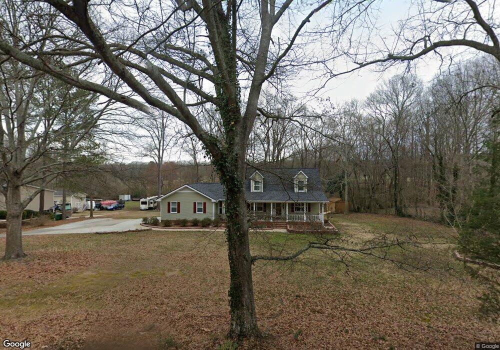
363 Miles Patrick Rd Winder, GA 30680
Estimated Value: $350,816 - $369,000
3
Beds
3
Baths
1,799
Sq Ft
$200/Sq Ft
Est. Value
About This Home
This home is located at 363 Miles Patrick Rd, Winder, GA 30680 and is currently estimated at $359,954, approximately $200 per square foot. 363 Miles Patrick Rd is a home located in Barrow County with nearby schools including County Line Elementary School, Russell Middle School, and Winder-Barrow High School.
Ownership History
Date
Name
Owned For
Owner Type
Purchase Details
Closed on
Mar 29, 2021
Sold by
Fleming William O
Bought by
Vickery Steven Travis
Current Estimated Value
Home Financials for this Owner
Home Financials are based on the most recent Mortgage that was taken out on this home.
Original Mortgage
$274,928
Outstanding Balance
$246,186
Interest Rate
2.9%
Mortgage Type
FHA
Estimated Equity
$113,768
Create a Home Valuation Report for This Property
The Home Valuation Report is an in-depth analysis detailing your home's value as well as a comparison with similar homes in the area
Home Values in the Area
Average Home Value in this Area
Purchase History
| Date | Buyer | Sale Price | Title Company |
|---|---|---|---|
| Vickery Steven Travis | $280,000 | -- |
Source: Public Records
Mortgage History
| Date | Status | Borrower | Loan Amount |
|---|---|---|---|
| Open | Vickery Steven Travis | $274,928 |
Source: Public Records
Tax History
| Year | Tax Paid | Tax Assessment Tax Assessment Total Assessment is a certain percentage of the fair market value that is determined by local assessors to be the total taxable value of land and additions on the property. | Land | Improvement |
|---|---|---|---|---|
| 2025 | $3,464 | $124,924 | $18,000 | $106,924 |
| 2024 | $3,444 | $122,007 | $18,000 | $104,007 |
| 2023 | $3,433 | $122,007 | $18,000 | $104,007 |
| 2022 | $3,257 | $96,182 | $18,000 | $78,182 |
| 2021 | $883 | $67,027 | $16,000 | $51,027 |
| 2020 | $787 | $62,842 | $16,000 | $46,842 |
| 2019 | $804 | $61,795 | $16,000 | $45,795 |
| 2018 | $1,792 | $57,395 | $11,600 | $45,795 |
| 2017 | $1,477 | $49,494 | $11,600 | $37,894 |
| 2016 | $1,445 | $47,639 | $11,600 | $36,039 |
| 2015 | $1,446 | $47,639 | $11,600 | $36,039 |
| 2014 | $1,293 | $42,899 | $6,860 | $36,039 |
| 2013 | -- | $39,931 | $6,860 | $33,071 |
Source: Public Records
Map
Nearby Homes
- 326 Miles Patrick Rd
- 154 Williamsburg Way
- 197 Buena Vista St
- 223 Lacey Ln
- 27 Creekside Dr
- 421 N 5th Ave
- 222 Ryan Rd
- 303 Rocky Point Ct
- 0 E Northcrest Dr Unit 10648147
- 136 Alexander Ct
- 236 6th Ave
- 436 Northcrest Dr
- 326 Fayette Dr
- 469 Plantation Dr
- 284 E 5th Ave
- 2050 Whispering Way
- 206 E 5th Ave
- 352 3rd Ave
- 273 Partridge Trail
- 171 Brookview Terrace
- 367 Miles Patrick Rd Unit 1
- 375 Miles Patrick Rd Unit 1
- 355 Miles Patrick Rd
- 377 Miles Patrick Rd Unit 1
- 351 Miles Patrick Rd
- 362 Miles Patrick Rd
- 368 Miles Patrick Rd
- 2.23 ACRES Miles Patrick Rd
- 379 Miles Patrick Rd Unit 1
- 349 Miles Patrick Rd
- 345 Miles Patrick Rd
- 385 Miles Patrick Rd
- 352 Miles Patrick Rd
- 89 Sims Rd
- 378 Miles Patrick Rd
- 341 Miles Patrick Rd
- 374 Miles Patrick Rd
- 382 Miles Patrick Rd
- 113 Sims Rd
- 340 Miles Patrick Rd
Your Personal Tour Guide
Ask me questions while you tour the home.