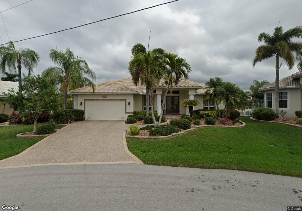
3630 Aruba Ct Punta Gorda, FL 33950
Punta Gorda Isles NeighborhoodEstimated Value: $921,000 - $1,105,000
3
Beds
3
Baths
2,863
Sq Ft
$342/Sq Ft
Est. Value
About This Home
This home is located at 3630 Aruba Ct, Punta Gorda, FL 33950 and is currently estimated at $979,901, approximately $342 per square foot. 3630 Aruba Ct is a home located in Charlotte County with nearby schools including Sallie Jones Elementary School, Punta Gorda Middle School, and Charlotte High School.
Ownership History
Date
Name
Owned For
Owner Type
Purchase Details
Closed on
Jun 2, 2015
Sold by
Swanson Roger B and Swanson Cheryl A
Bought by
Swanson Family Revocable Trust
Current Estimated Value
Purchase Details
Closed on
Jul 23, 1996
Sold by
Imperia Enio
Bought by
Swanson Roger B and Swanson Cheryl A
Home Financials for this Owner
Home Financials are based on the most recent Mortgage that was taken out on this home.
Original Mortgage
$83,000
Outstanding Balance
$4,290
Interest Rate
8.36%
Estimated Equity
$975,611
Create a Home Valuation Report for This Property
The Home Valuation Report is an in-depth analysis detailing your home's value as well as a comparison with similar homes in the area
Home Values in the Area
Average Home Value in this Area
Purchase History
| Date | Buyer | Sale Price | Title Company |
|---|---|---|---|
| Swanson Family Revocable Trust | -- | Attorney | |
| Swanson Roger B | $113,000 | -- |
Source: Public Records
Mortgage History
| Date | Status | Borrower | Loan Amount |
|---|---|---|---|
| Open | Swanson Roger B | $83,000 |
Source: Public Records
Tax History
| Year | Tax Paid | Tax Assessment Tax Assessment Total Assessment is a certain percentage of the fair market value that is determined by local assessors to be the total taxable value of land and additions on the property. | Land | Improvement |
|---|---|---|---|---|
| 2025 | $10,542 | $615,777 | -- | -- |
| 2024 | $10,308 | $598,423 | -- | -- |
| 2023 | $10,308 | $580,993 | $0 | $0 |
| 2022 | $9,924 | $564,071 | $0 | $0 |
| 2021 | $9,577 | $547,642 | $0 | $0 |
| 2020 | $9,150 | $540,081 | $0 | $0 |
| 2019 | $9,142 | $527,938 | $0 | $0 |
| 2018 | $8,476 | $518,094 | $0 | $0 |
| 2017 | $8,329 | $507,438 | $0 | $0 |
| 2016 | $8,320 | $497,001 | $0 | $0 |
| 2015 | $8,402 | $493,546 | $0 | $0 |
| 2014 | $8,378 | $490,439 | $0 | $0 |
Source: Public Records
Map
Nearby Homes
- 3406 Saint Croix Ct
- 3701 Carmichael Dr
- 3520 Caya Largo Ct
- 2831 Deborah Dr
- 2611 Ryan Blvd
- 2436 Deborah Dr
- 2523 Ryan Blvd
- 3324 Antigua Dr
- 1318 San Mateo Dr
- 3805 Saba Ct
- 3607 Darin Dr
- 2335 Deborah Dr
- 2737 Saint Thomas Dr
- 3307 Dominica Ct
- 2507 Via Veneto Dr
- 2718 Saint Thomas Dr
- 2907 Ryan Blvd
- 3616 Darin Dr
- 2151 Charlotte Amalie Ct
- 2736 Mayaguana Ct
Your Personal Tour Guide
Ask me questions while you tour the home.