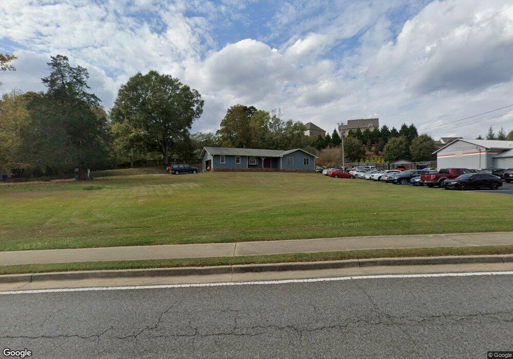
3630 Mathis Airport Pkwy Suwanee, GA 30024
Big Creek NeighborhoodEstimated Value: $352,000 - $423,000
3
Beds
2
Baths
1,445
Sq Ft
$275/Sq Ft
Est. Value
About This Home
This home is located at 3630 Mathis Airport Pkwy, Suwanee, GA 30024 and is currently estimated at $397,944, approximately $275 per square foot. 3630 Mathis Airport Pkwy is a home located in Forsyth County with nearby schools including Brookwood Elementary School, South Forsyth Middle School, and Lambert High School.
Ownership History
Date
Name
Owned For
Owner Type
Purchase Details
Closed on
Nov 17, 2022
Sold by
Cheek Greg D
Bought by
G And D 3630 Properties Llc
Current Estimated Value
Purchase Details
Closed on
Jun 24, 1998
Sold by
Mathis Danny C and Mathis Janis D
Bought by
Cheek Greg and Cheek Marilyn
Home Financials for this Owner
Home Financials are based on the most recent Mortgage that was taken out on this home.
Original Mortgage
$133,000
Interest Rate
7.21%
Mortgage Type
New Conventional
Create a Home Valuation Report for This Property
The Home Valuation Report is an in-depth analysis detailing your home's value as well as a comparison with similar homes in the area
Home Values in the Area
Average Home Value in this Area
Purchase History
| Date | Buyer | Sale Price | Title Company |
|---|---|---|---|
| G And D 3630 Properties Llc | -- | -- | |
| Cheek Greg | $140,000 | -- |
Source: Public Records
Mortgage History
| Date | Status | Borrower | Loan Amount |
|---|---|---|---|
| Previous Owner | Cheek Greg | $133,000 |
Source: Public Records
Tax History Compared to Growth
Tax History
| Year | Tax Paid | Tax Assessment Tax Assessment Total Assessment is a certain percentage of the fair market value that is determined by local assessors to be the total taxable value of land and additions on the property. | Land | Improvement |
|---|---|---|---|---|
| 2025 | $3,087 | $135,112 | $63,116 | $71,996 |
| 2024 | $3,087 | $125,880 | $55,692 | $70,188 |
| 2023 | $3,135 | $127,360 | $61,260 | $66,100 |
| 2022 | $2,830 | $73,396 | $26,132 | $47,264 |
| 2021 | $2,027 | $73,396 | $26,132 | $47,264 |
| 2020 | $1,956 | $70,836 | $26,132 | $44,704 |
| 2019 | $1,511 | $54,624 | $23,520 | $31,104 |
| 2018 | $1,218 | $44,040 | $21,776 | $22,264 |
| 2017 | $1,189 | $42,840 | $21,776 | $21,064 |
| 2016 | $1,068 | $38,484 | $17,420 | $21,064 |
| 2015 | $1,070 | $38,484 | $17,420 | $21,064 |
| 2014 | $891 | $33,672 | $0 | $0 |
Source: Public Records
Map
Nearby Homes
- 3440 Commander Cove
- 3470 Commander Cove
- 3485 Vermillion View
- 3430 Commander Cove
- 3510 Vermillion View
- 3440 Ronnie Ln
- 335 Pintail Ct
- 6505 Caldwell Ct
- 2690 Portabella Ln
- 2940 Bentbill Crossing
- 2850 Brandy Ln
- 5995 Ettington Dr
- 5625 Buckleigh Pointe
- 6005 Oakbury Ln
- 2380 Manor Creek Ct
- 355 Laurel Oak Dr
- 5060 Brent Knoll Ln Unit 1
- 6010 Somerset Ct
- 6930 Blackthorn Ln
- 5235 Villa Lake Ct
- 3725 Mathis Airpark Rd
- 3835 Laurel Lake Point
- 3835 Laurel Lake Point
- 3845 Laurel Lake Point
- 3640 Mathis Airport Pkwy
- 3715 Mathis Airport Dr
- 3595 Mathis Airport Pkwy
- 3855 Laurel Lake Point
- 5885 Stoneleigh Dr
- 5875 Stoneleigh Dr
- 3850 Laurel Lake Point
- 3830 Laurel Lake Point
- 5865 Stoneleigh Dr
- 5865 Stoneleigh Dr Unit 55
- 5915 Stoneleigh Dr
- 3840 Laurel Lake Point
- 3670 Mathis Airport Pkwy
- 3815 Laurel Lake Point
- 0R Stoneleigh Dr
- 5925 Stoneleigh Dr