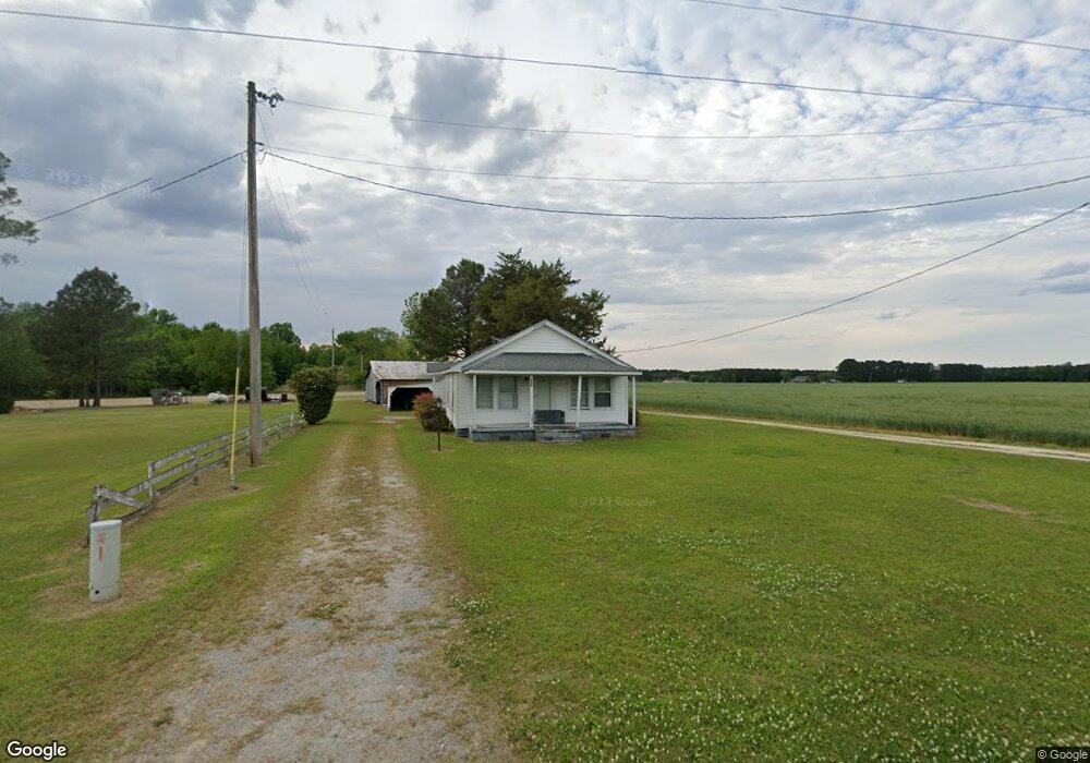
3630 Willie Measley Rd La Grange, NC 28551
Estimated Value: $93,494 - $210,000
2
Beds
2
Baths
980
Sq Ft
$140/Sq Ft
Est. Value
About This Home
This home is located at 3630 Willie Measley Rd, La Grange, NC 28551 and is currently estimated at $137,165, approximately $139 per square foot. 3630 Willie Measley Rd is a home located in Lenoir County with nearby schools including La Grange Elementary School, E.B. Frink Middle School, and North Lenoir High School.
Ownership History
Date
Name
Owned For
Owner Type
Purchase Details
Closed on
Aug 5, 2024
Sold by
Sutton Ruth Carolyn Colie and Sherwood Rus
Bought by
Sutton Ruth Carolyn Coli and Sutton Sherwood Russell
Current Estimated Value
Create a Home Valuation Report for This Property
The Home Valuation Report is an in-depth analysis detailing your home's value as well as a comparison with similar homes in the area
Home Values in the Area
Average Home Value in this Area
Purchase History
| Date | Buyer | Sale Price | Title Company |
|---|---|---|---|
| Sutton Ruth Carolyn Coli | $1,000 | None Listed On Document |
Source: Public Records
Tax History Compared to Growth
Tax History
| Year | Tax Paid | Tax Assessment Tax Assessment Total Assessment is a certain percentage of the fair market value that is determined by local assessors to be the total taxable value of land and additions on the property. | Land | Improvement |
|---|---|---|---|---|
| 2025 | $640 | $75,057 | $11,655 | $63,402 |
| 2024 | $365 | $29,739 | $7,040 | $22,699 |
| 2023 | $353 | $29,739 | $7,040 | $22,699 |
| 2022 | $353 | $29,739 | $7,040 | $22,699 |
| 2021 | $353 | $29,739 | $7,040 | $22,699 |
| 2020 | $353 | $29,739 | $7,040 | $22,699 |
| 2019 | $353 | $29,739 | $7,040 | $22,699 |
| 2018 | $349 | $29,739 | $7,040 | $22,699 |
| 2017 | $344 | $29,739 | $7,040 | $22,699 |
| 2014 | $372 | $32,893 | $7,040 | $25,853 |
| 2013 | -- | $32,893 | $7,040 | $25,853 |
| 2011 | -- | $32,893 | $7,040 | $25,853 |
Source: Public Records
Map
Nearby Homes
- 3733 Fields Station Rd
- 5130 Aldridge Store Rd
- Lot #2 Albert Sugg Rd
- 101 Forest Dr
- 303 E James St
- Hayden Plan at Blair Ridge
- Freeport Plan at Blair Ridge
- Cali Plan at Blair Ridge
- Belhaven Plan at Blair Ridge
- 3821 Lindsey Ln
- 210 Wood St
- 201 Wood St
- 202 Wood St
- 208 Wood St
- 217 Wood St
- 204 Wood St
- 205 Wood St
- 206 Wood St
- 6272 Highway 70 E
- 202 E Washington St
- 3612 Willie Measley Rd
- 3593 Willie Measley Rd
- 3645 Willie Measley Rd
- 3571 Willie Measley Rd
- 3545 Willie Measley Rd
- 3636 Willie Measley Rd
- 3718 Willie Measley Rd
- 3498 Willie Measley Rd Unit 3510
- 4709 Eason Rd
- 3755 Willie Measley Rd
- 4704 Fields Station Rd
- 4579 Eason Rd
- 4804 Eason Rd
- 4850 Eason Rd
- 4573 Eason Rd
- 4862 Eason Rd
- 4878 Eason Rd
- 4433 Eason Rd
- 4834 Eason Rd
- 4836 Eason Rd