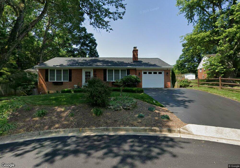
3631 Embassy Ln Fairfax, VA 22030
Estimated Value: $797,000 - $892,000
3
Beds
5
Baths
1,933
Sq Ft
$434/Sq Ft
Est. Value
About This Home
This home is located at 3631 Embassy Ln, Fairfax, VA 22030 and is currently estimated at $838,526, approximately $433 per square foot. 3631 Embassy Ln is a home located in Fairfax City with nearby schools including Daniels Run Elementary School, Johnson Middle School, and Fairfax High.
Ownership History
Date
Name
Owned For
Owner Type
Purchase Details
Closed on
Jan 29, 2004
Sold by
Burgess Robert
Bought by
Joehnk Vicki
Current Estimated Value
Home Financials for this Owner
Home Financials are based on the most recent Mortgage that was taken out on this home.
Original Mortgage
$292,000
Outstanding Balance
$136,852
Interest Rate
5.82%
Mortgage Type
New Conventional
Estimated Equity
$701,674
Purchase Details
Closed on
May 24, 1996
Sold by
Rollins Marion G
Bought by
Burgess Robert C
Home Financials for this Owner
Home Financials are based on the most recent Mortgage that was taken out on this home.
Original Mortgage
$154,282
Interest Rate
8.01%
Create a Home Valuation Report for This Property
The Home Valuation Report is an in-depth analysis detailing your home's value as well as a comparison with similar homes in the area
Home Values in the Area
Average Home Value in this Area
Purchase History
| Date | Buyer | Sale Price | Title Company |
|---|---|---|---|
| Joehnk Vicki | $365,000 | -- | |
| Burgess Robert C | $155,700 | -- |
Source: Public Records
Mortgage History
| Date | Status | Borrower | Loan Amount |
|---|---|---|---|
| Open | Joehnk Vicki | $292,000 | |
| Previous Owner | Burgess Robert C | $154,282 |
Source: Public Records
Tax History Compared to Growth
Tax History
| Year | Tax Paid | Tax Assessment Tax Assessment Total Assessment is a certain percentage of the fair market value that is determined by local assessors to be the total taxable value of land and additions on the property. | Land | Improvement |
|---|---|---|---|---|
| 2025 | $8,990 | $829,400 | $237,800 | $591,600 |
| 2024 | $7,741 | $751,600 | $218,700 | $532,900 |
| 2023 | $7,529 | $734,500 | $213,800 | $520,700 |
| 2022 | $7,418 | $734,500 | $213,800 | $520,700 |
| 2021 | $6,899 | $641,800 | $213,800 | $428,000 |
| 2020 | $6,397 | $595,100 | $213,800 | $381,300 |
| 2019 | $6,172 | $581,700 | $213,800 | $367,900 |
| 2018 | $6,091 | $574,600 | $211,800 | $362,800 |
| 2017 | $2,952 | $556,900 | $205,700 | $351,200 |
| 2016 | $2,801 | $544,600 | $201,700 | $342,900 |
| 2015 | $5,256 | $533,000 | $197,800 | $335,200 |
| 2014 | $4,804 | $512,500 | $189,400 | $323,100 |
Source: Public Records
Map
Nearby Homes
- 9917 Colony Rd
- 3506 Queen Anne Dr
- 3831 Farrcroft Dr
- 9917 Duncan St
- 10087 Daniels Run Way
- 10006 Hunter St
- 3907 Fairview Dr
- 3790 Lyndhurst Dr Unit 103
- 10005 Spring Lake Terrace
- 3501 Redwood Ct
- 3931 Tedrich Blvd
- 9904 Great Oaks Way
- 10211 Stratford Ave
- 9815 Bolton Village Ct
- 3975 Lyndhurst Dr Unit 103
- 3800 Hemlock Way
- 3536 Sutton Heights Cir
- 10118 Dwight Ave
- 4026 Walters Ct
- 10171 Fair Woods Dr Unit 301
- 3629 Embassy Ln
- 3630 Parklane Rd
- 3635 Parklane Rd
- 3628 Parklane Rd
- 3630 Embassy Ln
- 3627 Embassy Ln
- 3628 Embassy Ln
- 3626 Parklane Rd
- 3626 Embassy Ln
- 3625 Embassy Ln
- 3624 Parklane Rd
- 3631 Parklane Rd
- 9826 Hampton Ln
- 9824 Hampton Ln
- 3624 Embassy Ln
- 3627 Parklane Rd
- 9822 Hampton Ln
- 3623 Embassy Ln
- 9828 Hampton Ln
- 3622 Parklane Rd