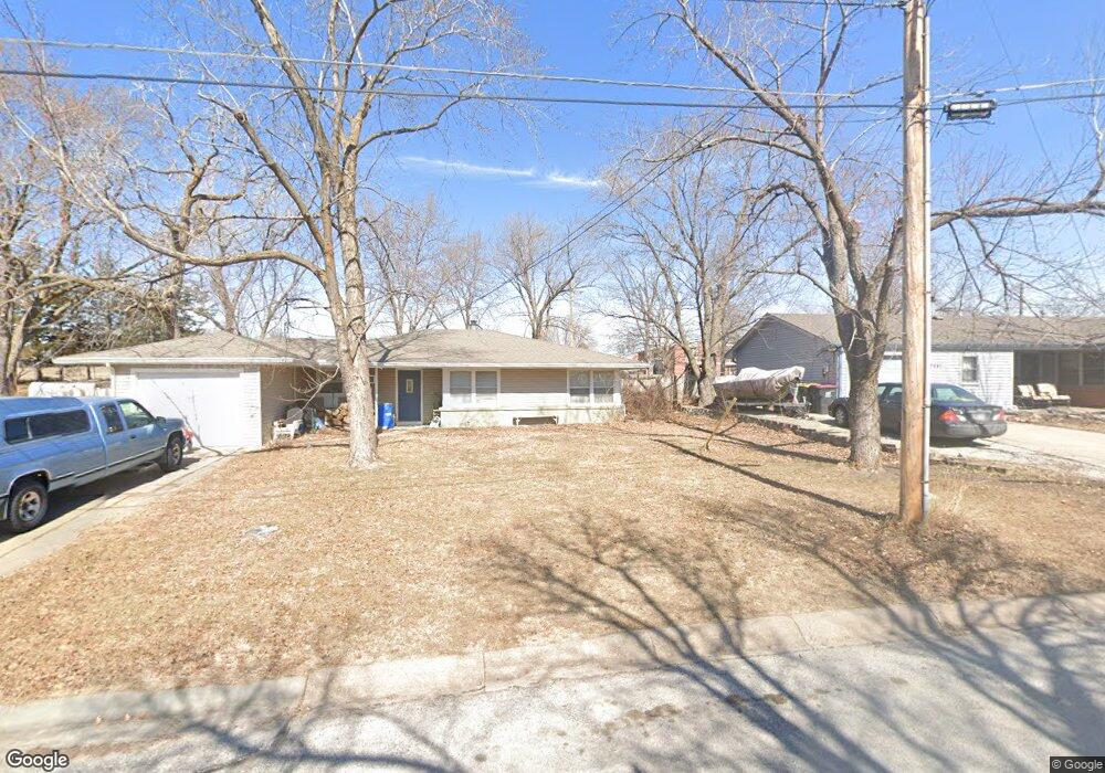
3631 NW Michael St Lincoln, NE 68524
Arnold Heights NeighborhoodEstimated Value: $193,000 - $218,000
3
Beds
1
Bath
1,199
Sq Ft
$169/Sq Ft
Est. Value
About This Home
This home is located at 3631 NW Michael St, Lincoln, NE 68524 and is currently estimated at $202,937, approximately $169 per square foot. 3631 NW Michael St is a home located in Lancaster County with nearby schools including Arnold Elementary School, Schoo Middle School, and North Star High School.
Ownership History
Date
Name
Owned For
Owner Type
Purchase Details
Closed on
Mar 9, 2015
Sold by
Woodrum Sydnee
Bought by
Smith Levi
Current Estimated Value
Purchase Details
Closed on
Feb 24, 2011
Sold by
Warrick Gordon L
Bought by
Smith Levi and Woodrum Sydnee R
Home Financials for this Owner
Home Financials are based on the most recent Mortgage that was taken out on this home.
Original Mortgage
$80,895
Interest Rate
5.5%
Mortgage Type
FHA
Purchase Details
Closed on
Sep 9, 2008
Sold by
Callahan Kevin Michael and Callahan Shannon
Bought by
Warrick Gordon L
Purchase Details
Closed on
Jan 25, 2005
Sold by
Bartels Travis Alan
Bought by
Callahan Kevin Michael
Purchase Details
Closed on
Mar 12, 2002
Sold by
Smith George M and Gulley Nancy E
Bought by
Bartels Travis Alan
Home Financials for this Owner
Home Financials are based on the most recent Mortgage that was taken out on this home.
Original Mortgage
$69,200
Interest Rate
7.01%
Mortgage Type
FHA
Purchase Details
Closed on
Oct 4, 1999
Sold by
Smith George M
Bought by
Smith George M and Smith Nancy E
Create a Home Valuation Report for This Property
The Home Valuation Report is an in-depth analysis detailing your home's value as well as a comparison with similar homes in the area
Home Values in the Area
Average Home Value in this Area
Purchase History
| Date | Buyer | Sale Price | Title Company |
|---|---|---|---|
| Smith Levi | -- | None Available | |
| Smith Levi | $83,000 | Nltal | |
| Warrick Gordon L | $93,000 | Ct | |
| Callahan Kevin Michael | $86,000 | -- | |
| Bartels Travis Alan | $70,000 | -- | |
| Smith George M | -- | -- |
Source: Public Records
Mortgage History
| Date | Status | Borrower | Loan Amount |
|---|---|---|---|
| Previous Owner | Smith Levi | $80,895 | |
| Previous Owner | Bartels Travis Alan | $69,200 |
Source: Public Records
Tax History Compared to Growth
Tax History
| Year | Tax Paid | Tax Assessment Tax Assessment Total Assessment is a certain percentage of the fair market value that is determined by local assessors to be the total taxable value of land and additions on the property. | Land | Improvement |
|---|---|---|---|---|
| 2025 | $2,473 | $167,000 | $44,000 | $123,000 |
| 2024 | $2,473 | $176,600 | $33,000 | $143,600 |
| 2023 | $2,754 | $164,300 | $33,000 | $131,300 |
| 2022 | $2,822 | $141,600 | $27,500 | $114,100 |
| 2021 | $2,670 | $141,600 | $27,500 | $114,100 |
| 2020 | $1,959 | $102,500 | $27,500 | $75,000 |
| 2019 | $1,959 | $102,500 | $27,500 | $75,000 |
| 2018 | $1,756 | $91,500 | $27,500 | $64,000 |
| 2017 | $1,773 | $91,500 | $27,500 | $64,000 |
| 2016 | $1,632 | $83,800 | $27,500 | $56,300 |
| 2015 | $1,621 | $83,800 | $27,500 | $56,300 |
| 2014 | $1,612 | $82,900 | $27,500 | $55,400 |
| 2013 | -- | $82,900 | $27,500 | $55,400 |
Source: Public Records
Map
Nearby Homes
- 5421 W Benton St
- 5401 W Benton St
- 3811 Castle Cir
- 4806 W Mathis St
- 3724 NW 49th St
- 4930 W Kingsley St
- 4121 NW 57th Ct
- 2909 NW 56 St
- 5407 W Butler Ave
- 4940 W Madison Ave
- 5411 Wilkins Cir
- 4140 W Huntington Ave
- 4135 W Huntington Ave
- 5031 W Condor Ln
- 2100 NW 45th St
- 5239 W Partridge Ln
- 5171 W Partridge Ln
- 5041 W Partridge Ln
- 4137 W Thatcher Ln
- 1722 NW 55th St
- 3641 NW Michael St
- 3621 NW Michael St
- 3611 NW Michael St
- 3620 NW Michael St
- 3615 NW 54th St
- 5441 W Benton St
- 3610 NW Michael St
- 5320 Michael Cir
- 3601 NW Michael St
- 5431 W Benton St
- 3625 NW 54th St
- 5327 W Luke St
- 3600 NW Michael St
- 5321 Michael Cir
- 3707 NW 54th St
- 3541 NW Michael St
- 5310 Michael Cir
- 3516 NW Michael St
- 5410 W Benton St
- 5315 W Luke St