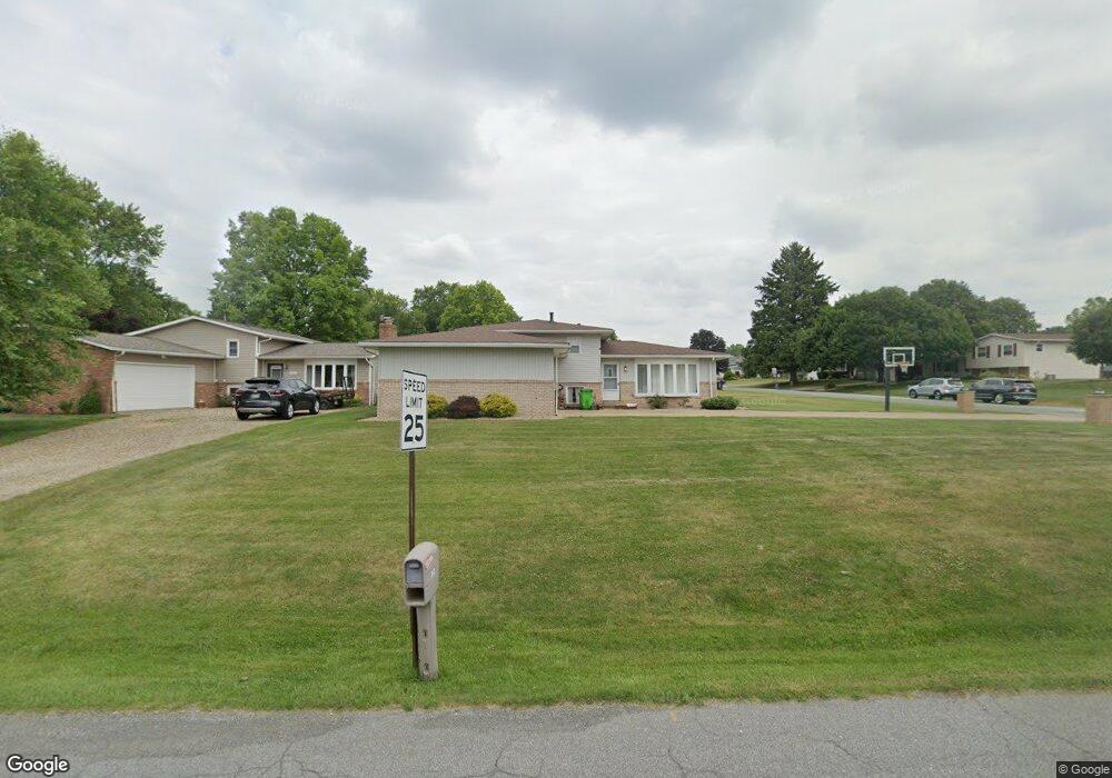
3632 Briardale Dr NW Massillon, OH 44646
Amherst Heights-Clearview NeighborhoodEstimated Value: $200,117 - $245,000
3
Beds
1
Bath
1,052
Sq Ft
$212/Sq Ft
Est. Value
About This Home
This home is located at 3632 Briardale Dr NW, Massillon, OH 44646 and is currently estimated at $223,529, approximately $212 per square foot. 3632 Briardale Dr NW is a home located in Stark County with nearby schools including Pfeiffer Intermediate School, Edison Middle School, and Perry High School.
Ownership History
Date
Name
Owned For
Owner Type
Purchase Details
Closed on
Oct 22, 2009
Sold by
Burley Jack L and Burley Nancy L
Bought by
Casto Quentin G
Current Estimated Value
Home Financials for this Owner
Home Financials are based on the most recent Mortgage that was taken out on this home.
Original Mortgage
$116,351
Outstanding Balance
$76,053
Interest Rate
5.1%
Mortgage Type
FHA
Estimated Equity
$147,476
Purchase Details
Closed on
Oct 8, 1996
Sold by
Cross Robert L
Bought by
Burley Jack L and Burley Nancy
Home Financials for this Owner
Home Financials are based on the most recent Mortgage that was taken out on this home.
Original Mortgage
$67,000
Interest Rate
8%
Mortgage Type
New Conventional
Purchase Details
Closed on
May 22, 1992
Purchase Details
Closed on
Apr 18, 1988
Create a Home Valuation Report for This Property
The Home Valuation Report is an in-depth analysis detailing your home's value as well as a comparison with similar homes in the area
Home Values in the Area
Average Home Value in this Area
Purchase History
| Date | Buyer | Sale Price | Title Company |
|---|---|---|---|
| Casto Quentin G | $118,500 | Attorney | |
| Burley Jack L | $77,000 | -- | |
| -- | $60,000 | -- | |
| -- | $52,900 | -- |
Source: Public Records
Mortgage History
| Date | Status | Borrower | Loan Amount |
|---|---|---|---|
| Open | Casto Quentin G | $116,351 | |
| Previous Owner | Burley Jack L | $67,000 |
Source: Public Records
Tax History Compared to Growth
Tax History
| Year | Tax Paid | Tax Assessment Tax Assessment Total Assessment is a certain percentage of the fair market value that is determined by local assessors to be the total taxable value of land and additions on the property. | Land | Improvement |
|---|---|---|---|---|
| 2025 | -- | $56,040 | $17,190 | $38,850 |
| 2024 | -- | $56,040 | $17,190 | $38,850 |
| 2023 | $2,491 | $49,670 | $15,790 | $33,880 |
| 2022 | $2,504 | $49,670 | $15,790 | $33,880 |
| 2021 | $2,667 | $49,670 | $15,790 | $33,880 |
| 2020 | $2,394 | $42,780 | $13,270 | $29,510 |
| 2019 | $2,160 | $42,780 | $13,270 | $29,510 |
| 2018 | $2,133 | $42,780 | $13,270 | $29,510 |
| 2017 | $1,990 | $36,960 | $10,710 | $26,250 |
| 2016 | $2,001 | $36,960 | $10,710 | $26,250 |
| 2015 | $2,019 | $36,960 | $10,710 | $26,250 |
| 2014 | $1,924 | $34,690 | $10,050 | $24,640 |
| 2013 | $917 | $34,690 | $10,050 | $24,640 |
Source: Public Records
Map
Nearby Homes
- 1836 Sedwick Ave NW
- Hudson Plan at Aberdeen Oaks - Single Family Homes
- Ballenger Plan at Aberdeen Oaks - Single Family Homes
- Aviano Plan at Aberdeen Oaks - Single Family Homes
- Allegheny Plan at Aberdeen Oaks - Single Family Homes
- Lehigh Plan at Aberdeen Oaks - Single Family Homes
- 3460 Spindle St NW
- 2766 Duxbury Cir NW
- 2942 Torrey Pines Cir NW
- 3450 Crown Point St NW
- 2827 Bramblebush Ave NW
- 5179 Birkdale St NW
- 1804 Jackson Ave NW
- 000 Jackson Ave NW
- 3051 Blue Ash Ave NW
- 951 Mill Ridge Path NE
- 0 Birkdale St NW Unit 5122150
- 5827 Hawks Nest Cir NW
- 5829 Hawks Nest Cir NW
- 5831 Hawks Nest Cir NW
- 3622 Briardale Dr NW
- 1617 Thornridge Rd NW
- 3646 Briardale Dr NW
- 3610 Briardale Dr NW
- 1616 Thornridge Rd NW
- 3631 Briardale Dr NW
- 3639 Briardale Dr NW
- 1625 Thornridge Rd NW
- 3623 Briardale Dr NW
- 3656 Briardale Dr NW
- 3647 Briardale Dr NW
- 1626 Thornridge Rd NW
- 1706 Warrington Rd NW
- 3615 Briardale Dr NW
- 1633 Thornridge Rd NW
- 1700 Warrington Rd NW
- 3655 Briardale Dr NW
- 1714 Warrington Rd NW
- 1634 Thornridge Rd NW
- 3605 Briardale Dr NW