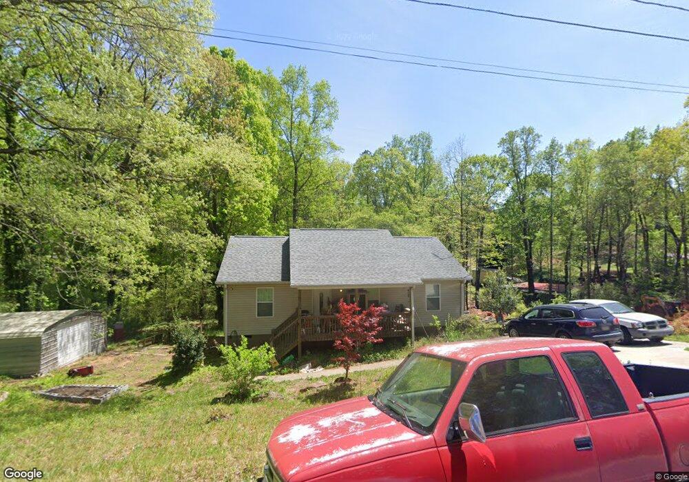
3637 Shoreland Dr Buford, GA 30518
Estimated Value: $381,000 - $610,294
--
Bed
2
Baths
1,176
Sq Ft
$388/Sq Ft
Est. Value
About This Home
This home is located at 3637 Shoreland Dr, Buford, GA 30518 and is currently estimated at $456,074, approximately $387 per square foot. 3637 Shoreland Dr is a home with nearby schools including Friendship Elementary School, C.W. Davis Middle School, and Flowery Branch High School.
Ownership History
Date
Name
Owned For
Owner Type
Purchase Details
Closed on
Dec 5, 2013
Sold by
Frazier Susan R
Bought by
Frazier Susan R
Current Estimated Value
Purchase Details
Closed on
Jun 4, 2009
Sold by
Frazier Phillip
Bought by
Frazier Susan R
Purchase Details
Closed on
Mar 3, 2003
Sold by
Frazier Phillip D
Bought by
Frazier Susan R
Purchase Details
Closed on
Aug 13, 2001
Sold by
Mcneal William Earl
Bought by
Mcneal Madge L
Purchase Details
Closed on
Oct 23, 1981
Sold by
Mcclure C L
Bought by
Frazier Phillip
Create a Home Valuation Report for This Property
The Home Valuation Report is an in-depth analysis detailing your home's value as well as a comparison with similar homes in the area
Home Values in the Area
Average Home Value in this Area
Purchase History
| Date | Buyer | Sale Price | Title Company |
|---|---|---|---|
| Frazier Susan R | $91,000 | -- | |
| Frazier Susan R | -- | -- | |
| Frazier Susan R | -- | -- | |
| Mcneal Madge L | -- | -- | |
| Frazier Phillip | $6,000 | -- |
Source: Public Records
Tax History Compared to Growth
Tax History
| Year | Tax Paid | Tax Assessment Tax Assessment Total Assessment is a certain percentage of the fair market value that is determined by local assessors to be the total taxable value of land and additions on the property. | Land | Improvement |
|---|---|---|---|---|
| 2024 | $3,848 | $154,840 | $47,600 | $107,240 |
| 2023 | $3,160 | $142,840 | $37,120 | $105,720 |
| 2022 | $2,971 | $114,520 | $35,680 | $78,840 |
| 2021 | $2,315 | $87,440 | $25,960 | $61,480 |
| 2020 | $1,864 | $68,280 | $10,240 | $58,040 |
| 2019 | $1,587 | $57,520 | $10,240 | $47,280 |
| 2018 | $1,398 | $49,000 | $10,240 | $38,760 |
| 2017 | $1,221 | $43,160 | $10,240 | $32,920 |
| 2016 | $1,032 | $37,240 | $4,320 | $32,920 |
| 2015 | $1,027 | $37,240 | $4,320 | $32,920 |
| 2014 | $1,027 | $40,880 | $7,960 | $32,920 |
Source: Public Records
Map
Nearby Homes
- 3617 Shoreland Dr
- 3441 Shoreland Dr
- 5989 Lanier Islands Pkwy
- 6313 Shoreland Cir
- 6120 Hutchins Dr
- 6181 Shoreland Cir
- 6132 Hutchins Dr
- 6111 Blackberry Ln
- 3374 Lee Dr
- 3180 Lee Dr
- 3394 Lee Dr
- 6095 Blackberry Ln
- 6205 Bridgewood Dr
- 6225 Bridgewood Dr
- 6119 Bethany View Trail
- 5862 Bay View Dr
- 5885 Bay View Dr
- 3631 Shoreland Dr
- 3647 Shoreland Dr
- 3653 Shoreland Dr
- 3295 N Waterworks Rd
- 3613 Shoreland Dr
- 3607 Shoreland Dr
- 4567 Shoreland Dr
- 0 N Waterworks Rd Unit 10229285
- 0 N Waterworks Rd Unit 10308925
- 0 N Waterworks Rd Unit 7287285
- 00 N Waterworks Rd
- 0 N Waterworks Rd
- N N Waterworks Rd
- 3651 Shoreland Dr
- 3655 Shoreland Dr
- 3265 N Waterworks Rd
- 3601 Shoreland Dr
- 3564 Shoreland Dr
- 3537 Shoreland Dr
- 3369 N Waterworks Rd