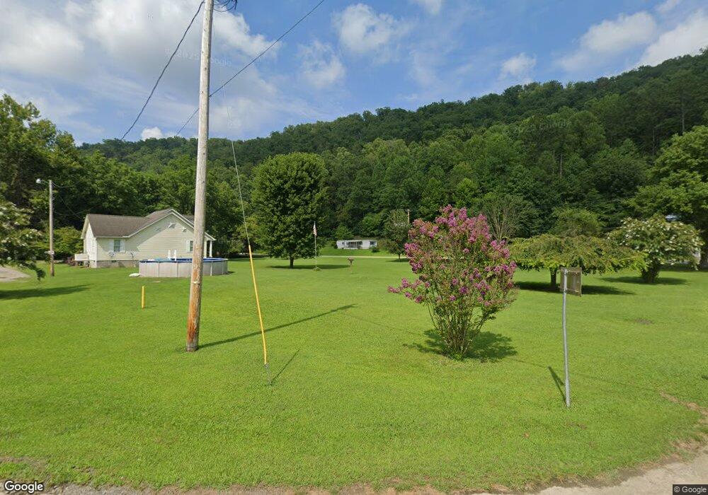
36380 Moses Fork Dunlow, WV 25511
Estimated Value: $87,000 - $116,000
3
Beds
2
Baths
1,672
Sq Ft
$61/Sq Ft
Est. Value
About This Home
This home is located at 36380 Moses Fork, Dunlow, WV 25511 and is currently estimated at $101,500, approximately $60 per square foot. 36380 Moses Fork is a home with nearby schools including Dunlow Elementary School, Crum Middle School, and Tolsia High School.
Ownership History
Date
Name
Owned For
Owner Type
Purchase Details
Closed on
Jun 5, 2012
Sold by
Blackburn John and Blackburn Alice
Bought by
Messer Michael and Messer Debra L
Current Estimated Value
Home Financials for this Owner
Home Financials are based on the most recent Mortgage that was taken out on this home.
Original Mortgage
$48,000
Interest Rate
3.84%
Mortgage Type
New Conventional
Create a Home Valuation Report for This Property
The Home Valuation Report is an in-depth analysis detailing your home's value as well as a comparison with similar homes in the area
Home Values in the Area
Average Home Value in this Area
Purchase History
| Date | Buyer | Sale Price | Title Company |
|---|---|---|---|
| Messer Michael | -- | None Available |
Source: Public Records
Mortgage History
| Date | Status | Borrower | Loan Amount |
|---|---|---|---|
| Closed | Messer Michael | $48,000 |
Source: Public Records
Tax History Compared to Growth
Tax History
| Year | Tax Paid | Tax Assessment Tax Assessment Total Assessment is a certain percentage of the fair market value that is determined by local assessors to be the total taxable value of land and additions on the property. | Land | Improvement |
|---|---|---|---|---|
| 2024 | $318 | $45,960 | $5,220 | $40,740 |
| 2023 | $317 | $45,840 | $5,220 | $40,620 |
| 2022 | $296 | $43,920 | $4,620 | $39,300 |
| 2021 | $296 | $43,980 | $4,620 | $39,360 |
| 2020 | $287 | $43,140 | $4,620 | $38,520 |
| 2019 | $284 | $42,900 | $4,620 | $38,280 |
| 2018 | $523 | $42,060 | $4,620 | $37,440 |
| 2017 | $520 | $41,820 | $4,620 | $37,200 |
| 2016 | $510 | $41,160 | $4,260 | $36,900 |
| 2015 | $475 | $38,400 | $3,840 | $34,560 |
| 2014 | -- | $37,260 | $3,840 | $33,420 |
Source: Public Records
Map
Nearby Homes
- 100 James Collins Dr
- 0 Perry Ridge Rd
- 5975 Twelvepole Creek Rd
- 3944 Napier Ridge
- 166 Webb Rd
- 212 Delta Road 21
- 323 Upper Silver Creek Rd
- 9827 Yellow Creek
- 0 Jennies Creek Rd
- 6527 Hode Rd
- 180 Rockcastle Ln
- 3269 Hampton Ridge Rd
- 0 Little Elk Hode Road (D 38 P 137 & D 48 P 341) Unit 124464
- 0 Laurel Creek Rd (Db 344 Dp 515)
- 144 Dry Fork
- 000 Queens Ridge Rd
- 355 Peaceful Garden Cemetery Rd
- 2464 Lycans Ridge Rd
- 173 Glen Damron Ln
- 6 Ac Peaceful Garden Cemetery Rd
- 210 Wells Branch Rd
- 475 Wells Branch Rd
- 152 Pole Rt 152
- 152 12 Pole
- 124 Wells Branch Rd
- 938 Cabwaylingo Park Rd Unit Route 1 Box 60
- 982 Cabwaylingo Park Rd
- 416 Wells Branch Rd
- 0 Twelve Pole Creek Rd Unit 11250989
- 0 Twelve Pole Creek Rd Unit 11074685
- 60 Cabwaylingo Park Rd
- 35894 Route 152
- 35516 Route 152
- 65 Right Fork Wells Branch Rd
- 701 Wells Branch Rd
- 35474 Route 152
- 35414 Route 152
- 0 Wells Branch Rd
- 1640 Cabwaylingo Park Rd
- 91 Stumbo Hollow
