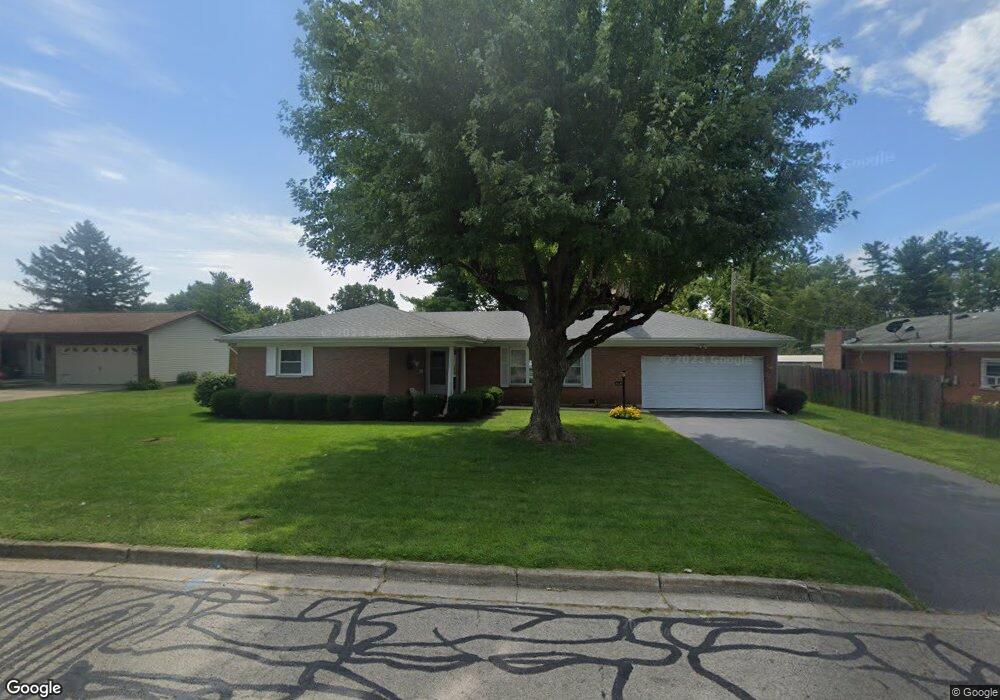
364 Curtis Dr Wilmington, OH 45177
Estimated Value: $226,000 - $243,480
3
Beds
2
Baths
1,392
Sq Ft
$169/Sq Ft
Est. Value
About This Home
This home is located at 364 Curtis Dr, Wilmington, OH 45177 and is currently estimated at $235,370, approximately $169 per square foot. 364 Curtis Dr is a home located in Clinton County with nearby schools including East End Elementary School, Denver Place Elementary School, and Roy E. Holmes Elementary School.
Ownership History
Date
Name
Owned For
Owner Type
Purchase Details
Closed on
Sep 22, 2020
Sold by
Powers Joyce L
Bought by
Powers David Eugene
Current Estimated Value
Purchase Details
Closed on
Sep 9, 2020
Sold by
Estate Of Eugene D Powers
Bought by
Powers Joyce L
Purchase Details
Closed on
Jan 1, 1990
Bought by
Powers Eugene D and Powers Joyce
Create a Home Valuation Report for This Property
The Home Valuation Report is an in-depth analysis detailing your home's value as well as a comparison with similar homes in the area
Home Values in the Area
Average Home Value in this Area
Purchase History
| Date | Buyer | Sale Price | Title Company |
|---|---|---|---|
| Powers David Eugene | -- | None Available | |
| Powers Joyce L | -- | None Available | |
| Powers Eugene D | -- | -- |
Source: Public Records
Tax History Compared to Growth
Tax History
| Year | Tax Paid | Tax Assessment Tax Assessment Total Assessment is a certain percentage of the fair market value that is determined by local assessors to be the total taxable value of land and additions on the property. | Land | Improvement |
|---|---|---|---|---|
| 2024 | $1,817 | $63,740 | $9,380 | $54,360 |
| 2023 | $1,817 | $63,740 | $9,380 | $54,360 |
| 2022 | $1,270 | $44,160 | $7,640 | $36,520 |
| 2021 | $1,285 | $44,160 | $7,640 | $36,520 |
| 2020 | $1,208 | $44,160 | $7,640 | $36,520 |
| 2019 | $1,125 | $38,850 | $8,710 | $30,140 |
| 2018 | $1,135 | $38,850 | $8,710 | $30,140 |
| 2017 | $551 | $38,850 | $8,710 | $30,140 |
| 2016 | $1,028 | $36,470 | $8,470 | $28,000 |
| 2015 | $1,006 | $36,470 | $8,470 | $28,000 |
| 2013 | $1,061 | $37,630 | $8,470 | $29,160 |
Source: Public Records
Map
Nearby Homes
- 0 Mccoy Rd Unit 1761017
- 215 Leyland Park Dr Unit 1C
- 619 Hiatt Ave
- 719 Hiatt Ave
- 320 Lorish Ave
- 813 N Lincoln St
- 793 Hiatt Ave
- 353 Hiatt Ave
- Edmon Plan at Creekview
- Elder Plan at Creekview
- Sullivan Plan at Creekview
- Cabral Plan at Creekview
- Elm Plan at Creekview
- Pine Plan at Creekview
- 165 Lorish Ave
- 26 E Kentucky Ave
- 0 S St Rt 73 Unit 1827681
- 31 Fairland Ave
- 379 Virginia Cir
- 0 Prairie Ave Unit 1793216
- 382 Curtis Dr
- 344 Curtis Dr
- 375 Curtis Dr
- 359 Curtis Dr
- 31 Carol Ct
- 326 Curtis Dr
- 873 Williams Dr
- 341 Curtis Dr
- 395 Curtis Dr
- 861 Williams Dr
- 324 Leyland Park Dr Unit 21A
- 39 Carol Ct
- 39 Carol Ct
- 326 Leyland Park Dr Unit 21B
- 308 Curtis Dr
- 323 Curtis Dr
- 334 Leyland Park Dr
- 332 Leyland Park Dr Unit 22B
- 330 Leyland Park Dr
- 330 Leyland Park Dr Unit 22A