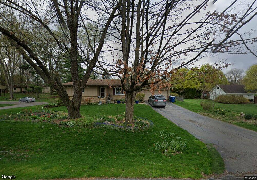
3640 Maple Dr Ypsilanti, MI 48197
Estimated Value: $316,000 - $381,000
3
Beds
1
Bath
1,360
Sq Ft
$254/Sq Ft
Est. Value
About This Home
This home is located at 3640 Maple Dr, Ypsilanti, MI 48197 and is currently estimated at $345,558, approximately $254 per square foot. 3640 Maple Dr is a home located in Washtenaw County with nearby schools including Pittsfield Elementary School, Scarlett Middle School, and Huron High School.
Ownership History
Date
Name
Owned For
Owner Type
Purchase Details
Closed on
Sep 25, 2006
Sold by
Dooley Edward J and Smith Julianne J
Bought by
Nielsen Christopher M and Nielsen Rebecca
Current Estimated Value
Home Financials for this Owner
Home Financials are based on the most recent Mortgage that was taken out on this home.
Original Mortgage
$156,800
Outstanding Balance
$94,185
Interest Rate
6.58%
Estimated Equity
$251,373
Purchase Details
Closed on
Oct 8, 1996
Sold by
Carpentier-Alting H J
Bought by
Jenson Thomas E and Jenson Rebecca A
Home Financials for this Owner
Home Financials are based on the most recent Mortgage that was taken out on this home.
Original Mortgage
$107,600
Interest Rate
8.47%
Purchase Details
Closed on
Aug 16, 1996
Sold by
Est Henrietta J Tousan
Bought by
Hendrik J and Carpentier Patricia F
Home Financials for this Owner
Home Financials are based on the most recent Mortgage that was taken out on this home.
Original Mortgage
$107,600
Interest Rate
8.47%
Create a Home Valuation Report for This Property
The Home Valuation Report is an in-depth analysis detailing your home's value as well as a comparison with similar homes in the area
Home Values in the Area
Average Home Value in this Area
Purchase History
| Date | Buyer | Sale Price | Title Company |
|---|---|---|---|
| Nielsen Christopher M | -- | None Available | |
| Jenson Thomas E | $2,000 | -- | |
| Hendrik J | $134,500 | -- |
Source: Public Records
Mortgage History
| Date | Status | Borrower | Loan Amount |
|---|---|---|---|
| Open | Nielsen Christopher M | $156,800 | |
| Previous Owner | Hendrik J | $107,600 |
Source: Public Records
Tax History Compared to Growth
Tax History
| Year | Tax Paid | Tax Assessment Tax Assessment Total Assessment is a certain percentage of the fair market value that is determined by local assessors to be the total taxable value of land and additions on the property. | Land | Improvement |
|---|---|---|---|---|
| 2025 | $3,502 | $161,445 | $0 | $0 |
| 2024 | $2,342 | $136,542 | $0 | $0 |
| 2023 | $2,251 | $124,200 | $0 | $0 |
| 2022 | $3,391 | $119,200 | $0 | $0 |
| 2021 | $3,024 | $114,200 | $0 | $0 |
| 2020 | $3,233 | $109,500 | $0 | $0 |
| 2019 | $3,024 | $95,900 | $95,900 | $0 |
| 2018 | $2,948 | $91,900 | $0 | $0 |
| 2017 | $2,852 | $94,900 | $0 | $0 |
| 2016 | $1,838 | $72,254 | $0 | $0 |
| 2015 | -- | $71,242 | $0 | $0 |
| 2014 | -- | $69,017 | $0 | $0 |
| 2013 | -- | $69,017 | $0 | $0 |
Source: Public Records
Map
Nearby Homes
- 3995 Helen Ave
- 4139 Persimmon Dr
- 2434 Harding Ave
- 2432 Harding Ave
- 2180 Ellsworth Rd
- 259 Elmhurst Ave
- 2418 Draper Ave
- 224 N Hewitt Rd
- 2002 Midvale Ave
- 3160 W Michigan Ave
- 2017 Harding Ave
- 4134 Montith Dr
- 4855 W Michigan Ave
- 550 Brookside St
- 3099 Village Cir Unit 52
- 2600 Collegewood St
- 2514 Carlton Dr
- 2564 Collegewood St
- 4523 Connor Dr
- 3611 Ca Canny Ct