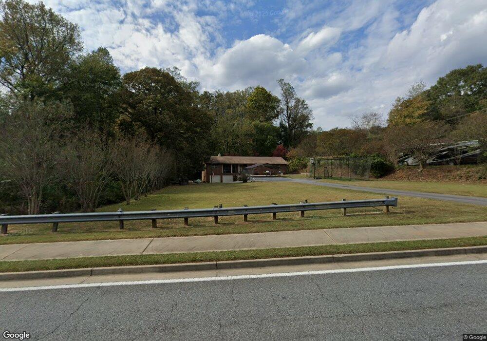
3640 Mathis Airport Pkwy Suwanee, GA 30024
Big Creek NeighborhoodEstimated Value: $455,000 - $521,000
3
Beds
2
Baths
1,942
Sq Ft
$251/Sq Ft
Est. Value
About This Home
This home is located at 3640 Mathis Airport Pkwy, Suwanee, GA 30024 and is currently estimated at $487,143, approximately $250 per square foot. 3640 Mathis Airport Pkwy is a home located in Forsyth County with nearby schools including Brookwood Elementary School, South Forsyth Middle School, and Lambert High School.
Ownership History
Date
Name
Owned For
Owner Type
Purchase Details
Closed on
Aug 2, 2017
Sold by
Cheek Marilyn Diane Truste
Bought by
Cheek Gregory Dexter and Cheek Amie H
Current Estimated Value
Purchase Details
Closed on
Jan 13, 2014
Sold by
Mathis Lenon Greshon
Bought by
Cheek Greg D
Purchase Details
Closed on
Aug 15, 2012
Sold by
Mcconnell Martha T
Bought by
Coal Mountain National Industr
Purchase Details
Closed on
Apr 26, 2010
Sold by
Mathis Leon G
Bought by
Mathis Rudean
Create a Home Valuation Report for This Property
The Home Valuation Report is an in-depth analysis detailing your home's value as well as a comparison with similar homes in the area
Home Values in the Area
Average Home Value in this Area
Purchase History
| Date | Buyer | Sale Price | Title Company |
|---|---|---|---|
| Cheek Gregory Dexter | $240,000 | -- | |
| Cheek Greg D | -- | -- | |
| Cheek Marilyn Diane | -- | -- | |
| Coal Mountain National Industr | $40,000 | -- | |
| Mathis Rudean | -- | -- |
Source: Public Records
Tax History Compared to Growth
Tax History
| Year | Tax Paid | Tax Assessment Tax Assessment Total Assessment is a certain percentage of the fair market value that is determined by local assessors to be the total taxable value of land and additions on the property. | Land | Improvement |
|---|---|---|---|---|
| 2025 | $3,235 | $161,340 | $63,312 | $98,028 |
| 2024 | $3,235 | $161,340 | $63,312 | $98,028 |
| 2023 | $2,176 | $168,552 | $63,312 | $105,240 |
| 2022 | $2,949 | $92,640 | $28,960 | $63,680 |
| 2021 | $2,342 | $92,640 | $28,960 | $63,680 |
| 2020 | $2,285 | $89,840 | $28,960 | $60,880 |
| 2019 | $2,370 | $93,804 | $34,084 | $59,720 |
| 2018 | $2,028 | $77,080 | $31,560 | $45,520 |
| 2017 | $392 | $74,640 | $31,560 | $43,080 |
| 2016 | $383 | $68,328 | $25,248 | $43,080 |
| 2015 | $383 | $68,328 | $25,248 | $43,080 |
| 2014 | $352 | $67,080 | $27,560 | $39,520 |
Source: Public Records
Map
Nearby Homes
- 3440 Commander Cove
- 3470 Commander Cove
- 3485 Vermillion View
- 3430 Commander Cove
- 3510 Vermillion View
- 335 Pintail Ct
- 2940 Bentbill Crossing
- 6505 Caldwell Ct
- 3440 Ronnie Ln
- 2690 Portabella Ln
- 5625 Buckleigh Pointe
- 5995 Ettington Dr
- 2850 Brandy Ln
- 6005 Oakbury Ln
- 2380 Manor Creek Ct
- 355 Laurel Oak Dr
- 5060 Brent Knoll Ln Unit 1
- 5235 Villa Lake Ct
- 6010 Somerset Ct
- 2530 Thackery Ct
- 3670 Mathis Airport Pkwy
- 3725 Mathis Airpark Rd
- 3630 Mathis Airport Pkwy
- 3690 Mathis Airport Pkwy
- 3845 Laurel Lake Point
- 5865 Stoneleigh Dr
- 5865 Stoneleigh Dr Unit 55
- 5875 Stoneleigh Dr
- 5855 Stoneleigh Dr
- 3855 Laurel Lake Point
- 3835 Laurel Lake Point
- 3835 Laurel Lake Point
- 5885 Stoneleigh Dr
- 5845 Stoneleigh Dr
- 3715 Mathis Airport Dr
- 3850 Laurel Lake Point
- 3595 Mathis Airport Pkwy
- 0R Stoneleigh Dr
- 5850 Stoneleigh Dr
- 5835 Stoneleigh Dr